Category:Location maps of South Australia
Jump to navigation
Jump to search
States of Australia: New South Wales · Queensland · South Australia · Tasmania · Victoria · Western Australia
Internal territories of Australia: Northern Territory
External territories of Australia: Cocos (Keeling) Islands ·
Internal territories of Australia: Northern Territory
External territories of Australia: Cocos (Keeling) Islands ·
Subcategories
This category has only the following subcategory.
Media in category "Location maps of South Australia"
The following 9 files are in this category, out of 9 total.
-
Australia Greater Adelaide location map.svg 437 × 1,154; 4.18 MB
-
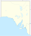
Australia South Australia location map blank.svg 1,535 × 1,783; 316 KB
-
Australia South Australia location map.svg 1,535 × 1,783; 367 KB
-
Australia South Australia relief location map.png 1,812 × 2,105; 719 KB
-
Australia South Australia Riverland location map.svg 609 × 276; 1.35 MB
-
Australia South Australia Cleve District location map.svg 1,183 × 1,250; 50 KB
-
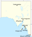
Labelled map of South Australia for Climate of Australia article.svg 1,535 × 1,783; 322 KB
-
South Australia.png 582 × 675; 211 KB
-
Woomera Test Range map.svg 1,535 × 1,783; 318 KB


