Category:Location maps of Mecklenburg-Vorpommern
Jump to navigation
Jump to search
Federal states of Germany:
 |
This category should only contain blank "Location maps" created for geo-location purposes which follow a same uniform standard, and have been created with a Geographic information system (GIS) software program using a compatible equirectangular or conical projection and for which the geographic coordinate system is known. For more information or questions see the wikiproject: German Wikipedia:Kartenwerkstatt/Positionskarten and this discussion page. |
Media in category "Location maps of Mecklenburg-Vorpommern"
The following 10 files are in this category, out of 10 total.
-
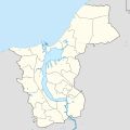 Locator map Rostock Grundkarte.svg 1,380 × 1,380; 426 KB
-
 Mecklenburg-Vorpommern (1994-2011) location map.svg 1,129 × 775; 324 KB
-
 Mecklenburg-Vorpommern location map 2011.svg 1,129 × 775; 865 KB
-
 Mecklenburg-Vorpommern location map G.svg 1,129 × 775; 485 KB
-
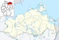
 Mecklenburg-Vorpommern location map.svg 1,127 × 773; 238 KB
-
 Mecklenburg-Vorpommern Relief Kreise Namen Grenze.png 1,744 × 1,197; 1.67 MB
-
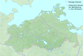
 Mecklenburg-Vorpommern relief location map.jpg 1,744 × 1,197; 504 KB
-
 Mecklenburg-Vorpommern relief location map.png 1,744 × 1,197; 1.62 MB
-
 Mecklenburg-vorpommern-lage-deutschland.jpg 250 × 340; 16 KB
-
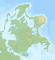 Rügen relief location map.png 2,460 × 2,683; 2.84 MB

_location_map.svg)


