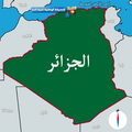
Category:Location maps of Algeria
Jump to navigation
Jump to search
Subcategories
This category has the following 2 subcategories, out of 2 total.
!
*
Media in category "Location maps of Algeria"
The following 9 files are in this category, out of 9 total.
-
Algeria northeast relief location map.jpg 369 × 244; 74 KB
-
Algeria northwest relief location map.jpg 300 × 281; 57 KB
-
Algeria relief location map.jpg 1,287 × 1,279; 494 KB
-
Central Northen Algeria location map.png 310 × 330; 39 KB
-
Eastern Northen Algeria location map.png 224 × 330; 31 KB
-
North Algeria location map.png 616 × 366; 82 KB
-
North Algeria relief location map.png 616 × 366; 340 KB
-
Theniet el Had national park location Arabic version.png 700 × 700; 100 KB
-
Western Northen Algeria location map.png 250 × 330; 25 KB


