Category:Local election maps of Wales
Jump to navigation
Jump to search
Subcategories
This category has the following 7 subcategories, out of 7 total.
Media in category "Local election maps of Wales"
The following 19 files are in this category, out of 19 total.
-
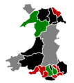
2004 Welsh Local Elections - Ward and Council Control.svg 721 × 401; 2.38 MB
-
2008 Welsh Local Elections - Ward and Council Control.svg 721 × 401; 2.38 MB
-
2012 Welsh Local Elections - Ward and Council Control.svg 721 × 401; 2.35 MB
-
2017 Welsh Local Elections - Ward and Council Control.svg 721 × 401; 2.35 MB
-
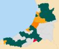
2022 Ceredigion County Council election map.png 1,200 × 1,004; 128 KB
-
2022 Monmouthshire Council Election results.svg 750 × 615; 737 KB
-
2022 Welsh Local Elections - Ward and Council Control.svg 1,080 × 600; 723 KB
-
Ceredigion county council election 2012 map.png 1,396 × 1,124; 203 KB
-
Isle of Anglesey UK local election 2013 map.svg 1,425 × 1,255; 759 KB
-
Isle of Anglesey UK local election 2017 results map.png 862 × 760; 150 KB
-
Pembrokeshire County Council 2012 Election results map.png 760 × 820; 164 KB
-
Pembrokeshire County Council 2017 Election results map.png 760 × 820; 162 KB
-
WalesLocal1999.png 882 × 992; 41 KB
-
WalesLocal2004.png 882 × 992; 18 KB
-
WalesLocal2008.png 882 × 992; 18 KB
-
WalesLocal2012.png 882 × 992; 19 KB
-
WalesLocal2013.png 882 × 992; 19 KB
-
Wrexham County Borough Council 2012 Election results map.png 1,200 × 875; 283 KB
-
Wrexham County Borough Council 2017 Election results map.png 1,200 × 875; 295 KB


