Category:Llywel (community)
Jump to navigation
Jump to search
Subcategories
This category has the following 6 subcategories, out of 6 total.
Media in category "Llywel (community)"
The following 76 files are in this category, out of 76 total.
-
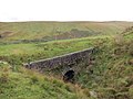
 A view under Pont ar Wysg - geograph.org.uk - 656025.jpg 640 × 480; 99 KB
-
 Bryn Blaen-Wysg - geograph.org.uk - 939175.jpg 640 × 480; 86 KB
-
 Enclosure - geograph.org.uk - 927814.jpg 640 × 480; 60 KB
-
 Epynt Way leg 6 and boundary fence - geograph.org.uk - 790153.jpg 480 × 640; 99 KB
-
 Epynt Way marker ^625 - geograph.org.uk - 790161.jpg 640 × 480; 83 KB
-
 Footbridges over Nant Gwydderig - geograph.org.uk - 790158.jpg 640 × 480; 109 KB
-
 Footpath up to Bryn-Merched - geograph.org.uk - 938012.jpg 640 × 480; 115 KB
-
 Forest Carpark south of Usk Reservoir - geograph.org.uk - 145854.jpg 640 × 480; 210 KB
-
 Forest edge - geograph.org.uk - 1072564.jpg 480 × 640; 141 KB
-
 Forest Walk near Usk reservoir - geograph.org.uk - 927760.jpg 640 × 480; 109 KB
-
 Frozen waterfall on Afon Giedd - geograph.org.uk - 1096621.jpg 640 × 480; 113 KB
-
 Full to the brim - geograph.org.uk - 757371.jpg 640 × 427; 76 KB
-
 Gwal y Cadno - geograph.org.uk - 981448.jpg 640 × 480; 140 KB
-
 Hen reilffordd - Former railway (geograph 7293700).jpg 1,024 × 768; 201 KB
-
 Hen reilffordd -Former railway (geograph 7293716).jpg 1,024 × 768; 182 KB
-

-
 Lane heading to Bronydd-mawr - geograph.org.uk - 937745.jpg 640 × 480; 71 KB
-
 Large expanse of tarmac - geograph.org.uk - 1177995.jpg 640 × 427; 174 KB
-
 Llyn Y Fan from Gwernwyddog - geograph.org.uk - 723153.jpg 640 × 480; 46 KB
-

-
 Moorland - geograph.org.uk - 927831.jpg 640 × 480; 34 KB
-
 Mynydd Wysg In Winter - geograph.org.uk - 479229.jpg 640 × 480; 90 KB
-
 Nant Erydr enters Glasfynydd Forest - geograph.org.uk - 1072590.jpg 480 × 640; 148 KB
-
 Nant Tywynni valley - geograph.org.uk - 918912.jpg 640 × 480; 129 KB
-
 Nant Tywynni valley - geograph.org.uk - 919013.jpg 640 × 480; 79 KB
-
 Nant-y-moch downstream - geograph.org.uk - 918951.jpg 640 × 480; 93 KB
-
 Nant-y-moch upstream - geograph.org.uk - 918944.jpg 640 × 480; 103 KB
-
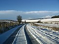
 Old road to Llywel - geograph.org.uk - 1173305.jpg 640 × 426; 218 KB
-
 Old road to Llywel - geograph.org.uk - 1175419.jpg 640 × 428; 189 KB
-
 On Mynydd Bwlch-y-Groes - geograph.org.uk - 1173318.jpg 640 × 427; 188 KB
-
 On Mynydd Bwlch-y-Groes - geograph.org.uk - 1173322.jpg 640 × 427; 196 KB
-
 On Mynydd Bwlch-y-Groes - geograph.org.uk - 1175428.jpg 640 × 427; 165 KB
-
 On Mynydd Bwlch-y-Groes - geograph.org.uk - 1175429.jpg 640 × 427; 166 KB
-
 On Mynydd Bwlch-y-Groes - geograph.org.uk - 1175433.jpg 640 × 426; 160 KB
-
 On Mynydd Bwlch-y-Groes - geograph.org.uk - 1177987.jpg 640 × 427; 158 KB
-
 On Mynydd Bwlch-y-Groes - geograph.org.uk - 1177998.jpg 640 × 428; 218 KB
-
 Pont ar Hydfer - geograph.org.uk - 146286.jpg 640 × 480; 180 KB
-
 Pont Pantysgallog - geograph.org.uk - 482083.jpg 640 × 574; 147 KB
-
 Pothole marked with a cairn - geograph.org.uk - 1096566.jpg 640 × 480; 133 KB
-
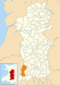
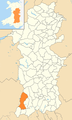 Powys Wales communities - Llywel locator.png 780 × 1,300; 430 KB
-
 Road Over Cwm-Gelli-gam - geograph.org.uk - 481178.jpg 640 × 480; 165 KB
-
 Sgwd Ddu - geograph.org.uk - 817421.jpg 480 × 640; 110 KB
-
 Sgwd Ddu - or is that Sgwd Wen^ - geograph.org.uk - 1100947.jpg 480 × 640; 109 KB
-
 Sheep on the flank of Cefn Cul - geograph.org.uk - 919003.jpg 640 × 480; 86 KB
-
 Sign in forest car park - geograph.org.uk - 927868.jpg 640 × 480; 135 KB
-
 Sinc y Waun Fignen Felen - geograph.org.uk - 817426.jpg 480 × 640; 102 KB
-
 Small waterfall, Nant y Llyn - geograph.org.uk - 832373.jpg 480 × 640; 330 KB
-
 Snowy tracks in Glasfynydd Forest - geograph.org.uk - 1072289.jpg 640 × 480; 87 KB
-
 Springtime scene - geograph.org.uk - 383776.jpg 640 × 425; 193 KB
-
 Sunset at Mynydd Bwlch-y-Groes - geograph.org.uk - 1178036.jpg 640 × 428; 142 KB
-
 Sunset at Mynydd Bwlch-y-Groes - geograph.org.uk - 1178037.jpg 640 × 425; 168 KB
-
 Sunset at Mynydd Bwlch-y-Groes - geograph.org.uk - 1178039.jpg 640 × 429; 147 KB
-
 Sunset at Mynydd Bwlch-y-Groes - geograph.org.uk - 1178040.jpg 640 × 427; 130 KB
-
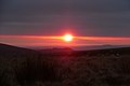
 Sunset from the Llywel to Tirabad road - geograph.org.uk - 1178051.jpg 640 × 427; 176 KB
-
 Tawe valley at Dderi Farm - geograph.org.uk - 918902.jpg 640 × 480; 86 KB
-
 Telephone Box at Pont ar Hydfer - geograph.org.uk - 383770.jpg 640 × 425; 183 KB
-
 The Cefn Cul - geograph.org.uk - 918996.jpg 640 × 480; 78 KB
-
 The infant Usk - geograph.org.uk - 656094.jpg 640 × 480; 90 KB
-
 The lane to Ynys Clydach - geograph.org.uk - 816808.jpg 640 × 427; 234 KB
-
 The road to Ynys Clydach - geograph.org.uk - 812893.jpg 640 × 427; 247 KB
-

-
 Towards Halfway Forest - geograph.org.uk - 1173311.jpg 640 × 426; 175 KB
-
 Towards Halfway Forest - geograph.org.uk - 1175424.jpg 640 × 427; 194 KB
-
 Towards Nant y Gynnen - geograph.org.uk - 1178010.jpg 640 × 426; 209 KB
-
 Tower at the Bwlch Bryn-rhudd - geograph.org.uk - 918934.jpg 640 × 480; 67 KB
-
 Upper Tawe valley floor - geograph.org.uk - 918895.jpg 640 × 403; 103 KB
-
 Usk spillway (water).jpg 640 × 480; 71 KB
-

-
 View through Glasfynydd Forest - geograph.org.uk - 1072595.jpg 640 × 480; 112 KB
-
 Wales Powys Community Llywel map.svg 512 × 723; 1.15 MB
-
 Walls by the Nant-y-moch - geograph.org.uk - 919008.jpg 640 × 480; 91 KB
-
 Waterfall on Afon Giedd - geograph.org.uk - 1096646.jpg 640 × 480; 97 KB
-
 Waterfall, Nant y Llyn - geograph.org.uk - 832368.jpg 480 × 640; 277 KB
-
 Waterfalls in Cwm Haffes - geograph.org.uk - 817401.jpg 640 × 480; 125 KB
-
 Waun Lleuci - geograph.org.uk - 937947.jpg 640 × 483; 100 KB
-
 Welsh Mountain Ponies - geograph.org.uk - 927776.jpg 640 × 480; 134 KB


.jpg)
.jpg)


.jpg)


