Category:Llynclys
Jump to navigation
Jump to search
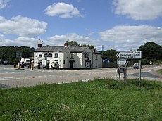
English: Llynclys is a village in Shropshire, England. It lies north of Pant on the crossroads of the A483 and B4396.
village in Shropshire, United Kingdom | |||||
| Upload media | |||||
| Instance of | |||||
|---|---|---|---|---|---|
| Location | Llanyblodwel, Shropshire, West Midlands, England | ||||
 | |||||
Subcategories
This category has the following 2 subcategories, out of 2 total.
L
- Llynclys railway station (6 F)
Media in category "Llynclys"
The following 52 files are in this category, out of 52 total.
-
"Dropped bridge" near Llynclys - geograph.org.uk - 51404.jpg 640 × 480; 156 KB
-
"Stoneacre" - geograph.org.uk - 417702.jpg 640 × 480; 82 KB
-
Bridge on the Montgomery Canal - geograph.org.uk - 51077.jpg 640 × 480; 164 KB
-
Chrickheath Wharf on the Montgomery Canal - geograph.org.uk - 51070.jpg 640 × 480; 147 KB
-
Crickheath Tramway and bridge, Llynclys, Shropshire.jpg 4,896 × 2,752; 7.71 MB
-
Crickheath Winding Hole, Llanymynech Branch of the Ellesmere Canal. Montgomery Canal.jpg 4,896 × 2,752; 6.58 MB
-
Disused railway line near Llynclys - geograph.org.uk - 3542448.jpg 1,600 × 1,200; 1.14 MB
-
Disused Railway Tracks - geograph.org.uk - 477775.jpg 480 × 640; 262 KB
-
Entrance gate to nature reserve near Llynclys - geograph.org.uk - 3542462.jpg 1,600 × 1,200; 1.11 MB
-
F W Davies crash at Llynclys, near Oswestry (1475734).jpg 1,642 × 1,250; 689 KB
-
F W Davies crash at Llynclys, near Oswestry (1475735).jpg 1,629 × 1,250; 717 KB
-
F W Davies crash at Llynclys, near Oswestry (1475736).jpg 1,637 × 1,250; 731 KB
-
F W Davies crash at Llynclys, near Oswestry (1475737).jpg 1,629 × 1,250; 666 KB
-
F W Davies crash at Llynclys, near Oswestry (1475738).jpg 1,623 × 1,250; 733 KB
-
F W Davies crash at Llynclys, near Oswestry (1475739).jpg 1,633 × 1,250; 776 KB
-
F W Davies crash at Llynclys, near Oswestry (1475740).jpg 1,638 × 1,250; 775 KB
-
F W Davies crash at Llynclys, near Oswestry (1475741).jpg 1,619 × 1,250; 755 KB
-
Footpath on Llynclys Common - geograph.org.uk - 548770.jpg 640 × 480; 133 KB
-
Llamas in field by Whitehaven - geograph.org.uk - 555758.jpg 640 × 480; 98 KB
-
Llynclys and Pant Women's Institute's 25th anniversary party (1474284).jpg 1,657 × 1,250; 739 KB
-
Llynclys and Pant Women's Institute's 25th anniversary party (1474285).jpg 1,645 × 1,250; 733 KB
-
Llynclys and Pant Women's Institute's 25th anniversary party (1474286).jpg 1,627 × 1,250; 775 KB
-
Llynclys and Pant Women's Institute's 25th anniversary party (1474287).jpg 1,646 × 1,250; 727 KB
-
Llynclys Pool - geograph.org.uk - 149959.jpg 640 × 480; 101 KB
-
Llynclys trackbed geograph-3388615-by-Ben-Brooksbank.jpg 2,394 × 1,279; 3.7 MB
-
Mixed grazing on Llynclys Common - geograph.org.uk - 548755.jpg 640 × 480; 117 KB
-
Montgomery Canal, Pant, Shropshire.jpg 3,513 × 2,739; 2.55 MB
-
Narrow gauge diesel loco - geograph.org.uk - 633901.jpg 640 × 428; 98 KB
-
Newly laid hedge - geograph.org.uk - 633875.jpg 640 × 428; 84 KB
-
Porthywaen Halt, near Llynclys - geograph.org.uk - 155442.jpg 640 × 480; 137 KB
-
Schoolhouse Bridge site, Llanymynech Branch of the Ellesmere Canal. Montgomery Canal.jpg 4,896 × 2,752; 4.68 MB
-
Schoolhouse Bridge, Llanymynech Branch of the Ellesmere Canal. Montgomery Canal.jpg 4,896 × 2,752; 4.89 MB
-
Sign of the season - geograph.org.uk - 555762.jpg 640 × 480; 109 KB
-
The Montgomery Canal, near Pant, Shropshire.jpg 4,896 × 2,752; 3.3 MB
-
The old Montgomery Canal, near Pant, Shropshire.jpg 4,896 × 2,752; 5.07 MB
-
The White Lion, Llynclys in 2006.jpg 640 × 480; 79 KB
-
Grassland in winter - geograph.org.uk - 633861.jpg 640 × 428; 71 KB
-
Lane to The Wood - geograph.org.uk - 313238.jpg 640 × 480; 146 KB
-
Nutree Farm, near Llynclys - geograph.org.uk - 150808.jpg 640 × 480; 103 KB
-
One must ask why^ - geograph.org.uk - 555759.jpg 640 × 480; 145 KB
-
Peacock at Llynclys - geograph.org.uk - 160335.jpg 639 × 476; 286 KB
-
Pear Tree Cottage, Crickheath Wharf - geograph.org.uk - 651046.jpg 640 × 428; 90 KB


