Category:Llanllwchaiarn
Jump to navigation
Jump to search
village in Powys, Wales, United Kingdom | |||||
| Upload media | |||||
| Instance of | |||||
|---|---|---|---|---|---|
| Location | Powys, Wales | ||||
 | |||||
Cymraeg: Pentref bychan a phlwyf yn ardal Maldwyn, Powys yw Llanllwchaearn (hefyd: Llanllwchaiarn). Saif y pentref ar lan Afon Hafren tua milltir i'r gogledd-ddwyrain o'r Drenewydd. Rhed lôn y B4568 trwyddo. Mae Camlas Trefaldwyn yn agos i'r pentref.
Subcategories
This category has the following 2 subcategories, out of 2 total.
D
Media in category "Llanllwchaiarn"
The following 42 files are in this category, out of 42 total.
-
A cow, one of many spotted on a Coastal Path - panoramio.jpg 4,000 × 3,000; 4.06 MB
-
Aberbechan Presbyterian Church - geograph.org.uk - 553099.jpg 640 × 480; 51 KB
-
Canada geese at Pwll Penarth - geograph.org.uk - 575105.jpg 640 × 480; 69 KB
-
Canal-side building, Dolfor lock - geograph.org.uk - 575099.jpg 640 × 480; 132 KB
-
Canal-side sign - geograph.org.uk - 575106.jpg 640 × 481; 119 KB
-
Cefn Vastre - geograph.org.uk - 1155134.jpg 640 × 405; 49 KB
-
Dolfor bridge - geograph.org.uk - 574831.jpg 640 × 480; 130 KB
-
Dolfor Bridge - geograph.org.uk - 575102.jpg 640 × 480; 137 KB
-
Fish ladder at Penarth weir - geograph.org.uk - 575113.jpg 490 × 640; 134 KB
-
Indistinguishable footpath - geograph.org.uk - 941819.jpg 640 × 480; 90 KB
-
Ingleby Llanllwchaiarn 01.png 891 × 818; 1.01 MB
-
Ingleby Llanllwchaiarn 02.png 956 × 825; 1.21 MB
-
Llanllwchaiarn church rummage sale (1506072).jpg 1,747 × 1,195; 233 KB
-
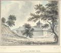
Llanllwchuarn, 1796.jpg 861 × 658; 415 KB
-
Pant Wood - geograph.org.uk - 591946.jpg 640 × 480; 81 KB
-
Pryce Pryce-Jones.gif 112 × 145; 11 KB
-
Wedding of Trixie Pritchard to William Blayney at Llanllwchaiarn church (1481814).jpg 1,848 × 1,196; 313 KB
-
Wedding of Trixie Pritchard to William Blayney at Llanllwchaiarn church (1481815).jpg 1,848 × 1,196; 312 KB
-
Wedding of Trixie Pritchard to William Blayney at Llanllwchaiarn church (1481816).jpg 1,848 × 1,196; 348 KB
-
Wedding of Trixie Pritchard to William Blayney at Llanllwchaiarn church (1481817).jpg 1,785 × 1,195; 337 KB
-
Wern Independent Chapel - geograph.org.uk - 18636.jpg 640 × 480; 50 KB
-
Approaching Newtown on the A483 - geograph.org.uk - 1470630.jpg 640 × 480; 127 KB
-
Autumn colour, Garn Wood - geograph.org.uk - 591341.jpg 640 × 480; 101 KB
-
Crooked hedgelines - geograph.org.uk - 592079.jpg 640 × 480; 73 KB
-
Dysart Terrace, Canal Road, Newtown - geograph.org.uk - 586736.jpg 640 × 480; 90 KB
-
East from the B4568 - geograph.org.uk - 591928.jpg 640 × 478; 77 KB
-
Farmland near Allt Nantypelau - geograph.org.uk - 531373.jpg 640 × 480; 93 KB
-
Farmland near Rhyd-yr-hwyaid - geograph.org.uk - 531347.jpg 640 × 480; 97 KB
-
Lower Gwestydd Lane - geograph.org.uk - 586813.jpg 480 × 640; 119 KB
-
Motygido Farm - geograph.org.uk - 59998.jpg 640 × 215; 41 KB
-
New development in Llanllwchaiarn - geograph.org.uk - 591922.jpg 640 × 480; 115 KB
-
Oaks and pasture - geograph.org.uk - 591936.jpg 640 × 480; 62 KB
-
Over the stile and turn left - geograph.org.uk - 531362.jpg 640 × 480; 96 KB
-
Pant Farm - geograph.org.uk - 553104.jpg 640 × 480; 63 KB
-
Pasture near Aberbechan Hall - geograph.org.uk - 591931.jpg 640 × 480; 77 KB
-
Pasture near Aberbechan Hall - geograph.org.uk - 591941.jpg 640 × 480; 77 KB
-
Road to Pant Farm - geograph.org.uk - 553092.jpg 640 × 480; 62 KB
-
Track to Aberbechan Dyke - geograph.org.uk - 553115.jpg 640 × 480; 121 KB


