Category:Llangynog, Powys
Jump to navigation
Jump to search
village and community in Powys (formerly in Montgomeryshire), Wales  | |||||
| Upload media | |||||
| Instance of | |||||
|---|---|---|---|---|---|
| Named after | |||||
| Location | Powys, Wales | ||||
| Population |
| ||||
| Area |
| ||||
 | |||||
Cymraeg: Pentref bychan yng ngogledd Powys yw Llangynog. Mae'n gorwedd ar lan Afon Tanad, ger cyflifiad yr afon honno ag Afon Eirth, ar y ffordd B4391 tua hanner ffordd rhwng Y Bala i'r gogledd-orllewin a'r Trallwng i'r de-ddwyrain, yn Nyffryn Tanad.
English: Llangynog lies at the confluence of the Afon Eirth and the Afon Tanat at the foot of the Berwyn range in Powys, Wales.
Subcategories
This category has the following 5 subcategories, out of 5 total.
Media in category "Llangynog, Powys"
The following 200 files are in this category, out of 346 total.
(previous page) (next page)-
 "S" is for ...^ - geograph.org.uk - 839732.jpg 640 × 400; 71 KB
-
 A glimpse of Ty'n-y-ffynonydd farm - geograph.org.uk - 6167640.jpg 1,306 × 979; 777 KB
-

-
-
 A summit boundary - geograph.org.uk - 4475592.jpg 640 × 480; 88 KB
-
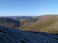
 A view from Cadair Berwyn. - geograph.org.uk - 552655.jpg 640 × 480; 65 KB
-
 A view from Pistyll Rhaeadr - geograph.org.uk - 1118499.jpg 640 × 424; 40 KB
-
 Above the Tanat Valley - geograph.org.uk - 1990301.jpg 1,600 × 1,190; 597 KB
-

-
 Afon Eirth at Llangynog - geograph.org.uk - 2239003.jpg 640 × 480; 128 KB
-
 Approaching Llechwedd-y-garth - geograph.org.uk - 4986272.jpg 1,600 × 1,064; 652 KB
-
 Approaching Llechwedd-y-garth - geograph.org.uk - 6188289.jpg 5,184 × 3,888; 5.14 MB
-
 Army storage barn - geograph.org.uk - 815572.jpg 640 × 412; 64 KB
-
 Aspiring trees - geograph.org.uk - 673986.jpg 640 × 480; 105 KB
-
 B4391 above Llangynog - geograph.org.uk - 6167638.jpg 1,306 × 979; 653 KB
-
 B4391 Berwyn High pass Road - geograph.org.uk - 38237.jpg 600 × 400; 126 KB
-
 B4391 heading uphill - geograph.org.uk - 5305398.jpg 640 × 480; 150 KB
-
 B4391 heading uphill out of Llangynog - geograph.org.uk - 6166815.jpg 1,469 × 1,102; 906 KB
-
 B4391 heads uphill - geograph.org.uk - 4475585.jpg 640 × 480; 145 KB
-
 B4391 near Pencraig - geograph.org.uk - 5305355.jpg 640 × 428; 102 KB
-
 B4520 Brecon to Builth - geograph.org.uk - 816071.jpg 640 × 427; 72 KB
-
 B4520 Brecon to Builth - geograph.org.uk - 816077.jpg 640 × 427; 66 KB
-
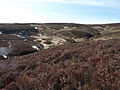
 Berwyn Moors. - geograph.org.uk - 551853.jpg 640 × 480; 91 KB
-
 Berwyn Mountains near Milltir Gerrig. - geograph.org.uk - 561801.jpg 640 × 480; 88 KB
-
 Berwyns NNR information sign - geograph.org.uk - 1172996.jpg 480 × 640; 87 KB
-
 Blaen-rhiwarth farm - geograph.org.uk - 1172605.jpg 640 × 480; 77 KB
-
 Blaen-rhiwarth farm - geograph.org.uk - 241741.jpg 640 × 480; 112 KB
-
 Blaen-rhiwarth Farm access road - geograph.org.uk - 1173035.jpg 640 × 480; 75 KB
-
 Boundary fence - geograph.org.uk - 6188278.jpg 5,184 × 3,888; 5.73 MB
-
 Boundary fence - geograph.org.uk - 6188280.jpg 5,184 × 3,888; 4.98 MB
-

-
 Boundary of Y Berwyn National Nature Reserve - geograph.org.uk - 6563866.jpg 5,184 × 3,888; 3.78 MB
-
 Bridge over Afon Tanat - geograph.org.uk - 241755.jpg 640 × 480; 98 KB
-
 Bridge to caravan site - geograph.org.uk - 6222580.jpg 5,184 × 3,888; 4.56 MB
-
 Bridleway above Cwm Nantewyn - geograph.org.uk - 4986265.jpg 1,600 × 1,064; 755 KB
-
 Bridleway above Glan-hafon Uchaf - geograph.org.uk - 6166541.jpg 979 × 1,306; 903 KB
-
 Bridleway descent beside the Nant Ddial - geograph.org.uk - 6166299.jpg 1,469 × 1,102; 797 KB
-
 Bridleway through a bluebell patch - geograph.org.uk - 6166319.jpg 1,469 × 1,102; 713 KB
-
 Buarth-glas - geograph.org.uk - 732173.jpg 640 × 425; 105 KB
-
 Bush and road - geograph.org.uk - 815911.jpg 640 × 427; 68 KB
-
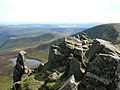 Cadair Berwyn New Top Rocks - geograph.org.uk - 38162.jpg 600 × 450; 123 KB
-

-
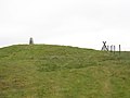
 Cairn on the path to Moel Sych - geograph.org.uk - 647918.jpg 640 × 480; 64 KB
-
 Cairn on the summit of Glan Hafon - geograph.org.uk - 6165977.jpg 1,469 × 1,102; 577 KB
-
-
 Camping at the Henstent site - geograph.org.uk - 1990318.jpg 1,600 × 1,200; 734 KB
-
 Capel Carmel, Llangynog - geograph.org.uk - 6378020.jpg 4,000 × 3,000; 2.46 MB
-
 Carmel chapel in Llangynog - geograph.org.uk - 3107436.jpg 640 × 480; 74 KB
-
 Carmel chapel, Llangynog - geograph.org.uk - 4475341.jpg 640 × 480; 121 KB
-
 Cattle grid out to open country - geograph.org.uk - 6167642.jpg 1,469 × 1,102; 774 KB
-
 Cefn Gledwen - geograph.org.uk - 669211.jpg 640 × 480; 100 KB
-
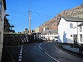 Centre of Llangynog - geograph.org.uk - 2238971.jpg 640 × 480; 72 KB
-
 Chalet style accommodation - geograph.org.uk - 4249314.jpg 640 × 360; 99 KB
-
 Chapel at entrance to Llangynog - geograph.org.uk - 2238977.jpg 640 × 480; 94 KB
-
 Chapel at Llangynog - geograph.org.uk - 2238990.jpg 640 × 480; 83 KB
-
 Clear path across the moor - geograph.org.uk - 674025.jpg 640 × 480; 109 KB
-
 Cliffs above Tan-y-pistyll - geograph.org.uk - 474092.jpg 640 × 512; 54 KB
-
 Climbing Moel Blaen-y-cwm in 1988 - geograph.org.uk - 6413586.jpg 4,167 × 3,755; 1.8 MB
-
 Concrete bridge and mountain track - geograph.org.uk - 269962.jpg 640 × 480; 63 KB
-
-
 Converted chapel at Llangynog Bridge - geograph.org.uk - 3107431.jpg 640 × 480; 68 KB
-
 Cottage beside the lane - geograph.org.uk - 3107409.jpg 640 × 480; 108 KB
-

-
 Craig Berwyn peak - geograph.org.uk - 270036.jpg 640 × 480; 51 KB
-
 Craig Llwyn-Armon - geograph.org.uk - 5305391.jpg 640 × 480; 130 KB
-
 Craig Melangell - geograph.org.uk - 4249304.jpg 640 × 360; 60 KB
-
 Craig Rhiwarth - geograph.org.uk - 5185206.jpg 1,024 × 682; 118 KB
-
 Craig Rhiwarth - geograph.org.uk - 553119.jpg 640 × 480; 96 KB
-
 Craig Rhiwarth - geograph.org.uk - 553122.jpg 480 × 640; 112 KB
-
 Craig Rhiwarth and the Tanat Valley - geograph.org.uk - 6681967.jpg 1,024 × 670; 372 KB
-

-
 Craig Rhiwarth in Tanat Valley - geograph.org.uk - 3737058.jpg 1,024 × 683; 224 KB
-
 Craig y Gibin - geograph.org.uk - 5305384.jpg 640 × 480; 130 KB
-

-
 Craig-las looking into Cwm Dwygo - geograph.org.uk - 2750058.jpg 4,320 × 3,240; 3.27 MB
-
 Cwm Glan-Hafon - geograph.org.uk - 2752688.jpg 720 × 540; 89 KB
-
 Cwm Glan-Hafon - geograph.org.uk - 2752723.jpg 720 × 540; 95 KB
-
 Cwm Lleoh - geograph.org.uk - 2752729.jpg 960 × 720; 128 KB
-
 Cwm Llêch from the forest track - geograph.org.uk - 6413559.jpg 5,390 × 3,755; 2.22 MB
-
 Cwm Maen Gwynedd - geograph.org.uk - 648489.jpg 480 × 640; 82 KB
-
 Cwm Pennant - geograph.org.uk - 477532.jpg 640 × 480; 77 KB
-
 Cwm Pennant - geograph.org.uk - 66516.jpg 640 × 433; 125 KB
-
 Cwm Rhiwarth - geograph.org.uk - 1427134.jpg 640 × 426; 75 KB
-
 Cwm Rhiwarth towards Craig Rhiwarth ^ Llangynog - geograph.org.uk - 3736701.jpg 1,024 × 683; 143 KB
-
 Cyrniau Summit - geograph.org.uk - 3281235.jpg 1,600 × 1,200; 1.49 MB
-
 Date plaque at Llechwedd-y-garth - geograph.org.uk - 3107032.jpg 640 × 480; 81 KB
-

-
 Drive up to Llwyn Onn - geograph.org.uk - 732227.jpg 640 × 425; 79 KB
-
 Drover's Arms Inn on Epynt mountain - geograph.org.uk - 157616.jpg 640 × 480; 139 KB
-
 Edge of Rhyd y Felin forest - geograph.org.uk - 1758541.jpg 3,648 × 2,736; 4.85 MB
-
 Eglwys Sant Melangell, Pennant Melangell - geograph.org.uk - 6241086.jpg 1,600 × 1,200; 546 KB
-

-
 End of the track at Tan-y-graig - geograph.org.uk - 6166553.jpg 1,469 × 1,102; 839 KB
-
 Entrance to Llangynog - geograph.org.uk - 3261265.jpg 640 × 480; 52 KB
-
 Evans-Evans wedding at Llangynog (5389936677).jpg 475 × 623; 54 KB
-
 Fake tanks on Sennybridge artillery range - geograph.org.uk - 157629.jpg 640 × 480; 148 KB
-
 Fallen Boundary Stone - geograph.org.uk - 4414078.jpg 640 × 480; 116 KB
-

-
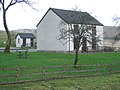
 Farm in Cwm Pennant - geograph.org.uk - 3107083.jpg 640 × 480; 90 KB
-
 Farmhouse chimney ruins in Cwm Llech - geograph.org.uk - 3107113.jpg 640 × 480; 117 KB
-
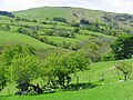
 Farmland in Cwm Rhiwarth - geograph.org.uk - 241751.jpg 640 × 480; 128 KB
-
 Farmland in Cwm Rhiwarth, Powys - geograph.org.uk - 2281819.jpg 1,024 × 685; 201 KB
-
 Fence and grouse moor - geograph.org.uk - 1267339.jpg 640 × 480; 123 KB
-
 Fence, Hirnant - geograph.org.uk - 6472378.jpg 1,024 × 689; 193 KB
-
 Field footpath - geograph.org.uk - 4986278.jpg 1,600 × 1,064; 458 KB
-
 Fields by B4391 - geograph.org.uk - 4475580.jpg 640 × 480; 179 KB
-
 Footbridge high up in Cwm Llech - geograph.org.uk - 3107149.jpg 640 × 480; 126 KB
-
 Footbridge in a boggy area - geograph.org.uk - 2589580.jpg 640 × 480; 166 KB
-
 Footbridge over the Afon Tanat - geograph.org.uk - 1267363.jpg 550 × 413; 154 KB
-
 Footpath across heather moorland - geograph.org.uk - 6563876.jpg 3,888 × 5,184; 5.34 MB
-
 Footpath across the field - geograph.org.uk - 732273.jpg 640 × 425; 67 KB
-
 Footpath through farmyard - geograph.org.uk - 732217.jpg 640 × 425; 76 KB
-
 Footpath to Nant-y-Llyn - geograph.org.uk - 766828.jpg 640 × 426; 77 KB
-
 Forest above Bwlch y Main - geograph.org.uk - 4822199.jpg 6,000 × 4,000; 4.2 MB
-
 Forest clearance near the sheepfold - geograph.org.uk - 2589585.jpg 640 × 480; 224 KB
-
 Former shop and housing, Llanygnog - geograph.org.uk - 4986301.jpg 1,600 × 1,064; 570 KB
-
 Former village school in Llangynog - geograph.org.uk - 6166583.jpg 1,469 × 1,102; 672 KB
-

-
 Garden path, Nant-ewyn - geograph.org.uk - 4986269.jpg 1,600 × 1,064; 861 KB
-
 Garnedd Wen - geograph.org.uk - 2764282.jpg 4,320 × 3,240; 3.33 MB
-
 Gate at the end of Glan-Hafon track - geograph.org.uk - 2782159.jpg 4,320 × 3,240; 3.39 MB
-
 Gateway on the lane to Pennant Melangell - geograph.org.uk - 4986285.jpg 1,600 × 1,064; 717 KB
-
 Gateway to Blaen-rhiwarth - geograph.org.uk - 2589604.jpg 640 × 480; 363 KB
-
 Glan Hafon - geograph.org.uk - 2764277.jpg 4,320 × 3,240; 3.4 MB
-
 Glan-yr-afon cottage - geograph.org.uk - 1173032.jpg 640 × 480; 88 KB
-
 Godor North Top - geograph.org.uk - 29145.jpg 640 × 480; 106 KB
-
 Grouse butt on the moor near Bryn Ysbio - geograph.org.uk - 1260237.jpg 640 × 480; 141 KB
-
 Half way through No Man's Land - geograph.org.uk - 157622.jpg 640 × 480; 111 KB
-
 Handsome tup, Llangynog - geograph.org.uk - 552021.jpg 640 × 480; 137 KB
-

-
 Henstent caravan park - geograph.org.uk - 880419.jpg 640 × 480; 69 KB
-
 Herberage building plaque, Llanglynog, South Wales.jpg 4,034 × 2,907; 2.76 MB
-
 High on the ridge - geograph.org.uk - 2589577.jpg 640 × 480; 343 KB
-
 Hillside above Dyffryn Tanat - geograph.org.uk - 4821054.jpg 6,000 × 4,000; 3.93 MB
-
 Hillside above Llwyn-onn - geograph.org.uk - 6166830.jpg 1,469 × 1,102; 874 KB
-
 Hillside at Glan-yr-afon - geograph.org.uk - 2589612.jpg 640 × 480; 239 KB
-
 Hillside in Upper Cwm Llech - geograph.org.uk - 3107141.jpg 640 × 480; 104 KB
-
 In need of some roof repairs - geograph.org.uk - 6222573.jpg 5,184 × 3,888; 4.92 MB
-
 In The Tanat Valley - geograph.org.uk - 3672366.jpg 2,560 × 1,920; 1.96 MB
-
 Incline above Llangynog - geograph.org.uk - 669891.jpg 640 × 480; 143 KB
-
 It's been raining again - geograph.org.uk - 2589615.jpg 640 × 480; 249 KB
-
 Lane along Cwm Pennant - geograph.org.uk - 2589595.jpg 640 × 480; 355 KB
-
 Lane in Cwm Pennant - geograph.org.uk - 3106990.jpg 640 × 480; 77 KB
-

-
 Lane near Afon Eirth - geograph.org.uk - 2589600.jpg 640 × 480; 417 KB
-
 Lane outside Llangynog - geograph.org.uk - 3106746.jpg 640 × 480; 102 KB
-
 Large car park in Llangynog - geograph.org.uk - 3106687.jpg 640 × 480; 65 KB
-
 Leaving Open Country - geograph.org.uk - 6188282.jpg 5,184 × 3,888; 5.13 MB
-
 Little used footpath - geograph.org.uk - 2589610.jpg 640 × 480; 309 KB
-
 Llangynog - geograph.org.uk - 839772.jpg 640 × 480; 71 KB
-
 Llangynog Ancient Yew Tree. - geograph.org.uk - 6021298.jpg 2,003 × 1,337; 1.1 MB
-
 Llangynog and Tanat Valley - geograph.org.uk - 67254.jpg 640 × 480; 154 KB
-
 Llangynog Bridge over Afon Tanat (geograph 2238984).jpg 640 × 480; 122 KB
-
 Llangynog ochr y Bala.JPG 4,272 × 2,848; 9.21 MB
-
 Llangynog Pilgrims Church, Llangynog, Powys.jpg 4,848 × 3,636; 3.58 MB
-
 Llangynog Powys.jpg 2,592 × 1,944; 1.59 MB
-
 Llangynog SY10, UK - panoramio (1).jpg 3,264 × 2,448; 2.41 MB
-
 Llangynog SY10, UK - panoramio (2).jpg 3,264 × 2,448; 2.63 MB
-
 Llangynog SY10, UK - panoramio.jpg 3,264 × 2,448; 2.89 MB
-
 Llangynog with Y Gribin - geograph.org.uk - 477517.jpg 640 × 480; 74 KB
-
 Llangynog, Powys - geograph.org.uk - 3943463.jpg 1,024 × 683; 204 KB
-
 Llyn Lluncaws - geograph.org.uk - 169238.jpg 640 × 479; 84 KB
-
 Llyn Lluncaws - geograph.org.uk - 474050.jpg 640 × 512; 64 KB
-
 Llyn Lluncaws from the Berwyn ridge - geograph.org.uk - 648477.jpg 640 × 480; 65 KB
-

-
 Looking across Cwm Nantewyn - geograph.org.uk - 1260199.jpg 640 × 480; 135 KB
-
 Looking across Llangynog - geograph.org.uk - 1990254.jpg 1,600 × 1,200; 503 KB
-
 Looking at Glan-Hafon from the Llangynog Road - geograph.org.uk - 2769800.jpg 3,664 × 2,375; 1.55 MB
-
 Looking down Cwm Llech - geograph.org.uk - 3107158.jpg 640 × 480; 98 KB
-
 Looking down Cwm Rhiwarth - geograph.org.uk - 241747.jpg 640 × 480; 112 KB
-
 Looking in to Cwm Pennant from Craig-Las - geograph.org.uk - 2750045.jpg 4,320 × 3,240; 3.1 MB
-
-
 Looking towards Cyrniau from Bwlch y Main - geograph.org.uk - 2769810.jpg 3,656 × 2,370; 1.41 MB
-
 Looking up Cwm Rhiwarth - geograph.org.uk - 241744.jpg 640 × 480; 101 KB
-
 Looking up to Craig Rhiwarth - geograph.org.uk - 844416.jpg 425 × 640; 65 KB
-
 Minor road up Cwm Pennant - geograph.org.uk - 1326764.jpg 640 × 428; 107 KB
-
 Moel Dimoel - geograph.org.uk - 1141417.jpg 640 × 480; 84 KB
-
 Moel Dimoel, 494m - geograph.org.uk - 1990346.jpg 1,600 × 998; 388 KB
-
 Moel Sych - geograph.org.uk - 29130.jpg 640 × 480; 96 KB
-
 Moorland - geograph.org.uk - 1757482.jpg 3,648 × 2,736; 5.21 MB
-
 Moorland - geograph.org.uk - 1757496.jpg 3,648 × 2,736; 4.76 MB
-
 Moorland above Nantyroffeiriad - geograph.org.uk - 670057.jpg 640 × 480; 119 KB
-
 Moorland above Nantyroffeiriad - geograph.org.uk - 674006.jpg 640 × 480; 123 KB
-
 Moorland above the valley of Nant Chrechwyl - geograph.org.uk - 6563872.jpg 5,184 × 3,888; 3.62 MB
-
 Moorland and fence - geograph.org.uk - 1757695.jpg 3,648 × 2,736; 4.78 MB
-
 Moorland edge - geograph.org.uk - 673989.jpg 640 × 480; 115 KB
-
 Moorland Footbridge in Berwyns - geograph.org.uk - 3737128.jpg 1,024 × 683; 174 KB
-
 Moorland spur - geograph.org.uk - 1758498.jpg 3,648 × 2,736; 4.83 MB
-
 Moorland streams - geograph.org.uk - 1758485.jpg 3,648 × 2,736; 4.9 MB
-
 More moorland - geograph.org.uk - 669206.jpg 640 × 480; 100 KB
-
 More moorland - geograph.org.uk - 670078.jpg 640 × 480; 101 KB
-
-
 Nant Boundary stone - geograph.org.uk - 1172810.jpg 640 × 480; 144 KB
-

-
 Nant y Llyn - geograph.org.uk - 51508.jpg 640 × 511; 132 KB
-
 Nant y Llyn - geograph.org.uk - 551875.jpg 640 × 480; 164 KB
-
 Nant y Llyn Valley - geograph.org.uk - 474028.jpg 640 × 512; 75 KB
-
 Nant y Llyn Valley - geograph.org.uk - 474070.jpg 640 × 512; 65 KB
-
 Nant yr Offeiriad - geograph.org.uk - 671695.jpg 627 × 461; 202 KB
-
 Nant yr Offeiriad - geograph.org.uk - 674002.jpg 640 × 480; 99 KB


.jpg)


.jpg)


.jpg)
.jpg)


