Category:Llangeinor
Jump to navigation
Jump to search
village in Bridgend County Borough, Wales, United Kingdom  | |||||
| Upload media | |||||
| Instance of | |||||
|---|---|---|---|---|---|
| Location | Bridgend County Borough, Wales | ||||
 | |||||
Cymraeg: Pentref ym mwrdeistref sirol Pen-y-bont ar Ogwr yw Llangeinwyr (Seisnigiad: Llangeinor). Saif yn y Cymoedd tua 5 milltir i'r gogledd o dref Pen-y-bont ar Ogwr ei hun.
English: Llangeinor ( Welsh: Llangeinwyr) is a small village located in the Garw Valley around 5 miles north of Bridgend in Bridgend County Borough, Wales. The entire village is now protected as part of a conservation area.
Subcategories
This category has the following 2 subcategories, out of 2 total.
C
L
Media in category "Llangeinor"
The following 38 files are in this category, out of 38 total.
-
 Bend on the A4093 to Blackmill - geograph.org.uk - 1017321.jpg 640 × 480; 109 KB
-
 Bog on Llangeinor Common - geograph.org.uk - 1019400.jpg 640 × 480; 111 KB
-
 Bridleway up to Pen y Foel and barns - geograph.org.uk - 1019370.jpg 640 × 479; 119 KB
-
 Cattle Grid over minor road - geograph.org.uk - 947272.jpg 640 × 480; 46 KB
-
 Coal heads south from the valleys - geograph.org.uk - 842094.jpg 640 × 427; 85 KB
-

-
 Cycle path alongside disused railway (geograph 2797984).jpg 640 × 480; 124 KB
-
 Cycle path running alongside the disused railway (geograph 2789829).jpg 640 × 480; 116 KB
-
 Flytipping near Llangeinor. - geograph.org.uk - 1185794.jpg 640 × 480; 82 KB
-
 Footpath and sign near Llangeinor - geograph.org.uk - 1019358.jpg 640 × 480; 97 KB
-

-
 Fork in the track Llangeinor Common - geograph.org.uk - 1019181.jpg 640 × 461; 115 KB
-
 Garw valley at Llangeinor - geograph.org.uk - 1019752.jpg 640 × 480; 114 KB
-
 Kissing Gate at Llangeinor Common - geograph.org.uk - 1019709.jpg 640 × 480; 118 KB
-
 Llangeinor near the turn for Bettws - geograph.org.uk - 1019749.jpg 640 × 480; 81 KB
-
 Llangeinor service reservoir - geograph.org.uk - 1017293.jpg 640 × 426; 80 KB
-
 Local Memorials (geograph 4726337).jpg 3,019 × 2,346; 1.45 MB
-

-
 Road crossing disused railway - geograph.org.uk - 947394.jpg 640 × 480; 77 KB
-
 Road past the school in Llangeinor - geograph.org.uk - 1019744.jpg 640 × 480; 81 KB
-

-
 Steep bracken slope and trees - geograph.org.uk - 1019769.jpg 640 × 432; 117 KB
-
 Stile on footpath at Llangeinor - geograph.org.uk - 1019717.jpg 640 × 480; 80 KB
-
 Sympathetic restoration required - geograph.org.uk - 1017307.jpg 640 × 480; 117 KB
-
 The Llangeinor Arms - geograph.org.uk - 1019343.jpg 640 × 465; 68 KB
-
 Track on Llangeinor Common - geograph.org.uk - 1019395.jpg 640 × 480; 103 KB
-
 Track on top of Llangeinor Common - geograph.org.uk - 1019199.jpg 640 × 480; 100 KB
-
 Trackside bracken on Llangeinor Common - geograph.org.uk - 1019190.jpg 640 × 490; 117 KB
-
 Valley road north through Llangeinor - geograph.org.uk - 1019739.jpg 640 × 480; 78 KB
-

-
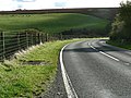
 A4093 climbing away from Llangeinor - geograph.org.uk - 1019764.jpg 640 × 480; 99 KB
-

-
 A4093 from above the hairpin - geograph.org.uk - 1019782.jpg 640 × 480; 82 KB
-

-

-
 Farm gates and part of a shed - geograph.org.uk - 475413.jpg 640 × 469; 84 KB
-
 Junction of link road with the A4061 - geograph.org.uk - 475392.jpg 640 × 480; 114 KB
-
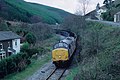
 Llangeinor - geograph.org.uk - 358849.jpg 640 × 480; 87 KB


.jpg)
.jpg)


.jpg)


