Category:Llanfaes
Jump to navigation
Jump to search
village in Anglesey, Wales  | |||||
| Upload media | |||||
| Instance of | |||||
|---|---|---|---|---|---|
| Location | Anglesey, Irish Sea | ||||
 | |||||
Cymraeg: Pentre a safle hen fynachlog, yn ymyl Biwmares yn ne-ddwyrain Ynys Môn yw Llan-faes (hefyd Llanfaes). Yn yr Oesoedd Canol roedd yn rhan o cwmwd Dindaethwy, cantref Menai. Hyd dechrau'r 19eg ganrif roedd gwasaneth cwch fferi yn mynd â theithwyr drosodd rhwng glan-môr Llan-faes a man ar Draeth Lafan a gyrchid o Abergwyngregin.
English: Llanfaes is a small village on the island of Anglesey, Wales, located on the shore of the eastern entrance to the Menai Strait, the tidal waterway separating Anglesey from the north Wales coast.
Subcategories
This category has only the following subcategory.
C
Media in category "Llanfaes"
The following 62 files are in this category, out of 62 total.
-
 B5109 At Allt Goch Fawr - geograph.org.uk - 1436263.jpg 640 × 480; 201 KB
-
 B5109 At Coed Du - geograph.org.uk - 1436270.jpg 639 × 436; 93 KB
-
 B5109 At The Almshouses - geograph.org.uk - 1436266.jpg 640 × 480; 151 KB
-
 Baron Hill East Lodge - geograph.org.uk - 932275.jpg 640 × 480; 121 KB
-
 Burton Way, Llanfaes - geograph.org.uk - 1548751.jpg 640 × 362; 45 KB
-
 Cottages at Old Llanfaes - geograph.org.uk - 935132.jpg 640 × 469; 94 KB
-

-

-
 Dragon at Henllys - geograph.org.uk - 1158655.jpg 640 × 427; 69 KB
-
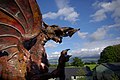
 Dragon with attitude - geograph.org.uk - 550493.jpg 480 × 640; 108 KB
-
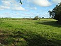 Farmland near Bodgylched - geograph.org.uk - 680638.jpg 640 × 480; 93 KB
-
 Fryars Bay - geograph.org.uk - 435437.jpg 640 × 462; 78 KB
-
 Gas Control Equipment - geograph.org.uk - 314468.jpg 640 × 480; 103 KB
-
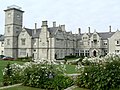
 Henllys Hall - geograph.org.uk - 932481.jpg 640 × 413; 52 KB
-
 Henllys, the Anglesey home of HPB - geograph.org.uk - 550537.jpg 640 × 480; 80 KB
-
 Houses in Burton Way, Llanfaes - geograph.org.uk - 1548753.jpg 640 × 480; 64 KB
-
 Housing estate at Llanfaes - geograph.org.uk - 938851.jpg 640 × 480; 82 KB
-
 Industrial buildings on the Llanfaes Friary site.jpg 2,000 × 1,500; 1.43 MB
-

-
 Llanfaes Lodge - geograph.org.uk - 938875.jpg 640 × 504; 103 KB
-
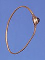 Medieval gold finger ring.jpg 1,067 × 1,436; 161 KB
-
 No, it isn't Lourdes - geograph.org.uk - 550557.jpg 480 × 640; 125 KB
-
 Plaque near shrine at Henllys - geograph.org.uk - 1587048.jpg 426 × 640; 105 KB
-
 Shrine at Henllys - geograph.org.uk - 1587037.jpg 640 × 426; 148 KB
-
 Siop Newydd, Llanfaes - geograph.org.uk - 938659.jpg 640 × 480; 56 KB
-
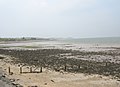
 The beach north Beaumaris at low tide - geograph.org.uk - 416012.jpg 640 × 544; 77 KB
-

-
 The Fryars Slipway - geograph.org.uk - 416906.jpg 640 × 480; 63 KB
-
 The main entrance to Henllys Hall - geograph.org.uk - 935044.jpg 640 × 483; 75 KB
-

-
 The uphill climb from Llanfaes - geograph.org.uk - 932634.jpg 640 × 480; 118 KB
-

-

-

-

-
 A Friesian herd at Gyfynys - geograph.org.uk - 935621.jpg 640 × 382; 63 KB
-
 Approaching Henllys - geograph.org.uk - 314501.jpg 640 × 480; 99 KB
-
 Fairways And Hazards - geograph.org.uk - 314358.jpg 640 × 480; 101 KB
-
 H.P.B. Henllys - geograph.org.uk - 314438.jpg 640 × 480; 100 KB
-
 Henllys - geograph.org.uk - 314489.jpg 640 × 480; 98 KB
-
 Henllys Golf Course - geograph.org.uk - 314413.jpg 640 × 480; 97 KB
-
 Henllys Golf Course - geograph.org.uk - 314443.jpg 640 × 480; 98 KB
-
 Holiday Country - geograph.org.uk - 246551.jpg 640 × 480; 100 KB
-
 House on the beach at Fryars Road - geograph.org.uk - 416919.jpg 640 × 480; 81 KB
-

-

-

-
 Perfect location - geograph.org.uk - 333477.jpg 640 × 426; 75 KB
-
 The Countryside Of Ynys Môn - geograph.org.uk - 314422.jpg 640 × 480; 102 KB
-
 The Golf Course At Henllys - geograph.org.uk - 314418.jpg 640 × 480; 102 KB
-
 The New Clubhouse - geograph.org.uk - 314423.jpg 640 × 480; 99 KB
-
 The road through the woods - geograph.org.uk - 680644.jpg 640 × 480; 153 KB
-
 The Road To Plas Cichle - geograph.org.uk - 314464.jpg 640 × 480; 99 KB
-
 The road to the sea - geograph.org.uk - 417248.jpg 640 × 480; 95 KB
-
 The Smithy, Llanfaes - geograph.org.uk - 314478.jpg 640 × 468; 97 KB
-
 The southern end of Fryars Bay - geograph.org.uk - 435430.jpg 640 × 488; 71 KB
-
 The Third Green - geograph.org.uk - 314355.jpg 640 × 480; 100 KB
-
 The track to Bodgylched - geograph.org.uk - 680634.jpg 640 × 480; 151 KB
-
 Ty Bach Garden Wall - geograph.org.uk - 314447.jpg 640 × 480; 99 KB
-
 Ty Bach, Llanfaes - geograph.org.uk - 314451.jpg 640 × 480; 97 KB
-
 View towards the aquarium - geograph.org.uk - 416621.jpg 640 × 382; 45 KB
-


