Category:Llanelwedd
Jump to navigation
Jump to search
Cymraeg: Pentref a chymuned yn ne Powys ger Llanfair-ym-Muallt yw Llanelwedd. Saif ger glan ogleddol Afon Gwy ar lôn yr A481. Mae ganddo boblogaeth o 787 o bobl (Cyfrifiad 2001).
English: Llanelwedd is a village and community near Builth Wells, in Powys, Wales. It lies within the historic boundaries of the former county of Radnorshire.
Français : Llanelwedd est un village et commune au sud du comté de Powys, Pays de Galles. Il s'est situé près de Llanfair-ym-Muallt (Builth Wells) aux bords de la Gwy. Il a environ 787 d'habitants (2001).

village in Wales, United Kingdom  | |||||
| Upload media | |||||
| Instance of | |||||
|---|---|---|---|---|---|
| Named after |
| ||||
| Location | Powys, Wales | ||||
| Located in or next to body of water | |||||
| Population |
| ||||
 | |||||
Subcategories
This category has the following 8 subcategories, out of 8 total.
B
L
- The Llanelwedd Arms Hotel (4 F)
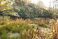
- Llanelwedd quarry (1 F)
R
S
- St Matthew's church, Llanelwedd (15 F)
W
- Wye Bridge, Builth Wells (23 F)
Media in category "Llanelwedd"
The following 200 files are in this category, out of 358 total.
(previous page) (next page)-
 Smithfield Tractors, Llanelwedd - geograph.org.uk - 1994258.jpg 640 × 516; 82 KB
-
 "Burger" Factory - geograph.org.uk - 1033408.jpg 640 × 480; 55 KB
-
 "The Rocks", River Wye, near Builth Wells - geograph.org.uk - 4925374.jpg 1,600 × 1,068; 597 KB
-
 A bend in the River Wye, Llanelwedd - geograph.org.uk - 3504403.jpg 800 × 600; 145 KB
-
 A couple of sheep - geograph.org.uk - 3137085.jpg 1,024 × 683; 177 KB
-
 A-road junction ahead, Llanelwedd - geograph.org.uk - 3503363.jpg 800 × 617; 178 KB
-

-

-
 A470 junction near Builth Road, Powys - geograph.org.uk - 3641298.jpg 800 × 555; 110 KB
-
 A470 near Builth Road - geograph.org.uk - 5330723.jpg 640 × 427; 270 KB
-
 A470 near Builth Wells - geograph.org.uk - 5330719.jpg 640 × 427; 345 KB
-
 A481 at Lugano - geograph.org.uk - 4979164.jpg 2,408 × 2,137; 1.09 MB
-
 A483 Approaching Llanelwedd - geograph.org.uk - 5086695.jpg 640 × 427; 340 KB
-
 A483 entering Llanelwedd - geograph.org.uk - 5078158.jpg 640 × 480; 415 KB
-
 A483 heads away from Llanelwedd - geograph.org.uk - 3503173.jpg 800 × 600; 143 KB
-
 A483 looking north - geograph.org.uk - 2226292.jpg 640 × 480; 89 KB
-
 A483 near Pencerrig - geograph.org.uk - 3286736.jpg 640 × 480; 41 KB
-
 A483 near to Llanelwedd - geograph.org.uk - 5078155.jpg 640 × 427; 349 KB
-
 A483 north of Llanelwedd - geograph.org.uk - 3286731.jpg 640 × 480; 72 KB
-
 A483 passing school at Llannelwedd - geograph.org.uk - 3132822.jpg 640 × 479; 100 KB
-
 A483 passing the Royal Welsh Showground - geograph.org.uk - 5078151.jpg 640 × 427; 347 KB
-
 A483, Llanwedd - geograph.org.uk - 5078162.jpg 640 × 480; 388 KB
-
 Aberedw Hillside - geograph.org.uk - 4976312.jpg 4,168 × 3,126; 2.78 MB
-
 Access lane to Court Farm, Builth Road - geograph.org.uk - 3631887.jpg 615 × 640; 115 KB
-

-

-

-

-
 Aerial view - Builth Wells and the River Wye - geograph.org.uk - 6406505.jpg 1,800 × 1,200; 408 KB
-
 Afon Gwy - River Wye - geograph.org.uk - 1444610.jpg 640 × 480; 73 KB
-

-
 All in a row - geograph.org.uk - 2116158.jpg 1,024 × 768; 158 KB
-
 Altar in St Mary - geograph.org.uk - 4287539.jpg 533 × 800; 63 KB
-

-

-
 Area near Builth Road Station - geograph.org.uk - 4042513.jpg 1,024 × 768; 1.25 MB
-
 BandB up the road - geograph.org.uk - 1526225.jpg 640 × 480; 85 KB
-
 Bed and Breakfast - geograph.org.uk - 1526208.jpg 640 × 480; 77 KB
-
 Below Caer Fawr - geograph.org.uk - 5780139.jpg 1,200 × 800; 575 KB
-
 Bible on the table - geograph.org.uk - 4287660.jpg 1,024 × 683; 104 KB
-

-

-
 Brecknockshire flag.jpg 1,955 × 1,725; 1.78 MB
-
 Bridleway crosses the quarry road - geograph.org.uk - 1064294.jpg 640 × 480; 201 KB
-
 Builth Road boundary sign, Powys - geograph.org.uk - 3631553.jpg 800 × 571; 186 KB
-
 Builth Road railway station, Powys - geograph.org.uk - 4001816.jpg 1,024 × 768; 215 KB
-
 Builth Road station - geograph.org.uk - 3075810.jpg 4,230 × 3,084; 7.62 MB
-
 Builth Well Garages, Llanelwedd - geograph.org.uk - 3641607.jpg 800 × 653; 168 KB
-
 Builth Wells Bridge in mist - geograph.org.uk - 3136510.jpg 1,024 × 680; 86 KB
-
 Builth Wells, Bridge over River Wye - geograph.org.uk - 2939716.jpg 1,600 × 1,200; 564 KB
-

-
 Bulith Wells Suzuki Garage - geograph.org.uk - 4979163.jpg 4,227 × 1,962; 803 KB
-

-
 Burger roundabout - geograph.org.uk - 1064253.jpg 640 × 480; 179 KB
-
 Burger van by the tree - geograph.org.uk - 2116013.jpg 600 × 800; 88 KB
-

-
 Caer Einon from the north - geograph.org.uk - 5778621.jpg 1,200 × 800; 624 KB
-
 Caerynwch Tywysog 6ed - geograph.org.uk - 2515901.jpg 640 × 480; 68 KB
-

-

-

-
 Cambrian Arms, Builth Road - geograph.org.uk - 3631612.jpg 800 × 668; 147 KB
-

-
 Cambrian Forge, Builth Road, Powys - geograph.org.uk - 3632534.jpg 800 × 564; 129 KB
-
 Canolfan Gelfyddydau Glannau Gwy - geograph.org.uk - 2515802.jpg 640 × 480; 56 KB
-
 Canolfan yr Aelodau - geograph.org.uk - 2518605.jpg 640 × 480; 81 KB
-
 Carneddau hills, view from Craig Fawr - geograph.org.uk - 5780125.jpg 1,200 × 796; 594 KB
-
 Carneddau hillside with path - geograph.org.uk - 5778638.jpg 1,200 × 772; 605 KB
-
 Castle behind the houses. - geograph.org.uk - 2116037.jpg 1,024 × 768; 121 KB
-
 Cattle judging at The Welsh Winter Fair, Builth Wells - geograph.org.uk - 3247619.jpg 3,437 × 2,646; 3.57 MB
-
 Ceiling in St Mary - geograph.org.uk - 4287662.jpg 1,024 × 683; 104 KB
-
 Chair at the Table - geograph.org.uk - 4287661.jpg 1,024 × 683; 102 KB
-
 Children's playground, Llanelwedd - geograph.org.uk - 3503271.jpg 800 × 600; 188 KB
-
 Chimney at Builth Wells - geograph.org.uk - 5681941.jpg 480 × 640; 131 KB
-
 Chimney near the garage - geograph.org.uk - 2117737.jpg 600 × 800; 68 KB
-
 Church House Farm - geograph.org.uk - 3711208.jpg 800 × 600; 93 KB
-
 Church House postbox - geograph.org.uk - 3711204.jpg 450 × 600; 76 KB
-
 Coed Cwm Henllan Lodge from A483 - geograph.org.uk - 3132829.jpg 640 × 427; 87 KB
-
 Coronation Bungalow - geograph.org.uk - 1035674.jpg 640 × 480; 79 KB
-
 Cwmbach Llechrhyd - geograph.org.uk - 5330739.jpg 640 × 427; 381 KB
-

-
 Date board - geograph.org.uk - 4737103.jpg 3,264 × 2,448; 3.14 MB
-
 Date stone on the Chapel - geograph.org.uk - 3709557.jpg 800 × 600; 76 KB
-
 Deep Pool - geograph.org.uk - 1064195.jpg 640 × 428; 258 KB
-
 Deserted farmhouse north of Aberedw Hill - geograph.org.uk - 3839293.jpg 1,500 × 1,125; 2.09 MB
-
 Distances from Llanelwedd - geograph.org.uk - 3503317.jpg 800 × 800; 194 KB
-
 Distances from Llanelwedd - geograph.org.uk - 3641659.jpg 799 × 800; 139 KB
-
 Do not cross this bridge, Builth Road - geograph.org.uk - 3632492.jpg 800 × 533; 188 KB
-
 Doubly green recycling skip, Builth Road - geograph.org.uk - 3632067.jpg 800 × 538; 146 KB
-
 Eagle Lectern - geograph.org.uk - 4287523.jpg 1,024 × 683; 114 KB
-
 Eastern boundary of Llanelwedd - geograph.org.uk - 3503139.jpg 800 × 683; 190 KB
-
 Edward Davies Memorial - geograph.org.uk - 4287536.jpg 1,024 × 683; 97 KB
-

-
 End of the Terrace - geograph.org.uk - 2116135.jpg 600 × 800; 96 KB
-

-

-
 Entrance lodge to Pencerrig Hotel - geograph.org.uk - 830001.jpg 640 × 426; 90 KB
-
 Entrance to a car park, Llanelwedd - geograph.org.uk - 3504426.jpg 800 × 670; 155 KB
-
 Entrance to Neuadd Henllan - geograph.org.uk - 6189248.jpg 640 × 480; 86 KB
-
 Entrance to the Chef - geograph.org.uk - 2117698.jpg 1,024 × 768; 81 KB
-
 Entrance to the Quarry - geograph.org.uk - 818014.jpg 640 × 427; 85 KB
-
 Entrance, Royal Welsh Showground - geograph.org.uk - 4923027.jpg 1,600 × 898; 385 KB
-

-

-
 Eyot in the Wye, Llanelwedd - geograph.org.uk - 3504410.jpg 800 × 637; 189 KB
-
 Farmland below Caer Einon - geograph.org.uk - 5784643.jpg 1,280 × 800; 746 KB
-
 Farmland south-west of Hundred House in Powys - geograph.org.uk - 6212397.jpg 1,440 × 960; 1.55 MB
-
 Fields by the Wye - geograph.org.uk - 807934.jpg 640 × 427; 56 KB
-

-
 Footbridge over Dulas Brook, Builth Road - geograph.org.uk - 3641268.jpg 800 × 640; 239 KB
-
 Former mission hut, Builth Road, Powys - geograph.org.uk - 3632562.jpg 800 × 600; 148 KB
-

-
 Former shop, Builth Road, Powys - geograph.org.uk - 3632572.jpg 800 × 681; 212 KB
-
 Foundation stone, Wye Bridge, Builth - geograph.org.uk - 2431781.jpg 640 × 480; 117 KB
-
 From beside the Lectern - geograph.org.uk - 4287655.jpg 1,024 × 683; 142 KB
-

-
 Garage on the rail line - geograph.org.uk - 2117614.jpg 1,024 × 768; 134 KB
-
 Gate on road to Cefn-dyrys - geograph.org.uk - 6384870.jpg 4,032 × 3,024; 4.02 MB
-
 Gate to the house - geograph.org.uk - 3709558.jpg 800 × 600; 102 KB
-
 Gelli-Cadwgan - geograph.org.uk - 4979166.jpg 4,608 × 2,387; 1.3 MB
-
 Gelli-cadwgan and Coedspoil - geograph.org.uk - 1037999.jpg 640 × 480; 60 KB
-
 Gelli-cadwgan farm - geograph.org.uk - 1037958.jpg 640 × 480; 48 KB
-
 Grazing east of Builth Wells, Powys - geograph.org.uk - 2374497.jpg 800 × 569; 314 KB
-
 Grazing east of Builth Wells, Powys - geograph.org.uk - 2374506.jpg 600 × 800; 326 KB
-
 Grazing east of Builth Wells, Powys - geograph.org.uk - 2374512.jpg 800 × 558; 278 KB
-
 Green fields below Caer Einon - geograph.org.uk - 5778677.jpg 1,200 × 800; 641 KB
-
 Hafod a Hendre - geograph.org.uk - 5988931.jpg 4,032 × 3,024; 1.47 MB
-
 Head on the Eagle - geograph.org.uk - 4287531.jpg 1,024 × 683; 60 KB
-
 Hope Chapel - geograph.org.uk - 3709476.jpg 800 × 600; 78 KB
-
 Hope Chapel Benchmark - geograph.org.uk - 3709561.jpg 450 × 600; 91 KB
-
 Horses being judged, Royal Welsh Show - geograph.org.uk - 5479414.jpg 1,024 × 683; 574 KB
-
 House on Station road - geograph.org.uk - 2117690.jpg 1,024 × 768; 114 KB
-

-
 Howdens Joinery Llanelwedd - geograph.org.uk - 3641644.jpg 800 × 584; 118 KB
-
 In the sheep judging ring, Royal Welsh Show - geograph.org.uk - 5479814.jpg 1,024 × 683; 631 KB
-
 Jewson Llanelwedd - geograph.org.uk - 3505854.jpg 800 × 522; 126 KB
-
 Jumping for Joy - geograph.org.uk - 4008020.jpg 1,024 × 768; 107 KB
-
 Junction ahead - geograph.org.uk - 913117.jpg 640 × 427; 65 KB
-
 Keeping Fit - geograph.org.uk - 4008026.jpg 1,024 × 768; 139 KB
-
 Lamb feeding by Blackrock Pool on Aberedw Hill - geograph.org.uk - 4976318.jpg 4,415 × 3,311; 2.23 MB
-
 Landslide on the walls - geograph.org.uk - 818116.jpg 640 × 427; 95 KB
-
 Lanelweth rocks.jpeg 900 × 688; 374 KB
-

-
 Layby alongside the A470 near Llanelwedd - geograph.org.uk - 3641506.jpg 800 × 642; 115 KB
-
 Layby on the A483 near to Llanelwedd - geograph.org.uk - 5086706.jpg 640 × 480; 400 KB
-

-
 Left on the hill - geograph.org.uk - 3137060.jpg 1,024 × 683; 160 KB
-
 Little Chef - Burger King, Llanelwedd - geograph.org.uk - 3504561.jpg 800 × 598; 134 KB
-
 Little Chef - geograph.org.uk - 2117647.jpg 1,024 × 768; 104 KB
-
 Llanelwedd - geograph.org.uk - 1445270.jpg 640 × 480; 78 KB
-
 Llanelwedd - new Vicarage - geograph.org.uk - 1042891.jpg 640 × 428; 398 KB
-

-
 Llanelwedd Church Powys - geograph.org.uk - 4623122.jpg 1,386 × 912; 1,018 KB
-
 Llanelwedd from Aberedw Hill - geograph.org.uk - 6087553.jpg 1,600 × 1,200; 290 KB
-
 Llanelwedd Jubilee Hall - geograph.org.uk - 3503309.jpg 800 × 670; 149 KB
-
 Llanelwedd Old Quarry - geograph.org.uk - 1033434.jpg 640 × 480; 69 KB
-
 Llanelwedd quarries 01.jpg 3,264 × 2,448; 2.66 MB
-
 Llanelwedd School - geograph.org.uk - 4008007.jpg 1,024 × 768; 183 KB
-
 Llanelwedd school - geograph.org.uk - 885274.jpg 640 × 426; 99 KB
-
 Llanelwedd school - geograph.org.uk - 886110.jpg 640 × 426; 77 KB
-
 Llanelwedd school house - geograph.org.uk - 885281.jpg 640 × 426; 64 KB
-
 Llanelwedd Show Ground - geograph.org.uk - 6295784.jpg 4,000 × 3,000; 2.6 MB
-
 Llanelwedd Terrace - geograph.org.uk - 2116095.jpg 1,024 × 768; 125 KB
-
 Llanelwedd Terrace houses, Llanelwedd - geograph.org.uk - 3505950.jpg 800 × 600; 113 KB
-
 Llanelwedd Vicarage and Church - geograph.org.uk - 1042884.jpg 640 × 428; 421 KB
-
 Llanelwedd village sign - geograph.org.uk - 1904082.jpg 640 × 480; 65 KB
-
 LlanelweddRoadSign.jpg 2,304 × 1,728; 656 KB
-
 Llwybr Tynllwyn - Tynllwyn Path - geograph.org.uk - 5722792.jpg 640 × 480; 82 KB
-
 Looking down at the Wye - geograph.org.uk - 3137055.jpg 1,024 × 683; 151 KB
-
 Looking down on the quarry - geograph.org.uk - 818052.jpg 640 × 427; 66 KB
-
 Looking down to Cwm Milo - geograph.org.uk - 3137089.jpg 1,024 × 683; 138 KB
-
 Looking in St Mary - geograph.org.uk - 4287521.jpg 1,024 × 683; 111 KB
-
 Looking over the Showground from Hafod a Hendre - geograph.org.uk - 5988929.jpg 4,032 × 3,024; 1.39 MB
-

-
 Mid Wales railway at Llanfaredd - geograph.org.uk - 3937658.jpg 3,264 × 1,836; 2.51 MB
-
 Mile Stone - geograph.org.uk - 3863562.jpg 480 × 640; 116 KB
-
 Mile Stone, Upper Llanelwedd Wood - geograph.org.uk - 3863568.jpg 640 × 480; 139 KB
-
 Moat Lane - Brecon train, near Builth Road, 1949 - geograph.org.uk - 4560901.jpg 2,152 × 1,448; 1.42 MB
-
 Montage above Information Boards, Builth Road Station - geograph.org.uk - 4042519.jpg 1,024 × 768; 1,003 KB
-
 Moorland on Aberedw Hill - geograph.org.uk - 4976333.jpg 4,603 × 3,451; 2.44 MB
-
 Nant y Prophwyd - geograph.org.uk - 6403118.jpg 1,536 × 2,048; 1.78 MB
-
 Nave in St Mary - geograph.org.uk - 4287518.jpg 1,024 × 683; 106 KB
-
 Near Gelli-cadwgan Quarry - geograph.org.uk - 1064262.jpg 640 × 480; 176 KB
-
 Neat Cutting for the track - geograph.org.uk - 1020572.jpg 640 × 480; 75 KB
-
 No longer a 'Little Chef' - geograph.org.uk - 5681922.jpg 640 × 480; 133 KB
-
 North Road Garage Llanelwedd - geograph.org.uk - 3504551.jpg 800 × 514; 118 KB
-
 North to the Sandtips - geograph.org.uk - 1064161.jpg 640 × 428; 264 KB
-
 Northbound A470 near Builth Road - geograph.org.uk - 5330730.jpg 640 × 427; 364 KB
-
 Old chapel and manse beside the road - geograph.org.uk - 3078611.jpg 640 × 480; 64 KB
-
 Old Crusher - geograph.org.uk - 1033426.jpg 640 × 480; 100 KB
-
 Old Milestone by the A470, - geograph.org.uk - 6037555.jpg 169 × 287; 33 KB
-

-

-

-

-

-

-
 Old Railway Gate - geograph.org.uk - 1035683.jpg 640 × 480; 75 KB
-
 Ordnance Survey Rivet - geograph.org.uk - 3863564.jpg 480 × 640; 103 KB
-
 Over the roundabout - geograph.org.uk - 2154078.jpg 1,024 × 768; 137 KB


