Category:Llanbadoc
Jump to navigation
Jump to search
village in Monmouthshire, Wales  | |||||
| Upload media | |||||
| Instance of | |||||
|---|---|---|---|---|---|
| Location | Monmouthshire, Wales | ||||
| Located in or next to body of water | |||||
| Population |
| ||||
 | |||||
Cymraeg: Pentref a chymuned yn Sir Fynwy yw Llanbadog, weithiau Llanbadog Fawr (Saesneg: Llanbadoc). Saif yr ochr draw i afon Wysg o dref Brynbuga, heb fod ymhell o'r briffordd A472.
English: Llanbadoc is a village and former civil parish in the ceremonial county of Monmouthshire in Wales.
Subcategories
This category has the following 2 subcategories, out of 2 total.
G
L
- St Madoc's Church, Llanbadoc (11 F)
Media in category "Llanbadoc"
The following 200 files are in this category, out of 626 total.
(previous page) (next page)-
 2010 Wales Monmouthshire Community Llanbadoc map.svg 512 × 682; 699 KB
-
 2024 Wales Monmouthshire Community Llanbadoc map.svg 512 × 682; 603 KB
-
 3000 watery steps information board, Usk - geograph.org.uk - 4644020.jpg 800 × 601; 160 KB
-

-
 7.5 tonne limit through Usk town - geograph.org.uk - 2998695.jpg 640 × 515; 69 KB
-
 7.5 tonne weight limit through Usk - geograph.org.uk - 2421705.jpg 640 × 421; 71 KB
-

-
 A glimpse of Llandegfedd reservoir - geograph.org.uk - 4271963.jpg 800 × 451; 182 KB
-
-
 A view from a field gate, Monkswood - geograph.org.uk - 3196278.jpg 640 × 480; 127 KB
-
-

-

-
 A472 at Coleg Gwent campus entrance - geograph.org.uk - 5810375.jpg 1,024 × 769; 209 KB
-
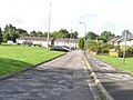
 A472 at Monkswood village boundary - geograph.org.uk - 5810353.jpg 1,024 × 768; 139 KB
-
 A472 at The Beaufort Arms - geograph.org.uk - 5810359.jpg 1,024 × 768; 155 KB
-
 A472 Berthin Road, Little Mill - geograph.org.uk - 5810344.jpg 1,024 × 769; 101 KB
-
 A472 east of Monkswood - geograph.org.uk - 5810369.jpg 1,024 × 769; 182 KB
-
 A472 layby, Rhadyr - geograph.org.uk - 2998588.jpg 640 × 530; 93 KB
-
 Abandoned gatehouse, Rhadyr - geograph.org.uk - 2998647.jpg 640 × 480; 134 KB
-
 Abergavenny Road houses, Usk - geograph.org.uk - 2998087.jpg 640 × 480; 105 KB
-

-
 Access road to construction site - geograph.org.uk - 6965694.jpg 5,184 × 3,456; 7.66 MB
-

-
 Access road to Rhadyr houses - geograph.org.uk - 2998678.jpg 640 × 480; 89 KB
-
 Access track to a field gate, Monkswood - geograph.org.uk - 3196270.jpg 640 × 624; 158 KB
-
 Across a disused railway bridge, Usk - geograph.org.uk - 3314867.jpg 640 × 389; 69 KB
-

-
 Alexandra Place, Monkswood - geograph.org.uk - 3196785.jpg 640 × 504; 86 KB
-
 Alexandra Terrace, Monkswood - geograph.org.uk - 3196768.jpg 640 × 441; 75 KB
-
 Angler in River Usk, Kemeys Commander - geograph.org.uk - 6971083.jpg 5,184 × 3,456; 7.68 MB
-
 Anglers' entrance to edge of Llandegfedd reservoir - geograph.org.uk - 5792639.jpg 5,184 × 3,456; 6.06 MB
-

-
 Arable field by Estavarney Lane - geograph.org.uk - 6967980.jpg 5,179 × 3,451; 4.76 MB
-
 Arable land above the River Usk - geograph.org.uk - 1280151.jpg 640 × 426; 92 KB
-
 Arable land in the Usk valley - geograph.org.uk - 4274001.jpg 800 × 450; 101 KB
-

-
 ARAF-SLOW on the A472, Little Mill, Monmouthshire - geograph.org.uk - 6861876.jpg 1,600 × 1,561; 410 KB
-
-
 Barn alongside the A472, Monkswood - geograph.org.uk - 3196374.jpg 640 × 463; 71 KB
-
 Barn at Estavarney Farm - geograph.org.uk - 6968293.jpg 5,184 × 3,456; 6.95 MB
-
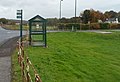
 Beaufort Arms bus stop sign, Monkswood, Monmouthshire - geograph.org.uk - 6864870.jpg 1,600 × 1,434; 856 KB
-
 Beaufort Arms bus stop, Monkswood - geograph.org.uk - 3196630.jpg 640 × 574; 72 KB
-
-
 Beaufort Crescent, from the east - geograph.org.uk - 3664532.jpg 1,024 × 768; 123 KB
-
 Beaufort Crescent, from the south - geograph.org.uk - 3664544.jpg 1,024 × 768; 154 KB
-
 Beech Hill cliff south of Llancayo - geograph.org.uk - 2837222.jpg 480 × 640; 134 KB
-
 Beech tree by public footpath - geograph.org.uk - 6970602.jpg 5,179 × 3,451; 4.62 MB
-
 Beech trees - geograph.org.uk - 2271834.jpg 680 × 1,024; 356 KB
-
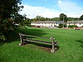
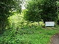
 Bench in Llanbadoc Island, Llanbadoc - geograph.org.uk - 4640979.jpg 800 × 610; 156 KB
-
 Bend ahead on the Usk road, Llanbadoc - geograph.org.uk - 2917461.jpg 640 × 630; 145 KB
-
 Bend in the road, south of Usk - geograph.org.uk - 2251517.jpg 640 × 480; 118 KB
-
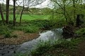
 Berthin Brook - geograph.org.uk - 3664557.jpg 1,024 × 768; 240 KB
-
 Berthin Brook - geograph.org.uk - 4274024.jpg 800 × 600; 167 KB
-
 Berthin Brook - geograph.org.uk - 6964622.jpg 5,179 × 3,451; 5.45 MB
-
 Berthin Brook, Little Mill - geograph.org.uk - 3196894.jpg 640 × 586; 174 KB
-
 Berthin Brook, Rhadyr - geograph.org.uk - 2998328.jpg 640 × 506; 138 KB
-
 Berthin Brook, Usk - geograph.org.uk - 1281229.jpg 640 × 426; 115 KB
-
 Between Cefn Mawr Lane and Rumble Street - geograph.org.uk - 3663969.jpg 1,024 × 768; 140 KB
-

-

-

-
 Black cattle at the edge of Cefn Mawr woodland - geograph.org.uk - 3663975.jpg 1,024 × 768; 141 KB
-

-
 Boundary of a small wood, west of Upper House - geograph.org.uk - 3665681.jpg 1,024 × 768; 135 KB
-

-

-
 Brambly stile, south-east side, Pentre-Waun road - geograph.org.uk - 3664664.jpg 1,024 × 768; 209 KB
-
 Bridge over Berthin Brook, Usk Campus - geograph.org.uk - 6964639.jpg 5,179 × 3,451; 5.74 MB
-
 Bridge, Berthin Brook, Usk Campus - geograph.org.uk - 6964658.jpg 5,184 × 3,456; 7.41 MB
-
 Britannia House, Usk - geograph.org.uk - 4639179.jpg 800 × 600; 112 KB
-

-
 Burlesque, Usk - geograph.org.uk - 2096737.jpg 640 × 449; 74 KB
-
 Burnt House, Glascoed Lane, Monkswood - geograph.org.uk - 6864827.jpg 1,600 × 1,311; 326 KB
-
 Burnt House, Monkswood - geograph.org.uk - 3196606.jpg 640 × 354; 54 KB
-
 Bus shelter in a hedge, Monkswood - geograph.org.uk - 3196455.jpg 640 × 460; 65 KB
-

-
 Cae-maen - geograph.org.uk - 4271926.jpg 800 × 451; 200 KB
-
 Car park, Coleg Gwent Usk campus, 1 - geograph.org.uk - 5014091.jpg 1,600 × 899; 720 KB
-
 Car park, Coleg Gwent Usk campus, 2 - geograph.org.uk - 5014096.jpg 1,600 × 899; 669 KB
-
 Cars and houses, Usk - geograph.org.uk - 4638676.jpg 800 × 601; 86 KB
-
 Cefn Lla Farm - geograph.org.uk - 930137.jpg 640 × 427; 170 KB
-
 Cefn Mawr Lane - geograph.org.uk - 3663987.jpg 1,024 × 768; 156 KB
-
 Cefn Mawr Lane bus stop and shelter, Monkswood - geograph.org.uk - 6981483.jpg 672 × 1,024; 320 KB
-
 Cefn Mawr Lane houses, Monkswood - geograph.org.uk - 3196317.jpg 640 × 486; 79 KB
-

-

-
 Cefn Mawr Lane, near Penpedairheol - geograph.org.uk - 3663943.jpg 1,024 × 768; 213 KB
-

-
 Children's play area in Little Mill, Monmouthshire - geograph.org.uk - 6845793.jpg 4,000 × 3,000; 2.63 MB
-
 Children's play area, Llanbadoc Island - geograph.org.uk - 2421495.jpg 640 × 480; 123 KB
-

-

-
 CHURCH - EGLWYS direction sign, Monkswood - geograph.org.uk - 6981585.jpg 761 × 1,024; 324 KB
-
 Church and churchyard, Monkswood - geograph.org.uk - 6981592.jpg 809 × 1,024; 277 KB
-
 Church information boards, Monkswood - geograph.org.uk - 6981645.jpg 768 × 1,024; 343 KB
-
 Church Lane junction, Glascoed, Monmouthshire - geograph.org.uk - 6994192.jpg 904 × 1,024; 308 KB
-

-
 Churchyard bench, Llanbadoc - geograph.org.uk - 4642746.jpg 800 × 600; 218 KB
-
 Churchyard bench, Llanbadoc - geograph.org.uk - 4645034.jpg 800 × 600; 230 KB
-
 Churchyard gravestones, Glascoed, Monmouthshire - geograph.org.uk - 6994244.jpg 1,024 × 933; 349 KB
-
 Churchyard trees, Llanbadoc - geograph.org.uk - 4642769.jpg 800 × 760; 229 KB
-
 Cilfeigan Park - geograph.org.uk - 2271829.jpg 1,024 × 680; 200 KB
-
 Cliff on right bank of River Usk - geograph.org.uk - 6972329.jpg 5,179 × 3,451; 4 MB
-
 Coed Cefn Ila - geograph.org.uk - 4271937.jpg 800 × 451; 205 KB
-
 Coed-Chambers Road, Glascoed, Monmouthshire - geograph.org.uk - 6994995.jpg 768 × 1,024; 382 KB
-
 Coed-y-Paen's northern boundary - geograph.org.uk - 3664712.jpg 1,024 × 768; 239 KB
-
 Coleg Gwent Equestrian Centre, Usk Campus - geograph.org.uk - 6965728.jpg 5,179 × 3,451; 4.9 MB
-

-
 Combined traffic sign in Little Mill, Monmouthshire - geograph.org.uk - 6849497.jpg 1,188 × 1,600; 275 KB
-
 Commemorative Seat at Llanbadoc - geograph.org.uk - 1268313.jpg 640 × 426; 94 KB
-

-
 Copse in arable field - geograph.org.uk - 6970279.jpg 5,179 × 3,451; 4.95 MB
-
 Cornfield near Usk - geograph.org.uk - 907290.jpg 640 × 426; 77 KB
-
 Cricket ground, Monkswood, Monmouthshire - geograph.org.uk - 6864834.jpg 1,600 × 1,112; 327 KB
-
 Cricket pavilion, Monkswood, Monmouthshire - geograph.org.uk - 6863999.jpg 1,600 × 1,268; 342 KB
-
 Crossroads sign, Llanbadoc - geograph.org.uk - 4642641.jpg 800 × 622; 186 KB
-
 Cycling across Usk Bridge, Usk - geograph.org.uk - 4638646.jpg 800 × 552; 100 KB
-
 Cygnets and swans on the Usk in Usk - geograph.org.uk - 4697469.jpg 720 × 800; 195 KB
-
 Dalmatian house, Llanbadoc - geograph.org.uk - 2917491.jpg 640 × 592; 113 KB
-
 Dandelions in the Usk valley - geograph.org.uk - 1279057.jpg 640 × 426; 112 KB
-
 Dandelions in the Usk valley - geograph.org.uk - 1279059.jpg 640 × 426; 75 KB
-
 Dangerous River Usk, Usk - geograph.org.uk - 3043068.jpg 640 × 480; 141 KB
-
 Dead-end School Road, Glascoed, Monmouthshire - geograph.org.uk - 6994968.jpg 894 × 1,024; 420 KB
-

-
 Derelict former pub, Monkswood, Monmouthshire - geograph.org.uk - 6859328.jpg 1,600 × 1,473; 465 KB
-

-
-

-
 Disused rail bridge at Usk - geograph.org.uk - 6225544.jpg 4,032 × 2,268; 5.2 MB
-
 Double fence protecting BAE Systems Glascoed - geograph.org.uk - 3664535.jpg 1,024 × 768; 156 KB
-
 Dowlais Brook from the road - geograph.org.uk - 2251661.jpg 640 × 480; 141 KB
-
 Drive to The Cedars, Llanbadoc - geograph.org.uk - 2251511.jpg 640 × 480; 117 KB
-
 Dwelling on the A472, towards Usk - geograph.org.uk - 2823220.jpg 640 × 480; 62 KB
-
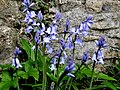 Early bluebells - geograph.org.uk - 1241528.jpg 640 × 480; 130 KB
-
 East along the A472, Little Mill, Monmouthshire - geograph.org.uk - 7008996.jpg 1,600 × 1,289; 336 KB
-
 East bank of the River Usk, Usk - geograph.org.uk - 3043290.jpg 640 × 474; 82 KB
-
 East of Coed-duon - geograph.org.uk - 930085.jpg 640 × 427; 177 KB
-
 East side of a cricket ground, Monkswood, Monmouthshire - geograph.org.uk - 6864006.jpg 1,600 × 1,057; 264 KB
-
 East side of Little Mill railway bridge, Monmouthshire - geograph.org.uk - 6861827.jpg 1,600 × 1,063; 278 KB
-

-
 Eastern boundary of Little Mill - geograph.org.uk - 3196824.jpg 640 × 476; 78 KB
-
 Eastern boundary of Monkswood - geograph.org.uk - 3196173.jpg 640 × 485; 101 KB
-
 Edge of arable field by riverside woodland - geograph.org.uk - 6966326.jpg 5,184 × 3,456; 6.25 MB
-
 Edge of Prescarra - geograph.org.uk - 930122.jpg 640 × 427; 159 KB
-
 Electric sub-station at Rhadyr - geograph.org.uk - 4273999.jpg 800 × 452; 106 KB
-

-
 Electricity substation, Rhadyr - geograph.org.uk - 2998390.jpg 640 × 483; 100 KB
-
 Embankment track, Usk - geograph.org.uk - 4641170.jpg 800 × 643; 217 KB
-
 Empty name sign holder, Monkswood, Monmouthshire - geograph.org.uk - 6864846.jpg 1,550 × 1,600; 411 KB
-
 End of 30mph speed limit NW of Usk - geograph.org.uk - 2998150.jpg 640 × 493; 74 KB
-

-

-

-
 Entrance to car park, reservoir inlet - geograph.org.uk - 5792391.jpg 5,179 × 3,451; 5.32 MB
-

-
 Entrance to Llanbadoc Island - geograph.org.uk - 2421459.jpg 640 × 493; 122 KB
-
 Entrance to The Island, Usk - geograph.org.uk - 2998058.jpg 640 × 453; 116 KB
-

-
 Entrance to Usk RFC - geograph.org.uk - 2883051.jpg 640 × 480; 105 KB
-
 Entrance to Usk RFC, Usk - geograph.org.uk - 4641073.jpg 800 × 602; 148 KB
-
 Entry by appointment only, Rhadyr - geograph.org.uk - 2998506.jpg 640 × 480; 97 KB
-
 Equestrian Centre, Rhadyr - geograph.org.uk - 2998527.jpg 640 × 377; 54 KB
-
 Estavarney Lane - geograph.org.uk - 3663982.jpg 1,024 × 768; 151 KB
-
 Estavarney Lane, Monkswood - geograph.org.uk - 3196212.jpg 640 × 623; 128 KB
-

-
 Farm buildings at Upper Trostra - geograph.org.uk - 3665838.jpg 1,024 × 768; 144 KB
-
 Farmland at Estavarney - geograph.org.uk - 1280157.jpg 640 × 426; 74 KB
-
 Farmland east of Yew Tree Farm - geograph.org.uk - 3663952.jpg 1,024 × 768; 182 KB
-
 Farmland near Lower Prescoed - geograph.org.uk - 3665271.jpg 1,024 × 768; 129 KB
-
 Farmland west of Trostra Common - geograph.org.uk - 3665824.jpg 1,024 × 768; 130 KB
-
 Field and trees, Little Mill, Monmouthshire - geograph.org.uk - 6861833.jpg 1,600 × 969; 364 KB
-

-
 Field edge footpath to kissing gate in hedgerow - geograph.org.uk - 6965752.jpg 5,179 × 3,451; 4.82 MB
-

-
 Field footpath south from woodland - geograph.org.uk - 6963961.jpg 5,179 × 3,451; 5.21 MB
-
 Field north of Pentre-waun Wood - geograph.org.uk - 5792865.jpg 5,179 × 3,451; 4.22 MB
-
 Field of Dandelions - geograph.org.uk - 1281268.jpg 640 × 426; 107 KB
-
-

-
 Field, looking across the Usk valley - geograph.org.uk - 2251666.jpg 640 × 480; 127 KB
-

-
 Footbridge over Dowlais Brook - geograph.org.uk - 3665248.jpg 1,024 × 768; 213 KB
-
 Footpath above Yew Tree Farm - geograph.org.uk - 5792214.jpg 5,184 × 3,456; 7.38 MB
-
 Footpath by edge of arable field - geograph.org.uk - 6967965.jpg 5,179 × 3,451; 5.95 MB
-
 Footpath down grass field, Usk Valley - geograph.org.uk - 6970212.jpg 5,184 × 3,456; 7.57 MB
-
 Footpath down to Yew Tree Farmhouse - geograph.org.uk - 5792241.jpg 5,179 × 3,451; 4.18 MB
-
 Footpath from Pentre Waun. - geograph.org.uk - 4271958.jpg 800 × 451; 197 KB
-
 Footpath to Monkswood - geograph.org.uk - 4272389.jpg 800 × 451; 237 KB
-
 Footpath to The Hill and Hill House - geograph.org.uk - 4272019.jpg 800 × 451; 198 KB
-
 Former Beaufort Arms pub, Monkswood, Monmouthshire - geograph.org.uk - 6859333.jpg 3,944 × 2,621; 1.74 MB
-
 Former Coleg Gwent Pig Unit, Rhadyr - geograph.org.uk - 2998510.jpg 640 × 480; 110 KB
-
 Former railway bridge, Usk - geograph.org.uk - 2998073.jpg 640 × 480; 102 KB
-
-
 Former telephone box, Wern Lane, Glascoed - geograph.org.uk - 6994436.jpg 875 × 1,024; 397 KB
-

-
 From 40 to 30 on the A472, Little Mill, Monmouthshire - geograph.org.uk - 6846698.jpg 1,600 × 1,483; 472 KB
-

-
 Galletleys of Usk - geograph.org.uk - 4641054.jpg 800 × 702; 106 KB
-


_Ltd,_Woodside_Industrial_Estate,_Usk_-_geograph.org.uk_-_2883126.jpg)


_Ltd,_Usk_-_geograph.org.uk_-_4641064.jpg)


