Category:Llanarmon, Gwynedd
Jump to navigation
Jump to search
village in United Kingdom  | |||||
| Upload media | |||||
| Pronunciation audio | |||||
|---|---|---|---|---|---|
| Instance of | |||||
| Location | Gwynedd, Wales | ||||
 | |||||
English: Llanarmon ( Welsh: Garmon's Church) is a parish and small village in the old commote of Eifionydd, (cantref of Dunoding) in upper Gwynedd. The village is four miles north east of Pwllheli and close by can be found the village of Llangybi, a holy well and the mountain of Carn Pentrych. A well preserved 15th Century manor house at Penarth Fawr is maintained by Cadw and another ancient monument Plas Du (Welsh:Black Place) is a well preserved, substantial sub-medieval gentry house. It also has important historical associations; it was known as the centre of the Roman Catholic faith in the region and was the home of Thomas Owen, High Sheriff of Caernarvonshire from 1569 who was imprisoned for sheltering missionary priests in the house in 1571.
Subcategories
This category has the following 3 subcategories, out of 3 total.
P
- Penarth Fawr (12 F)
- Plas-du (4 F)
S
Media in category "Llanarmon, Gwynedd"
The following 28 files are in this category, out of 28 total.
-
 A minor tributary of Afon Erch near Gwernallt - geograph.org.uk - 1779071.jpg 1,024 × 768; 338 KB
-
 Ancient burial urn found at Llanarmon 03036.jpg 1,574 × 911; 252 KB
-
-
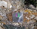 Community Reparation Sign - geograph.org.uk - 1778944.jpg 1,024 × 801; 358 KB
-
 Criafol - Rowanberries - geograph.org.uk - 519130.jpg 640 × 428; 129 KB
-
 Croesffordd Llanarmon Crossroads - geograph.org.uk - 1778908.jpg 1,024 × 620; 149 KB
-
 Eirin Duon - Damsons - geograph.org.uk - 519131.jpg 640 × 428; 167 KB
-
 Eirin Duon - Damsons - geograph.org.uk - 519133.jpg 640 × 428; 191 KB
-
 Elusendai Llangybi Almshouses - geograph.org.uk - 575138.jpg 640 × 428; 138 KB
-
 Erratics used as gate posts at Gwernallt Farm - geograph.org.uk - 1778959.jpg 1,024 × 609; 204 KB
-
 Farm track to Fferm 'Rorsedd Fach - geograph.org.uk - 1778899.jpg 1,024 × 769; 173 KB
-
 Hen Ysgol Llanarmon Old School (geograph 2677367).jpg 1,600 × 1,200; 372 KB
-
 Hen Ysgol Llanarmon Old School - geograph.org.uk - 346123.jpg 640 × 512; 64 KB
-
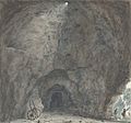 Inside of the cave, Llanarmon, c.1795.jpg 840 × 781; 444 KB
-
 Elusendai Llangybi Almshouses - geograph.org.uk - 575622.jpg 640 × 428; 176 KB
-
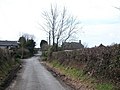
 Minor road junction north of Llanarmon - geograph.org.uk - 1775455.jpg 1,024 × 769; 152 KB
-
 More erratics at Gwernallt - geograph.org.uk - 1778964.jpg 1,024 × 756; 226 KB
-
 The Llangybi road north of Gwenallt - geograph.org.uk - 1779077.jpg 1,024 × 1,004; 309 KB
-
 Ty'n Llan Llanarmon - geograph.org.uk - 415926.jpg 640 × 428; 147 KB
-
 Ty'n Llan, Llanarmon - geograph.org.uk - 1778932.jpg 769 × 1,024; 219 KB
-
 Yr Hen Reithordy Llanarmon The Old Rectory - geograph.org.uk - 1775403.jpg 1,024 × 644; 273 KB
-
 Arwyddbost - Signpost - geograph.org.uk - 554330.jpg 640 × 428; 153 KB
-
 Croes Llangybi Cross - geograph.org.uk - 575135.jpg 640 × 428; 187 KB
-

-
 Elusendai Llangybi Almshouses - geograph.org.uk - 575140.jpg 640 × 428; 163 KB
-
 Elusendai Llangybi Almshouses - geograph.org.uk - 575615.jpg 640 × 428; 143 KB
-

-
 Low flying over Pencaenewydd - geograph.org.uk - 705175.jpg 640 × 330; 34 KB


.jpg)


