Category:Littleover
Jump to navigation
Jump to search
village and suburb in the City of Derby, Derbyshire, England  | |||||
| Upload media | |||||
| Instance of | |||||
|---|---|---|---|---|---|
| Location | City of Derby, Derbyshire, East Midlands, England | ||||
| Different from | |||||
 | |||||
Subcategories
This category has the following 4 subcategories, out of 4 total.
Media in category "Littleover"
The following 200 files are in this category, out of 248 total.
(previous page) (next page)-
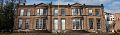
 11 and 15 Shepherd Street, Littleover.jpg 1,280 × 990; 421 KB
-
 15 Normanton Lane, Littleover.jpg 1,280 × 960; 538 KB
-
 17 and 19 Shepherd Street, Littleover.jpg 1,280 × 1,064; 396 KB
-
 45 Church Street, Littleover.jpg 1,280 × 960; 436 KB
-
 A field that will soon be built over - geograph.org.uk - 739881.jpg 640 × 480; 76 KB
-
 A footpath to the church and graveyard - geograph.org.uk - 6752753.jpg 3,000 × 2,000; 5.56 MB
-
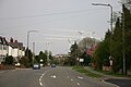
 A52 meets the Derby Ring Road (A5111) - geograph.org.uk - 3498506.jpg 1,600 × 1,067; 382 KB
-
 Aldi Supermarket - geograph.org.uk - 83193.jpg 640 × 414; 55 KB
-
 Ancient horse trough in The Hollow - geograph.org.uk - 727861.jpg 640 × 447; 84 KB
-
 Arlington Road - geograph.org.uk - 6775591.jpg 3,000 × 2,000; 3.92 MB
-
 Arlington Road - geograph.org.uk - 6775600.jpg 3,000 × 2,000; 4.14 MB
-
 Ash Venkatesh.png 180 × 300; 93 KB
-
 Bains store littleover.jpg 3,264 × 2,448; 3.02 MB
-
 Balmoral Close - geograph.org.uk - 6756241.jpg 3,000 × 2,000; 4.13 MB
-
 Barncroft House - geograph.org.uk - 6752748.jpg 3,000 × 2,000; 5.38 MB
-
 Beechwood Crescent - geograph.org.uk - 6752741.jpg 3,000 × 2,000; 3.73 MB
-
 Beechwood Crescent - geograph.org.uk - 6752745.jpg 3,000 × 2,000; 3.75 MB
-
 Blue Pool, Littleover - geograph.org.uk - 80286.jpg 640 × 480; 54 KB
-
 Bonsall Avenue - geograph.org.uk - 6776439.jpg 3,000 × 2,000; 5.58 MB
-
 Boundary markers, Uttoxeter Road - geograph.org.uk - 6066561.jpg 1,280 × 889; 380 KB
-
 Brayfield Road - geograph.org.uk - 6752746.jpg 3,000 × 2,000; 4.18 MB
-
 Bretton Avenue - geograph.org.uk - 6769593.jpg 3,000 × 2,000; 3.34 MB
-
 Bretton Avenue - geograph.org.uk - 6769596.jpg 3,000 × 2,000; 3.74 MB
-
 Bretton Avenue - geograph.org.uk - 6769601.jpg 3,000 × 2,000; 5.06 MB
-
 Bretton Avenue - geograph.org.uk - 6769605.jpg 3,000 × 2,000; 3.32 MB
-
 Broughton Avenue - geograph.org.uk - 6776390.jpg 3,000 × 2,000; 4.54 MB
-
 Building the super hospital - geograph.org.uk - 5710756.jpg 2,048 × 1,360; 1.62 MB
-
 Burton Road - geograph.org.uk - 1814477.jpg 800 × 600; 137 KB
-
 Burton Road - geograph.org.uk - 6752729.jpg 3,000 × 2,000; 5.12 MB
-
 Burton Road - geograph.org.uk - 6752733.jpg 3,000 × 2,000; 3.49 MB
-
 Burton Road - geograph.org.uk - 6756208.jpg 3,000 × 2,000; 4.94 MB
-
 Burton Road - geograph.org.uk - 6762473.jpg 3,000 × 2,000; 4.47 MB
-
 Burton Road - geograph.org.uk - 6775475.jpg 3,000 × 2,000; 3.98 MB
-
 Burton Road - geograph.org.uk - 6775479.jpg 3,000 × 2,000; 4.37 MB
-
 Burton Road - geograph.org.uk - 6775484.jpg 3,000 × 2,000; 5.38 MB
-
 Burton Road - geograph.org.uk - 6775487.jpg 3,000 × 2,000; 4.04 MB
-
 Burton Road close to the Derby Ring Road - geograph.org.uk - 3196250.jpg 1,024 × 767; 524 KB
-
 Burton Road heading east - geograph.org.uk - 3424767.jpg 640 × 480; 70 KB
-
 Bus stop on Royal Derby Hospital campus - geograph.org.uk - 5440422.jpg 1,024 × 768; 112 KB
-
 Carlton Road - geograph.org.uk - 6775616.jpg 3,000 × 2,000; 4.03 MB
-
 Carlton Road - geograph.org.uk - 6775620.jpg 3,000 × 2,000; 3.68 MB
-
 Chain Lane - geograph.org.uk - 6762456.jpg 3,000 × 2,000; 4.64 MB
-
 Chain Lane - geograph.org.uk - 6762460.jpg 3,000 × 2,000; 4.53 MB
-
 Chain Lane - geograph.org.uk - 6762467.jpg 3,000 × 2,000; 5.88 MB
-
 Children's Hospital Derby - geograph.org.uk - 5952337.jpg 640 × 480; 68 KB
-
 Church of St Peter, Littleover - geograph.org.uk - 5597034.jpg 1,280 × 960; 443 KB
-
 Church of St Peter, Littleover - geograph.org.uk - 5597035.jpg 1,280 × 990; 358 KB
-
 Clemson's Park Littleover - geograph.org.uk - 727838.jpg 640 × 480; 105 KB
-
 Colwyn Avenue - geograph.org.uk - 6775627.jpg 3,000 × 2,000; 1.11 MB
-
 Constable Avenue - geograph.org.uk - 6769620.jpg 3,000 × 2,000; 5.13 MB
-
 Constable Drive - geograph.org.uk - 6756196.jpg 3,000 × 2,000; 4.19 MB
-
 Constable Drive - geograph.org.uk - 6756200.jpg 3,000 × 2,000; 4.89 MB
-
 Constable Lane - geograph.org.uk - 6769612.jpg 3,000 × 2,000; 4.16 MB
-
 Convenience Store - geograph.org.uk - 2841221.jpg 4,000 × 3,000; 2.37 MB
-
 Crich Avenue - geograph.org.uk - 6756224.jpg 3,000 × 2,000; 4.15 MB
-
 Cross Close Walk - geograph.org.uk - 5597047.jpg 1,280 × 960; 522 KB
-
 Dean Close - geograph.org.uk - 6762445.jpg 3,000 × 2,000; 3.92 MB
-
 Dean Close - geograph.org.uk - 6762448.jpg 3,000 × 2,000; 4.41 MB
-
 Dean Close - geograph.org.uk - 6762453.jpg 3,000 × 2,000; 1.14 MB
-
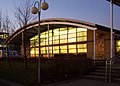
 Derby Medical School - geograph.org.uk - 5894983.jpg 640 × 480; 79 KB
-
 Derby New Church - geograph.org.uk - 5817168.jpg 1,280 × 960; 426 KB
-

-
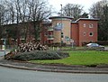
 DerbyHeights Care Home Littleover Derby.jpg 1,006 × 671; 233 KB
-
 DerbyHeights Care Home Littleover Derby1.jpg 1,123 × 749; 190 KB
-
 DerbySchool1RH.JPG 2,358 × 1,692; 601 KB
-
 Development at last - geograph.org.uk - 6769590.jpg 3,000 × 2,000; 4.77 MB
-
 DGSFront.jpg 960 × 280; 61 KB
-
 Dovestone Gardens - geograph.org.uk - 6762465.jpg 3,000 × 2,000; 3.59 MB
-
 East end of Farley Road, Littleover - geograph.org.uk - 6119108.jpg 1,024 × 768; 191 KB
-
 Eastwood Avenue - geograph.org.uk - 6769644.jpg 3,000 × 2,000; 4.39 MB
-
 Eastwood Drive - geograph.org.uk - 6768939.jpg 3,000 × 2,000; 4.63 MB
-
 Eastwood Drive - geograph.org.uk - 6769646.jpg 3,000 × 2,000; 4.91 MB
-
 Eastwood Drive - geograph.org.uk - 6769648.jpg 3,000 × 2,000; 3.56 MB
-
 Eastwood Drive - geograph.org.uk - 6769650.jpg 3,000 × 2,000; 3.63 MB
-

-
 Elms Avenue - geograph.org.uk - 6756157.jpg 3,000 × 2,000; 941 KB
-
 Elms Avenue - geograph.org.uk - 6756162.jpg 3,000 × 2,000; 4.23 MB
-
 Elms Avenue - geograph.org.uk - 6756166.jpg 3,000 × 2,000; 3.77 MB
-
 Elms Avenue - geograph.org.uk - 6773561.jpg 3,000 × 2,000; 1.11 MB
-
 Elms Avenue - geograph.org.uk - 6773566.jpg 3,000 × 2,000; 5.2 MB
-
 Elms Drive - geograph.org.uk - 6756171.jpg 3,000 × 2,000; 3.6 MB
-
 Elms Drive - geograph.org.uk - 6756182.jpg 3,000 × 2,000; 3.97 MB
-
 Elms Drive - geograph.org.uk - 6756186.jpg 3,000 × 2,000; 3.76 MB
-
 Farley Road - geograph.org.uk - 6775501.jpg 2,915 × 1,871; 1.45 MB
-
 Farley Road - geograph.org.uk - 6775523.jpg 3,000 × 2,000; 4.48 MB
-
 Farley Road - geograph.org.uk - 6775534.jpg 3,000 × 2,000; 4.05 MB
-
 Farley Road - geograph.org.uk - 6776382.jpg 3,000 × 2,000; 4.38 MB
-
 Fast food advert on bus stop near school - geograph.org.uk - 2840490.jpg 4,000 × 3,000; 2.4 MB
-
 Flats under repair, Hall Park Close - geograph.org.uk - 3424760.jpg 640 × 480; 91 KB
-
 Footpath to Old Hall Road - geograph.org.uk - 6752755.jpg 3,000 × 2,000; 1.85 MB
-

-
 George Turner - The Old Cottage Littleover Lane.jpg 1,000 × 802; 210 KB
-
 Glebe Rise - geograph.org.uk - 6776402.jpg 3,000 × 2,000; 4.31 MB
-
 Glebe Rise - geograph.org.uk - 6776405.jpg 3,000 × 2,000; 4.26 MB
-
 Greenway Drive - geograph.org.uk - 6762479.jpg 3,000 × 2,000; 4.15 MB
-
 Half Moon and local shops - geograph.org.uk - 2840473.jpg 4,000 × 3,000; 2.56 MB
-
 Hall Park Close, Littleover - geograph.org.uk - 3424762.jpg 640 × 480; 92 KB
-
 Heath Avenue - geograph.org.uk - 6752726.jpg 3,000 × 2,000; 3.97 MB
-
 Hillsway, Littleover - geograph.org.uk - 5597045.jpg 1,280 × 953; 436 KB
-
 Horse Trough, Littleover.jpg 1,280 × 960; 629 KB
-
 Horwood Avenue - geograph.org.uk - 6775583.jpg 3,000 × 2,000; 5.4 MB
-
 Horwood Avenue - geograph.org.uk - 6775585.jpg 3,000 × 2,000; 5.4 MB
-
 House on Burton Road - geograph.org.uk - 3424765.jpg 640 × 480; 61 KB
-
 Houses on Blagreaves Lane - geograph.org.uk - 3424751.jpg 640 × 452; 59 KB
-
 Houses on Uttoxeter New Road - geograph.org.uk - 4074213.jpg 640 × 480; 66 KB
-
 Houses on Uttoxeter New Road, California - geograph.org.uk - 5440432.jpg 1,024 × 768; 103 KB
-
 Jackson Avenue - geograph.org.uk - 6756144.jpg 3,000 × 2,000; 3.34 MB
-
 Junction of Manor Road, with Valley Road - geograph.org.uk - 2840450.jpg 4,000 × 3,000; 2.55 MB
-
 Junction of Normanton Lane and Valley Road - geograph.org.uk - 3618908.jpg 3,868 × 2,818; 2.05 MB
-

-
 Kings Drive - geograph.org.uk - 6756148.jpg 3,000 × 2,000; 3.87 MB
-
 Kings Drive - geograph.org.uk - 6756153.jpg 3,000 × 2,000; 3.72 MB
-
 Kings Drive - geograph.org.uk - 6756191.jpg 3,000 × 2,000; 3.32 MB
-
 Kingsway fire station - geograph.org.uk - 282012.jpg 640 × 427; 193 KB
-
 Lawn Heads Avenue - geograph.org.uk - 6752764.jpg 3,000 × 2,000; 3.66 MB
-
 Lawn Heads Avenue - geograph.org.uk - 6752770.jpg 3,000 × 2,000; 3.29 MB
-
 Lawn Heads Avenue - geograph.org.uk - 6752775.jpg 3,000 × 2,000; 4.25 MB
-
 Lime Walk - geograph.org.uk - 6768956.jpg 3,000 × 2,000; 1.02 MB
-
 Litteover Hollow.jpg 800 × 528; 87 KB
-
 Littleover community school.jpg 3,264 × 2,448; 2.44 MB
-
 Littleover Crescent - geograph.org.uk - 6776419.jpg 3,000 × 2,000; 4.51 MB
-
 Littleover Crescent - geograph.org.uk - 6776424.jpg 3,000 × 2,000; 3.57 MB
-
 Littleover Crescent - geograph.org.uk - 6776425.jpg 3,000 × 2,000; 3.96 MB
-
 Littleover Methodist Church - geograph.org.uk - 5923739.jpg 1,280 × 960; 324 KB
-
 Littleover, Warwick Avenue - geograph.org.uk - 3781044.jpg 1,200 × 922; 1.11 MB
-
 Louvain Road - geograph.org.uk - 6775547.jpg 3,000 × 2,000; 3.84 MB
-
 Louvain Road - geograph.org.uk - 6775550.jpg 3,000 × 2,000; 1.32 MB
-
 Louvain Road - geograph.org.uk - 6775553.jpg 3,000 × 2,000; 5.3 MB
-
 Louvain Road - geograph.org.uk - 6775556.jpg 3,000 × 2,000; 4.06 MB
-
 Louvain Road - geograph.org.uk - 6775557.jpg 3,000 × 2,000; 4.01 MB
-
 Manor Road - geograph.org.uk - 6743662.jpg 3,000 × 2,000; 3.94 MB
-
 Manor Road - geograph.org.uk - 6768942.jpg 3,000 × 2,000; 3.89 MB
-
 Manor Road - geograph.org.uk - 6769652.jpg 3,000 × 2,000; 5.74 MB
-
 Manor Road - geograph.org.uk - 6769655.jpg 3,000 × 2,000; 4.68 MB
-
 Manor Road - geograph.org.uk - 6775536.jpg 3,000 × 2,000; 5.26 MB
-
 Manor Road junction with Burton Road - geograph.org.uk - 6768945.jpg 3,000 × 2,000; 4.09 MB
-
 Mending the road and pavement - geograph.org.uk - 5311436.jpg 2,000 × 1,333; 2.51 MB
-
 Middleton Avenue - geograph.org.uk - 6752779.jpg 3,000 × 2,000; 809 KB
-
 Middleton Avenue - geograph.org.uk - 6752782.jpg 3,000 × 2,000; 3.82 MB
-
 Middleton Avenue - geograph.org.uk - 6752787.jpg 3,000 × 2,000; 3.79 MB
-
 Mostyn Avenue - geograph.org.uk - 6768962.jpg 3,000 × 2,000; 4.4 MB
-
 Mostyn Avenue - geograph.org.uk - 6776396.jpg 3,000 × 2,000; 3.7 MB
-
 Mostyn Avenue - geograph.org.uk - 6776397.jpg 3,000 × 2,000; 3.83 MB
-
 New flats in Littleover - geograph.org.uk - 727845.jpg 640 × 484; 76 KB
-
 Normanton Lane - geograph.org.uk - 6752740.jpg 3,000 × 2,000; 5.44 MB
-
 Normanton Lane - geograph.org.uk - 6776400.jpg 3,000 × 2,000; 4.18 MB
-
 Normanton Lane - geograph.org.uk - 6776411.jpg 3,000 × 2,000; 6.07 MB
-
 Normanton Lane - geograph.org.uk - 6776414.jpg 3,000 × 2,000; 4.19 MB
-
 North Street - geograph.org.uk - 6768938.jpg 3,000 × 2,000; 1.03 MB
-
 Now under offer - geograph.org.uk - 6704955.jpg 3,000 × 1,995; 4.62 MB
-
 Oak Drive, Littleover - geograph.org.uk - 5311466.jpg 2,000 × 1,333; 1.94 MB
-
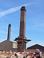 Old Brick Chimney - geograph.org.uk - 316983.jpg 480 × 640; 73 KB
-
 Old Brick Chimney - geograph.org.uk - 316985.jpg 640 × 480; 73 KB
-
 Old cottages in Park Lane, Littleover - geograph.org.uk - 728890.jpg 640 × 503; 54 KB
-
 Old Hall Avenue - geograph.org.uk - 6762471.jpg 3,000 × 2,000; 5.45 MB
-
 Old Hall Road - geograph.org.uk - 6752759.jpg 3,000 × 2,000; 4.37 MB
-
 Old Hall Road - geograph.org.uk - 6752761.jpg 3,000 × 2,000; 3.96 MB
-
 Old Vicarage Close - geograph.org.uk - 6752737.jpg 3,000 × 2,000; 5.32 MB
-
 Owlers Lane - geograph.org.uk - 5923731.jpg 1,280 × 960; 567 KB
-
 Owlers Lane - geograph.org.uk - 6769624.jpg 3,000 × 2,000; 4.5 MB
-
 Owlers Lane - geograph.org.uk - 6769630.jpg 3,000 × 2,000; 3.64 MB
-
 Park Drive - geograph.org.uk - 6769588.jpg 3,000 × 2,000; 2.7 MB
-
 Park Lane - geograph.org.uk - 6768960.jpg 3,000 × 2,000; 4.46 MB
-
 Pastures Hill - geograph.org.uk - 6786492.jpg 3,000 × 2,000; 5.81 MB
-
 Pastures Hill - geograph.org.uk - 6786496.jpg 3,000 × 2,000; 6.19 MB
-
 Pastures Hill - geograph.org.uk - 6786499.jpg 3,000 × 2,000; 5.55 MB
-
 Penrhyn Avenue - geograph.org.uk - 6776431.jpg 3,000 × 2,000; 3.67 MB
-
 Penrhyn Avenue - geograph.org.uk - 6776433.jpg 3,000 × 2,000; 4.12 MB
-
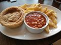 Pie chips n beans.jpg 3,264 × 2,448; 2.17 MB
-
 Princes Drive - geograph.org.uk - 6756232.jpg 3,000 × 2,000; 4.06 MB
-
 Princes Drive - geograph.org.uk - 6756250.jpg 3,000 × 2,000; 4.46 MB
-
 Princes Drive - geograph.org.uk - 6769640.jpg 3,000 × 2,000; 1.29 MB
-
 Queens Drive - geograph.org.uk - 6769634.jpg 3,000 × 2,000; 3.81 MB
-
 Radio Mast - Littleover - geograph.org.uk - 728878.jpg 460 × 640; 82 KB
-
 Redevelopment continues - geograph.org.uk - 6775468.jpg 3,000 × 2,000; 4.48 MB
-
 Road into Royal Derby Hospital campus - geograph.org.uk - 5440420.jpg 1,024 × 768; 124 KB
-
 Road on Royal Derby Hospital campus - geograph.org.uk - 5440415.jpg 1,024 × 768; 139 KB
-
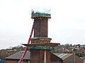
 Royal Derby Hospital - boiler house - geograph.org.uk - 5894994.jpg 480 × 640; 52 KB
-
 Royal Derby Hospital bus stop - geograph.org.uk - 3787426.jpg 1,280 × 957; 349 KB
-
 Rykneld Street And Remains Of Bronze Age Cemetery under here.jpg 2,448 × 3,264; 3.79 MB
-
 Rykneld Street And Remains Of Bronze Age Cemetery.jpg 2,448 × 3,264; 3.1 MB
-
 Rykneld Street And Remains Of Cemetery At Littleover.jpg 2,448 × 3,264; 3.3 MB
-
 Rykneld Street And Site Of Bronze Age Cemetery At Littleover.jpg 2,448 × 3,264; 3.33 MB
-
 Scarsdale Avenue - geograph.org.uk - 6756211.jpg 3,000 × 2,000; 3.85 MB
-
 Scarsdale Avenue - geograph.org.uk - 6756218.jpg 3,000 × 2,000; 1.34 MB
-
 Service station on Burton Road - geograph.org.uk - 3424770.jpg 640 × 480; 66 KB
-
 Shaldon Drive - geograph.org.uk - 6776393.jpg 3,000 × 2,000; 4.05 MB
-
 Site for a building site - geograph.org.uk - 2840483.jpg 4,000 × 3,000; 2.5 MB
-
 Snelston Crescent - geograph.org.uk - 6768941.jpg 3,000 × 2,000; 5.29 MB
-
 South Avenue - geograph.org.uk - 6775637.jpg 3,000 × 2,000; 4.06 MB
-
 South Avenue - geograph.org.uk - 6775641.jpg 3,000 × 2,000; 4.74 MB
-
 South Avenue sunset - geograph.org.uk - 5350712.jpg 2,000 × 1,503; 2.56 MB
-
 Sports Fields near Burton Road - geograph.org.uk - 3786920.jpg 3,862 × 2,806; 1.86 MB
-
 Spring in Manor Road - geograph.org.uk - 5311422.jpg 2,000 × 1,333; 3.03 MB
-
 Springfield - geograph.org.uk - 6756256.jpg 3,000 × 2,000; 3.86 MB
-
 St Peter's Church, Littleover.jpg 1,280 × 1,021; 580 KB
-
 St. Peter's Church Littleover - geograph.org.uk - 5311448.jpg 2,000 × 1,333; 2.8 MB
-
 Suburban road with silver birch trees - geograph.org.uk - 2840495.jpg 4,000 × 3,000; 2.56 MB
-
 The Argosy Public House - geograph.org.uk - 5311414.jpg 2,000 × 1,333; 1.95 MB
-
 The churchyard, Littleover - geograph.org.uk - 5597032.jpg 1,280 × 960; 599 KB


_-_geograph.org.uk_-_3498506.jpg)


