Category:Linguistic maps of the United States
Jump to navigation
Jump to search
Countries of North America: Canada · Costa Rica · Cuba · El Salvador · Guatemala · Honduras · Mexico · Nicaragua · Panama · United States of America‡
Other territories: Greenland
‡: partly located in North America
Other territories: Greenland
‡: partly located in North America
| NO WIKIDATA ID FOUND! Search for Linguistic maps of the United States on Wikidata | |
| Upload media |
Subcategories
This category has the following 7 subcategories, out of 7 total.
I
Media in category "Linguistic maps of the United States"
The following 30 files are in this category, out of 30 total.
-
African Languages Spoken in American Households.jpg 3,964 × 2,808; 4 MB
-
Canadian French distribution in the US and Canada.png 1,024 × 1,024; 195 KB
-
Cherokee Speakers by County, 2000.png 1,040 × 675; 530 KB
-
Español caribe+centroamérica+yucatán.png 357 × 634; 22 KB
-
Español caribeño.png 318 × 313; 7 KB
-
Estats Units d'America - Lengas.png 1,433 × 752; 296 KB
-
Extension spanish arizona.png 618 × 618; 12 KB
-
Finnish dialects and forms of speech.png 968 × 383; 68 KB
-
French in the United States.png 1,064 × 1,222; 435 KB
-
General American.png 422 × 359; 11 KB
-
Inland North Map.jpg 752 × 482; 141 KB
-
Louisiane Français 2021.png 9,727 × 8,864; 6.07 MB
-
Map General American-fr.svg 894 × 583; 224 KB
-
Mapa cifras.jpg 888 × 580; 133 KB
-
Mapa2017porc.jpg 888 × 580; 133 KB
-
Mapa2018%.div.png 888 × 580; 49 KB
-
Midland American English map.jpg 676 × 370; 87 KB
-
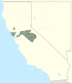
Miwok map-01.svg 512 × 590; 156 KB
-
New England English map.jpg 383 × 457; 59 KB
-
Non rhotic-whites-usa.png 573 × 673; 49 KB
-
Non-RhoticityUSA.png 392 × 557; 117 KB
-
Ojibwemowin map smallversion.jpg 350 × 222; 94 KB
-
Population speaking English at home by PUMA.png 8,000 × 4,000; 5.11 MB
-
SoutheasternSuperregionMap.jpg 1,471 × 863; 149 KB
-
Southern dialect levels.jpg 409 × 257; 47 KB
-
Southern dialect map.png 1,128 × 772; 108 KB
-
Spanish speakers in the US by state 2019.png 888 × 580; 50 KB
-
US State Name Etymologies mk.svg 1,230 × 607; 84 KB
-
US State Name Etymologies.svg 1,230 × 607; 53 KB
-
Usa languages 2015.svg 990 × 627; 1.3 MB


