Category:Linguistic maps of India
Jump to navigation
Jump to search
Subcategories
This category has the following 8 subcategories, out of 8 total.
*
N
P
Media in category "Linguistic maps of India"
The following 104 files are in this category, out of 104 total.
-
A language map of India prepared for the missionary projects at Serampore, 1822.jpg 1,155 × 1,400; 259 KB
-
Angika map.png 1,510 × 1,753; 302 KB
-
Awadhi bhasha.png 1,520 × 1,736; 748 KB
-
Bengali speaking zone.png 281 × 227; 5 KB
-
Bengali Verbreitung.png 232 × 246; 11 KB
-
Bengalispeaking region.png 1,000 × 1,138; 117 KB
-
Bhili map.png 1,510 × 1,753; 306 KB
-
Bhilispeakersmap.png 1,643 × 1,856; 824 KB
-
Bhojpuri language distribution - Assam.svg 1,414 × 978; 471 KB
-
Bhojpuri map.png 1,510 × 1,753; 305 KB
-
Bhojpuri Speaking Region in India.png 2,000 × 2,259; 1.04 MB
-
Bhumij language.svg 1,500 × 1,615; 3.1 MB
-
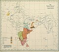
Map of the languages of North India - Hoernle 1880.jpg 1,760 × 2,456; 2.05 MB
-
Map of India showing the distribution of langages - Beames 1868.jpg 1,400 × 1,383; 266 KB
-
Falantes de Garo - Close.png 6,930 × 5,291; 3.18 MB
-
Falantes de Garo.png 3,963 × 3,027; 3.12 MB
-
Geographic distribution of Bengali language.png 2,806 × 2,080; 1.36 MB
-
Geographic Distribution of Native Konkani Speakers.png 720 × 845; 47 KB
-
Geographical distribution of Marwari language.jpg 720 × 657; 53 KB
-
Geographical distribution of Urdu in India and Pakistan.png 2,806 × 2,080; 1.57 MB
-
Gondi map.png 370 × 334; 31 KB
-
Grasi new 17 (2).png 401 × 547; 150 KB
-
Gujaratispeakers.png 1,000 × 1,138; 128 KB
-
Halbi map.png 1,510 × 1,753; 302 KB
-
Haryanvi map.png 1,510 × 1,753; 184 KB
-
Hindustani vs Deccani.png 335 × 394; 82 KB
-
Historical geographical distribution of Sharada, borders.png 914 × 599; 121 KB
-
Ho language distribution map.svg 1,500 × 1,615; 3.15 MB
-
Idioma bengalí.png 281 × 227; 14 KB
-
Idioma bhoshpurí.png 330 × 328; 6 KB
-
India lang 1973.jpg 912 × 1,162; 212 KB
-
India language map.jpg 3,937 × 3,937; 2.94 MB
-
India Languages - DPLA - 893e20f862c87371733f8494b21da84f.jpg 3,711 × 3,393; 1.8 MB
-
India-locator-language-map.png 1,519 × 1,773; 375 KB
-
Indian states by official language.png 1,486 × 1,734; 275 KB
-
Indien Sprachfamilien.png 688 × 727; 14 KB
-
Indigenous languages that co-occur with the Western Ghats WHS (cropped).png 5,257 × 4,532; 406 KB
-
Indigenous languages that co-occur with the Western Ghats WHS.png 10,255 × 13,089; 1.31 MB
-
Indika. The country and the people of India and Ceylon (1891) (14583573639).jpg 1,909 × 3,008; 961 KB
-
KaNordindien.png 292 × 980; 41 KB
-
KaSuedindien.png 296 × 857; 33 KB
-
Konkanispeakers.png 1,000 × 1,138; 124 KB
-
KonLinguasphere.png 344 × 400; 91 KB
-
Kudmali language region.svg 1,500 × 1,615; 3.1 MB
-
Kuki-Chin languages map.png 528 × 702; 93 KB
-
Kumaoni Language Speakers in India (2011 Census).png 1,396 × 1,440; 124 KB
-
Kurmali map.png 1,510 × 1,753; 304 KB
-
Kurukh language distribution - Assam.svg 1,414 × 978; 471 KB
-
Language Map India.png 3,496 × 3,432; 16.31 MB
-
Language region maps of India (hy).png 1,594 × 1,870; 198 KB
-
Language region maps of India 2 two.jpg 656 × 743; 65 KB
-
Languages of India (1859).jpg 547 × 673; 70 KB
-
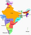
Languages of India.jpg 1,080 × 1,227; 97 KB
-
Languages of SouthAsia (Tamil).png 798 × 752; 191 KB
-
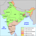
Lengas d'India.png 715 × 717; 185 KB
-
Lepcha language.png 407 × 518; 123 KB
-
Linguistic map of East Chota Nagpur.jpg 2,028 × 2,618; 5.52 MB
-
Location-Bangla01.png 250 × 115; 7 KB
-
Madhya Pradesh bhoyari map betul .png 1,664 × 1,080; 440 KB
-
Magahi map.png 1,510 × 1,753; 303 KB
-
Magahi speaking region.png 1,486 × 1,734; 278 KB
-
Maithili map.png 1,510 × 1,753; 304 KB
-
Major Indo-Aryan languages.png 572 × 599; 303 KB
-
Malayalam language (ml, Q36236) distribution.svg 1,488 × 1,623; 178 KB
-
Map of the languages of North India - Hoernle 1880.png 1,760 × 2,456; 3.69 MB
-
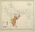
Map showing Distribution of Dravidian languages in 1913.jpg 960 × 878; 336 KB
-
Map Showing distribution of Dravidian languages in 1913.jpg 921 × 815; 304 KB
-
Marathispeakers.png 1,000 × 1,138; 131 KB
-
Meitei language distribution.svg 323 × 251; 4.59 MB
-
Monde indien langues.png 490 × 555; 110 KB
-
Ms-Languages-of-India-600w-01.jpg 600 × 680; 71 KB
-
Munda languages map (Indonesian version).svg 678 × 457; 1.46 MB
-
Munda languages map.svg 678 × 457; 1.46 MB
-
Munda ru.png 542 × 663; 107 KB
-
Munda-Sprachen.png 542 × 663; 76 KB
-
Mundari language distribution - Assam.svg 1,414 × 978; 471 KB
-
Odia language distribution - Assam.svg 1,414 × 978; 471 KB
-
Prevailing Languages Imperial Gazetteer of India 1909.jpg 3,063 × 2,531; 2.11 MB
-
Prevailing languages impgazind1909.jpg 1,455 × 1,202; 1.98 MB
-
Rajasthani language.png 1,456 × 1,472; 149 KB
-
Sadri (Nagpuria) language distribution map.svg 1,500 × 1,615; 3.14 MB
-
Sadri language distribution - Assam.svg 1,414 × 978; 471 KB
-
Sadri map.png 1,510 × 1,753; 304 KB
-
Sadri speaking region.png 1,486 × 1,734; 333 KB
-
Santali language distribution - Assam.svg 1,414 × 978; 471 KB
-
Santali map.png 1,510 × 1,753; 303 KB
-
Sindhi dialect borders.png 905 × 835; 15 KB
-
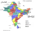
South asia local.png 725 × 622; 261 KB
-
South Indian script Burnell.png 2,300 × 2,832; 5.67 MB
-
SouthAsiaLanguages.png 1,964 × 1,832; 246 KB
-
States of South Asia 1.png 725 × 684; 126 KB
-
States of South Asia new.png 725 × 684; 156 KB
-
States of South Asia.png 798 × 752; 130 KB
-
Südasien Sprachfamilien-ast.png 877 × 953; 14 KB
-
Taalgroepen in india.png 688 × 727; 26 KB
-
Tibetan Languages in India and Pakistan minor correction.jpg 650 × 523; 93 KB
-
Tuluspeakers.PNG 1,000 × 1,138; 124 KB
-
Uttarpradesh-languages.GIF 1,175 × 828; 121 KB
-
भरतखण्डे प्रचलिता भाषाः.jpg 390 × 512; 88 KB
-
泰卢固人主要分布地.png 455 × 502; 101 KB


