Category:Lighthouse maps
Jump to navigation
Jump to search
Media in category "Lighthouse maps"
The following 200 files are in this category, out of 205 total.
(previous page) (next page)-
 12th Lighthouse District Map.jpg 1,086 × 1,400; 191 KB
-

-
 1836 Provincetown Long Point US Topo Bureau.jpg 1,234 × 1,066; 1.23 MB
-

-
-

-

-
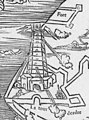
 ELLIOT(1875) p075 - Plate I. South Foreland, general plan of light-houses.jpg 1,904 × 1,398; 1.28 MB
-
 ELLIOT(1875) p079 - Plate II. South Foreland, ground-plan of engine-house.jpg 1,910 × 1,342; 1.15 MB
-
 ELLIOT(1875) p125 - Plate VI. Haishorough, general plan.jpg 1,882 × 1,402; 1.05 MB
-
 ELLIOT(1875) p145 - Plate IX. Souter Point, chart of vicinity.jpg 1,448 × 2,404; 2.23 MB
-
 ELLIOT(1875) p167 - Plate XVI. Coquet Island, chart of vicinity.jpg 1,448 × 2,310; 1.88 MB
-
 ELLIOT(1875) p189 - Plate XX. Land's End, chart of vicinity.jpg 1,534 × 2,430; 2.17 MB
-
 ELLIOT(1875) p301 - Plate XXXVII. LaHave, elevation and general plan.jpg 2,220 × 1,484; 1.41 MB
-
 Lighthouses and Lightships British Islands.jpg 3,987 × 5,055; 4.66 MB
-

-

-
 1889 USGS Long Point Provincetown.jpg 662 × 487; 121 KB
-

-
 BÜTTIKOFER(1890) 1.54 Cape Palmas - Map.jpg 830 × 560; 282 KB
-
 1908* Edgartown Light area USGS Topo Map.png 1,174 × 952; 1.85 MB
-
 1913 BostonHarbor map PortOfBoston BPL.png 732 × 627; 717 KB
-
 1913 DeerIsland BostonHarbor map PortOfBoston BPL.png 939 × 569; 830 KB
-
 1954-OrientPointLight-USGSMap.jpg 1,015 × 693; 160 KB
-
 Admiralty Chart 34 The Scilly Isles published 1911.jpg 15,950 × 10,918; 15.89 MB
-
 Admiralty Chart No 1123 South Coast of Ireland to Lands End, Published 1967.jpg 16,348 × 11,219; 9.13 MB
-
 Admiralty Chart No 1267 Approaches to Plymouth, Published 1890.jpg 12,155 × 8,314; 29.86 MB
-
 Admiralty Chart No 1267 Dodman Point to Start Point, Published 1962.jpg 15,191 × 8,411; 37.78 MB
-

-
 Admiralty Chart No 157 San Remo to Vada, Published 1960.jpg 16,482 × 11,315; 40.46 MB
-
 Admiralty Chart No 158 Vada to Civitavecchia, Published 1867.jpg 16,382 × 11,319; 42.07 MB
-
 Admiralty Chart No 1607 Thames Estuary Southern Part, Published 1967.jpg 14,926 × 8,420; 41.66 MB
-
 Admiralty Chart No 1753 Belfast Lough, Published 1885.jpg 16,239 × 11,068; 55.66 MB
-
 Admiralty Chart No 1772 Wexford Harbour, Published 1883.jpg 15,968 × 15,202; 56.36 MB
-
 Admiralty Chart No 1909 C. Ivi to Algiers, Published 1894.jpg 12,406 × 8,315; 10.78 MB
-
 Admiralty Chart No 1954 Thurso Bay to the North Minch, Scotland, Published 1896.jpg 15,014 × 8,532; 11.09 MB
-
 Admiralty Chart No 2291 Norway west coast sheet 2 Bergen to Stav Fiord, Published 1874.jpg 12,359 × 8,279; 16.19 MB
-
 Admiralty Chart No 2437 N Africa C. Tres Forcas to C. Ivi, Published 1895.jpg 12,718 × 8,090; 13.74 MB
-
 Admiralty Chart No 2450 Anvil Point to Beachy Head, Published 1954.jpg 17,475 × 11,269; 14.28 MB
-

-
 Admiralty Chart No 2490 Penmaquid Point to Fletchers Neck, Published 1866.jpg 11,971 × 11,531; 16.31 MB
-
 Admiralty Chart No 2617 Sound of Iona, Published 1860.jpg 8,296 × 12,072; 6.91 MB
-
 Admiralty Chart No 2620 Eddystone to Portland, Pubished 1880.jpg 16,235 × 11,031; 13.3 MB
-
 Admiralty Chart No 2739 Tralee and Brandon Bays, Published 1860, Corrections to 1972.jpg 16,319 × 11,312; 27.21 MB
-
 Admiralty Chart No 2739 Tralee and Brandon Bays, Published 1860.jpg 12,237 × 8,297; 14.19 MB
-
 Admiralty Chart No 3011 Norway south west coast Lister to Haadyret, Published 1899.jpg 12,452 × 8,382; 13.52 MB
-
 Admiralty Chart No 3292 Loch Alsh and Kyle Rhea, Published 1912.jpg 17,606 × 10,749; 24.62 MB
-
 Admiralty Chart No 343 Lunenburg to Mars Head, Published 1866.jpg 11,990 × 8,746; 15.05 MB
-
 Admiralty Chart No 3521 Ballachulish Bay, Published 1905.jpg 12,307 × 8,438; 32.97 MB
-
 Admiralty Chart No 3564 Loch Kishorn and the approaches to Loch Carron, Published 1906.jpg 10,507 × 15,982; 71.22 MB
-
 Admiralty Chart No 3718 Sound of Mull western portion, Published 1909.jpg 10,882 × 16,111; 86.55 MB
-
 Admiralty Chart No 3903 Fiumicino to Capo Circeo, Published 1944.jpg 12,284 × 8,456; 19.65 MB
-
 Admiralty Chart No 3904 Capo Circeo to Isola d'Ischia, Published 1934.jpg 12,281 × 8,460; 19.07 MB
-

-
 Admiralty Chart No 45 Clogher Head to Burrow Head, Published 1955.jpg 16,227 × 11,112; 12.22 MB
-
 Admiralty Chart No 509 Norway, west coast Blomö (Blomøyna) to Utvaer, Published 1895.jpg 8,175 × 14,551; 16.03 MB
-
 Alderney and Caskets 1890.jpg 1,400 × 774; 357 KB
-
 AnoNuevaMapa.png 999 × 563; 44 KB
-
 Archipel de Molène et île d'Ouessant.png 1,122 × 762; 26 KB
-
 Barra Ondina Beach of Salvador.jpg 941 × 577; 32 KB
-
 Bay Rock map, 1921.jpg 1,230 × 1,971; 196 KB
-
 Bjargtangar.png 600 × 480; 48 KB
-
 Bundesarchiv Bild 196-01085, Groß Dirschkeim.jpg 757 × 800; 67 KB
-
 Bustard Head, map showing position of lighthouse, 1938.jpg 2,420 × 2,953; 632 KB
-
 Bustard Head, plan, 1927.jpg 1,248 × 2,036; 212 KB
-
 Cape Bowling Green - Plan, 1927.jpg 1,250 × 2,020; 214 KB
-
 Cape Byron Light - site and locality plans - left, 1950.jpg 810 × 1,153; 55 KB
-
 Cape Byron Light - site and locality plans - right, 1950.jpg 810 × 1,153; 64 KB
-
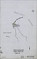 Cape Cleveland - Plan, 1927.jpg 1,260 × 1,997; 199 KB
-
 Cape Cleveland Lighthouse - Layout of Lighthouse Station, 1952.jpg 2,953 × 2,196; 572 KB
-
 Cape Don - Plan of sites for a lighthouse, 1912.jpg 2,953 × 2,046; 202 KB
-
 Cape Moreton - Plan Including North Point Hummock and Yellow Patch, 1927.jpg 1,253 × 2,023; 220 KB
-
 Capes of Virginia.jpg 1,872 × 3,328; 1.75 MB
-
 Carte belleile.gif 1,346 × 1,140; 57 KB
-
 Carte-Ouessant.png 596 × 436; 13 KB
-
 Cascais, coastal town (42700759011).jpg 4,416 × 2,959; 3.07 MB
-
 Cascais, coastal town (42700760411).jpg 4,312 × 3,618; 3.19 MB
-
 Chaoser Enez-Sun.svg 990 × 249; 84 KB
-
 Chausseedesein.png 990 × 249; 22 KB
-

-
 Cooktown Grassy Hill - Plan, 1927.jpg 1,256 × 2,002; 210 KB
-
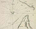
 Cordouan map.jpg 415 × 487; 61 KB
-
 CordouanCarteXVII.jpg 752 × 599; 94 KB
-
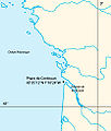
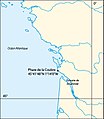 Coubre map.jpg 417 × 479; 64 KB
-
 Dent Island - Proposed Tram Line Crane, Oil Store and Boat Shed, 1925.jpg 2,362 × 1,807; 545 KB
-
 Devon Start Point.png 156 × 131; 3 KB
-
 Elbmündung (Geerz).jpg 4,495 × 3,323; 3.93 MB
-

-
 Faro Cabo Raper (OpenStreetMap).png 2,296 × 606; 1.23 MB
-
 Faros cantabria.jpg 778 × 250; 20 KB
-
 Fifth L(ight) H(ouse) district LCCN2005688354.jpg 2,833 × 3,893; 1.76 MB
-
 Fifth L(ight) H(ouse) district LCCN2005688354.tif 2,833 × 3,893; 31.56 MB
-
 Fifth Lighthouse District ppmsca.09354.jpg 2,387 × 3,035; 9.22 MB
-

-

-

-
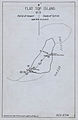 Flat Top Island - Parish of Howard, County of Carlisle.jpg 1,327 × 2,036; 208 KB
-
 Gotska Sandön map-fr.svg 850 × 650; 369 KB
-
 Gran Canaria & Las Palmas & Gando & Maspalomas Lighthouse Old Map 1895.jpg 1,528 × 1,153; 218 KB
-
 Green Cape lighthouse , plan showing position of buildings area of ground etc, 1883.jpg 2,362 × 1,496; 175 KB
-
 Green Cape Lighthouse, plan showing elevation position of buildings etc, 1880.jpg 2,362 × 1,499; 173 KB
-
 Grevskapsmålinger 9B11 3, Vestfold, 1812.jpg 6,864 × 6,939; 5.85 MB
-
 Grevskapsmålinger 9B9 23, Vestfold, 1811.jpg 6,840 × 6,946; 7.43 MB
-
 Ibrahimia-Satellite.jpg 473 × 322; 89 KB
-
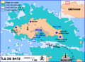 Ile-de-Batz.png 703 × 518; 24 KB
-
 Ile-de-Groix.png 800 × 549; 24 KB
-
 Ile-de-Sein.gif 300 × 210; 5 KB
-
 Ile-de-Sein.png 300 × 210; 28 KB
-
 Ilha Grande topographic map-EN.png 2,052 × 1,194; 1.52 MB
-
 Ilha Grande topographic map-FR.png 2,052 × 1,194; 1.52 MB
-
 Ilha Grande topographic map-PT.png 2,052 × 1,194; 1.52 MB
-
 Insel Neuwerk um 1900.jpg 1,040 × 1,640; 1.02 MB
-
 IslandsMap.JPG 996 × 601; 67 KB
-
 Isle Royale shipwrecks Lake Superior.jpg 1,190 × 550; 124 KB
-
 Kız Kulesi location.svg 489 × 397; 270 KB
-
 La Oliva - Faro de Tostón 08 ies.jpg 3,744 × 5,616; 5.23 MB
-
 La Tour d'Odre en 1550, Boulogne-sur-Mer..jpg 274 × 368; 36 KB
-
 Lady Elliot Island (QLD Lighthouses No. 21) - Plan, 1921.jpg 1,250 × 1,964; 190 KB
-
 Latarnie morskie w Polsce.png 1,045 × 433; 329 KB
-
 Lavieille.png 501 × 516; 264 KB
-
 Leuchtfeuer Aarøsund mit Sektoren.png 1,519 × 877; 469 KB
-
 Leuchtfeuer mit Wikidata auf OpenSeaMap.jpg 1,243 × 933; 84 KB
-

-
 Lighthouses in Maine.png 803 × 636; 75 KB
-
 Lisbon Lighthouses.png 934 × 591; 95 KB
-
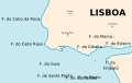 Lisbon Lighthouses.svg 934 × 591; 5 KB
-
-
 LocalizadorPORTEADS.PNG 588 × 599; 110 KB
-
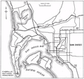 Location Map, Point Loma, near San Diego, California.png 1,618 × 1,530; 2.1 MB
-
 Long Point Battery 1865 Army Corps Engrs.png 1,472 × 1,049; 302 KB
-
 Long Point Provincetown Paine-Smith 1922.png 1,196 × 462; 142 KB
-
 Map Marshall Point Maine1.jpg 413 × 394; 28 KB
-
 Map Of Cleveland Harbor, Pier, Beacon - NARA - 86454382.jpg 6,448 × 5,260; 1.15 MB
-
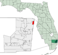 Map of Florida highlighting Lighthouse Point.png 450 × 429; 19 KB
-
 Map of Florida highlighting Lighthouse Point.svg 450 × 429; 1.16 MB
-
 Map of Isla de Mona as of February 1904, released on 14 March 1904 01.jpg 2,012 × 2,203; 413 KB
-
 Map of Isla de Mona as of February 1904, released on 14 March 1904 02.pdf 1,960 × 1,245, 5 pages; 3.5 MB
-
 Map of Jersey lights (1664169713).jpg 3,072 × 2,304; 1.51 MB
-

-

-

-

-

-
 Mapa twierdzy tamerlan.svg 1,024 × 768; 204 KB
-
 Montague Island, plan showing position of lighthouse quarters etc, 1888.jpg 2,362 × 1,466; 351 KB
-
 Montauk Lighthouse on NOAA chart.jpg 721 × 560; 216 KB
-
 NGA-List of lights 5.png 1,476 × 881; 114 KB
-
 NGA-List of lights.png 922 × 648; 119 KB
-
 NOAA Chart 13296 detail showing Range.png 1,777 × 2,228; 260 KB
-
 Norah Head plan of site showing contours, 1900.jpg 2,362 × 1,409; 471 KB
-

-
 OpenSeaMap Kiel Fjord.png 862 × 545; 410 KB
-
 Orlandskart.jpg 1,154 × 1,156; 179 KB
-
 Patos Island (30605405351).jpg 3,300 × 2,550; 996 KB
-
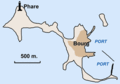
 Phares Gironde map.jpg 417 × 295; 45 KB
-
 Plan Alexandrie (Ptolémées).svg 1,702 × 1,065; 53 KB
-
 Plan Alexandrie - Nécropoles (époque hellénistique).png 5,111 × 2,969; 1.13 MB
-
 Plan d'Alexandrie à l'époque hellénistique.svg 1,109 × 644; 1.04 MB
-
 Plan of Seal Rocks & Sugarloaf Point, 1873 cropped.jpg 1,760 × 2,538; 450 KB
-
 Plan of Seal Rocks & Sugarloaf Point, 1873.jpg 2,370 × 3,000; 236 KB
-
 Point Conception, California, 1869 (map by C. Rockwell).jpg 591 × 384; 34 KB
-
 Port-Bourgenay.png 900 × 765; 202 KB
-
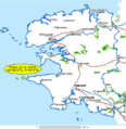
 Portugal Lighthouses.png 440 × 735; 72 KB
-
 Ptolemaic Alexandria - en.svg 1,702 × 1,065; 54 KB
-
 Ptolemaic Alexandria - pl.svg 1,702 × 1,065; 48 KB
-
 Ptolemaic Alexandria - ru.svg 1,702 × 1,065; 47 KB
-
 Ptolemaic Alexandria-hu.svg 1,702 × 1,065; 45 KB
-
 Radarkette Weser.jpg 2,225 × 2,803; 460 KB
-
 Raffles Lighthouse locator map.png 639 × 429; 115 KB
-
 Salvador 1 detalhe Barra Porto Farol.png 769 × 584; 75 KB
-
 Salvador 2 detalhe Abaeté.png 922 × 578; 63 KB
-
 San Diego Bay, Plan Showing Anchorages and Moorings - NARA - 295436.jpg 2,692 × 3,000; 4.93 MB
-
 Seekarte Altenbruch.png 779 × 322; 495 KB
-
 SEFI.png 706 × 437; 778 KB
-
 Sketch of buildings of the Brüsterort lighthouse 1873.jpg 1,008 × 1,024; 1.77 MB
-
 Smoky Cape Light, plan of site, 1888.jpg 2,362 × 1,344; 208 KB
-
 South Solitary Island Light, block plan showing lighthouse and quarters, 1878.jpg 2,362 × 1,554; 215 KB
-
 Stevenson Lighthouse image.jpg 300 × 221; 8 KB
-
 StPeterStPaulRocks1.png 752 × 908; 99 KB
-
 Sula sgeir island.jpg 2,496 × 3,632; 1.6 MB
-
 T-1533-A.jpg 11,023 × 7,947; 4.59 MB
-
 T-1533-B.jpg 8,022 × 11,457; 4.68 MB
-
 Tarbat ness lighthouse OS map 25inch Rosshire XXX.7 1880.jpeg 8,050 × 5,800; 3.2 MB
-
 Tour d'Odre au XVIIIè siècle.jpg 315 × 324; 29 KB
-
 Tour d'Odre, 154, Boulogne sur Mer..jpg 1,981 × 1,328; 370 KB
-
 United States Statutes at Large Volume 35 Part 2 scan image 1119.png 2,277 × 1,606; 95 KB
-
 United States Statutes at Large Volume 35 Part 2 scan image 1122.png 1,616 × 2,236; 90 KB
-
 United States Statutes at Large Volume 35 Part 2 scan image 1125.png 2,141 × 1,561; 118 KB
-
 United States Statutes at Large Volume 35 Part 2 scan image 1126.png 1,616 × 2,252; 56 KB
-
 USCG-List of lights.jpg 1,073 × 702; 122 KB
-
 USCG-List of lights.svg 935 × 626; 583 KB
-
 USCGLL1.jpg 704 × 364; 88 KB
-
 USCGLL1.PNG 704 × 364; 71 KB
-
 USGC-List of lighths list 6.png 928 × 550; 112 KB
-
 Vermilion Beach Map.jpg 300 × 236; 11 KB
-
 Vieste.map.png 552 × 586; 21 KB
-
 VK SulaSgeir.PNG 698 × 551; 10 KB
-
 VK SuleSkerry.PNG 698 × 551; 10 KB
-
 Wadden - Suderoogsand.PNG 440 × 467; 14 KB
-
 Waugoshance.png 575 × 408; 57 KB

.jpg)


.jpg)
_p075_-_Plate_I._South_Foreland,_general_plan_of_light-houses.jpg)
_p079_-_Plate_II._South_Foreland,_ground-plan_of_engine-house.jpg)
_p125_-_Plate_VI._Haishorough,_general_plan.jpg)
_p145_-_Plate_IX._Souter_Point,_chart_of_vicinity.jpg)
_p167_-_Plate_XVI._Coquet_Island,_chart_of_vicinity.jpg)
_p189_-_Plate_XX._Land%27s_End,_chart_of_vicinity.jpg)
_p301_-_Plate_XXXVII._LaHave,_elevation_and_general_plan.jpg)

_p.972_-_Lighthouses,_and_Canals,_in_the_British_Isles_(top)_-_J._Bartholomew_and_Co.jpg)
_p.973_-_Lighthouses,_and_Canals,_in_the_British_Isles_(bottom)_-_J._Bartholomew_and_Co.jpg)

.jpg)
_1.54_Cape_Palmas_-_Map.jpg)


,_Published_1857.jpg)


_to_Lister,_Published_1896.jpg)

_to_Utvaer,_Published_1895.jpg)


.jpg)
.jpg)


.jpg)

_H(ouse)_district_LCCN2005688354.jpg)


_-_Plan,_1921.jpg)


.jpg)
.jpg)


.jpg)


.jpg)

.svg)
.png)


.jpg)


.png)
.jpg)
.jpg)
.jpg)
.jpg)