Category:Level crossings in Hertfordshire
Jump to navigation
Jump to search
Ceremonial counties of England: Bedfordshire · Berkshire · Buckinghamshire · Cambridgeshire · Cheshire · Cornwall · Cumbria · Derbyshire · Devon · Dorset · Durham · East Riding of Yorkshire · East Sussex · Essex · Gloucestershire · Greater London · Greater Manchester · Hampshire · Herefordshire · Hertfordshire · Kent · Lancashire · Leicestershire · Lincolnshire · Merseyside · North Yorkshire · Northamptonshire · Northumberland · Nottinghamshire · Oxfordshire · Rutland · Shropshire · Somerset · South Yorkshire · Staffordshire · Suffolk · Surrey · Tyne and Wear · Warwickshire · West Midlands · West Sussex · West Yorkshire · Wiltshire · Worcestershire
City-counties: Bristol ·
Former historic counties:
Other former counties:
City-counties: Bristol ·
Former historic counties:
Other former counties:
Subcategories
This category has the following 2 subcategories, out of 2 total.
L
- Litlington level crossing (3 F)
Media in category "Level crossings in Hertfordshire"
The following 43 files are in this category, out of 43 total.
-
 A simple farm crossing near Hitchin, 2013 - panoramio.jpg 1,167 × 782; 392 KB
-
 Abbey Line looking north from Watford North.jpg 2,592 × 1,936; 2.89 MB
-
 Amwell End - geograph.org.uk - 1980948.jpg 1,280 × 960; 479 KB
-
 Amwell End, Ware - geograph.org.uk - 1980737.jpg 1,280 × 960; 474 KB
-
 Amwell Marsh level crossing 1 2020-08-23.jpg 3,971 × 2,941; 6.53 MB
-
 Amwell Marsh level crossing 2 2020-08-23.jpg 4,032 × 3,024; 7.41 MB
-
 Amwell Marsh level crossing 3 2020-08-23.jpg 4,032 × 3,024; 5.48 MB
-

-
 Cannons Mill Lane Footpath Crossing - geograph.org.uk - 237494.jpg 640 × 480; 115 KB
-

-
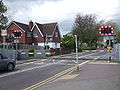
 Cranbourne Level Crossing - geograph.org.uk - 4327565.jpg 640 × 480; 99 KB
-
 Footpath level crossing, Royston - geograph.org.uk - 5415715.jpg 1,600 × 1,200; 515 KB
-
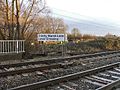
 Gates to Trinity Marsh Lane Level Crossing - geograph.org.uk - 98878.jpg 640 × 477; 104 KB
-
 Hardmead level crossing 1 2020-08-23.jpg 4,032 × 3,024; 7.27 MB
-
 Hardmead level crossing 2 2020-08-23.jpg 4,032 × 3,024; 5.95 MB
-
 Level crossing at Sawbridgeworth station - geograph.org.uk - 4544058.jpg 4,000 × 3,000; 4.11 MB
-

-

-
 Level crossing at Watford North - geograph.org.uk - 4522730.jpg 640 × 480; 148 KB
-
 Level crossing at Watford North - geograph.org.uk - 6639294.jpg 1,024 × 768; 288 KB
-
 Level crossing by Stanstead Lock - geograph.org.uk - 4340918.jpg 640 × 480; 107 KB
-
 Level crossing west of Ware station - geograph.org.uk - 4524869.jpg 640 × 480; 78 KB
-
 Level crossing, Slipe Lane, EN10 - geograph.org.uk - 4547852.jpg 640 × 480; 117 KB
-
 Old level crossing, Mead Lane - geograph.org.uk - 4627679.jpg 640 × 480; 128 KB
-
 Sawbridgeworth Level Crossing & Station with passing Class 755.jpg 4,911 × 2,621; 2.14 MB
-
 Sawbridgeworth Level Crossing.jpg 4,608 × 2,592; 3.16 MB
-

-
 Spellbrook Level Crossing - geograph.org.uk - 3895072.jpg 640 × 428; 122 KB
-
 St Margarets station with Liverpool Street train geograph-2886847-by-Ben-Brooksbank.jpg 2,197 × 1,449; 919 KB
-

-

-

-
 Trinity Marsh Lane level crossing - geograph.org.uk - 4647029.jpg 640 × 480; 150 KB
-
 Trinity Marsh Lane Level Crossing - geograph.org.uk - 98875.jpg 640 × 480; 117 KB
-

-
 Ware Level Crossing - geograph.org.uk - 189996.jpg 640 × 480; 116 KB
-
 Ware-station-NigelCox.jpg 640 × 480; 84 KB
-
 Watford North level crossing.jpg 2,450 × 1,829; 2.9 MB
-
 Watford North stn entrance2.JPG 1,600 × 1,200; 495 KB
-
 Watford North stn level crossing look northwest closed.JPG 1,600 × 1,200; 607 KB
-
 Watford North stn level crossing look northwest.JPG 1,600 × 1,200; 631 KB
-
 Watford North stn level crossing look southeast.JPG 1,600 × 1,200; 630 KB
-


