Category:Leighlinbridge
Jump to navigation
Jump to search
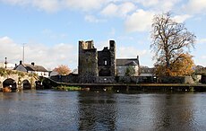
English: Leighlinbridge is a village on the River Barrow in County Carlow, Ireland. The N9 National primary route once passed through the village which was by-passed in the 1980s. It now lies on the R705 regional road.
town in Leinster, Ireland | |||||
| Upload media | |||||
| Instance of | |||||
|---|---|---|---|---|---|
| Location | County Carlow, Leinster, Ireland | ||||
| Elevation above sea level |
| ||||
 | |||||
Subcategories
This category has the following 3 subcategories, out of 3 total.
L
- Leighlinbridge Bridge (3 F)
- Leighlinbridge Castle (15 F)
Media in category "Leighlinbridge"
The following 31 files are in this category, out of 31 total.
-
An Irish Shop - geograph.org.uk - 1969437.jpg 1,600 × 1,200; 479 KB
-
Arched Entrance - geograph.org.uk - 6265594.jpg 800 × 600; 942 KB
-
Bridge and Castle - geograph.org.uk - 6865884.jpg 800 × 600; 214 KB
-
Bridge and Castle Ruin - geograph.org.uk - 6265605.jpg 800 × 600; 774 KB
-
Bridge and Towpath - geograph.org.uk - 6265583.jpg 800 × 600; 1,002 KB
-
Bridge over river Barrow - geograph.org.uk - 502673.jpg 640 × 480; 70 KB
-
Canal and Towpath - geograph.org.uk - 6265584.jpg 800 × 600; 1,000 KB
-
Castles of Leinster, Leighlinbridge, Carlow (1) - geograph.org.uk - 2495065.jpg 1,024 × 683; 916 KB
-
Castles of Leinster, Leighlinbridge, Carlow (2) - geograph.org.uk - 2495080.jpg 1,024 × 683; 980 KB
-
Field and Mound - geograph.org.uk - 6865888.jpg 800 × 600; 191 KB
-
Gated Entrance - geograph.org.uk - 7096991.jpg 800 × 600; 183 KB
-
Historic Plaque - geograph.org.uk - 7096995.jpg 800 × 600; 198 KB
-
Leighlin Bridge ^ Black Castle, Co Carlow - geograph.org.uk - 5616158.jpg 5,184 × 2,920; 5.62 MB
-
Leighlinbridge - Main Street - geograph.org.uk - 6503404.jpg 1,799 × 1,199; 345 KB
-
Leighlinbridge - The R Barrow, Co Carlow - geograph.org.uk - 5616154.jpg 5,184 × 2,920; 5.54 MB
-
Leighlinbridge, County Carlow - geograph.org.uk - 1840633.jpg 3,888 × 2,592; 3.34 MB
-
Plaque and Postbox - geograph.org.uk - 7096993.jpg 800 × 600; 217 KB
-
Rathvinden Lock - geograph.org.uk - 5501343.jpg 640 × 480; 153 KB
-
River and Bridge - geograph.org.uk - 6265592.jpg 800 × 600; 834 KB
-
River and Weir - geograph.org.uk - 6265587.jpg 800 × 600; 707 KB
-
Ruined Castle - geograph.org.uk - 6265607.jpg 800 × 600; 918 KB
-
Ruins in Leighinbridge - panoramio.jpg 2,816 × 2,112; 1.36 MB
-
Sportsfield Gateway - geograph.org.uk - 6865891.jpg 800 × 600; 110 KB
-
The Main Street at Leighlinbridge - geograph.org.uk - 6502572.jpg 1,799 × 1,199; 334 KB
-
The River Barrow at Leighlinbridge - geograph.org.uk - 74915.jpg 640 × 425; 99 KB
-
The River Barrow north of Leighlinbridge - geograph.org.uk - 6502568.jpg 1,799 × 1,199; 312 KB
-
The River Barrow, south from Leighlinbridge - geograph.org.uk - 6503403.jpg 1,799 × 1,199; 315 KB
-
Tyndall Plaque - geograph.org.uk - 5501346.jpg 480 × 640; 143 KB
-
War Memorial - geograph.org.uk - 6265598.jpg 600 × 800; 738 KB


