Category:Leigh, Staffordshire
Jump to navigation
Jump to search
English: Leigh is a civil parish in the East Staffordshire district, in the county of Staffordshire, England.
civil parish in East Staffordshire, Staffordshire, England  | |||||
| Upload media | |||||
| Instance of | |||||
|---|---|---|---|---|---|
| Location | East Staffordshire, Staffordshire, West Midlands, England | ||||
| Population |
| ||||
 | |||||
Subcategories
This category has the following 5 subcategories, out of 5 total.
Media in category "Leigh, Staffordshire"
The following 200 files are in this category, out of 203 total.
(previous page) (next page)-
 'Other route with public access' near Bearsbrook - geograph.org.uk - 6676246.jpg 1,600 × 1,200; 788 KB
-
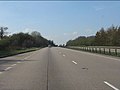
 A50 - Overfole accommodation bridge - geograph.org.uk - 2342120.jpg 640 × 480; 63 KB
-
 A50 about to cross Leigh Lane - geograph.org.uk - 2342153.jpg 640 × 480; 51 KB
-
 A50 at Fole Lane bridge - geograph.org.uk - 2342126.jpg 640 × 480; 45 KB
-
 A50 climbing near Checkleybank - geograph.org.uk - 2342146.jpg 640 × 480; 47 KB
-
 A50 eastbound near Hell Clough - geograph.org.uk - 3593071.jpg 640 × 480; 39 KB
-
 A50 eastbound near Overfole - geograph.org.uk - 3593073.jpg 640 × 480; 47 KB
-
 A50 near Deadman's Green - geograph.org.uk - 2342141.jpg 640 × 480; 58 KB
-
 A50 near Hell Clough - geograph.org.uk - 2342136.jpg 640 × 480; 57 KB
-
 A50 passes under power lines - geograph.org.uk - 3593072.jpg 640 × 481; 46 KB
-
 A50 south of Checkley - geograph.org.uk - 3593070.jpg 640 × 480; 43 KB
-
 A50 west of Fole Lane - geograph.org.uk - 2342129.jpg 640 × 480; 52 KB
-
 Access road to Moor House, Field - geograph.org.uk - 6676198.jpg 1,600 × 1,200; 307 KB
-
 Accommodation Bridge over the A50 - geograph.org.uk - 4241225.jpg 640 × 480; 250 KB
-

-
 All Saints Church, Church Leigh - geograph.org.uk - 5096399.jpg 640 × 472; 45 KB
-
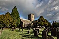 All Saints Church, Leigh - geograph.org.uk - 5996477.jpg 1,500 × 1,000; 1.44 MB
-

-

-
 B5027 heading east to Field - geograph.org.uk - 6676268.jpg 1,600 × 1,200; 546 KB
-
 B5027 towards Uttoxeter - geograph.org.uk - 5096476.jpg 640 × 480; 61 KB
-
-
 B5027, Painleyhill - geograph.org.uk - 5096472.jpg 640 × 480; 77 KB
-
 B5027-Hothill Lane junction - geograph.org.uk - 2148057.jpg 640 × 480; 103 KB
-
 Bend on the B5027 near Bearsbrook - geograph.org.uk - 6676249.jpg 1,600 × 1,200; 640 KB
-
 Bridge carrying track over A50 near Overfole - geograph.org.uk - 3592692.jpg 1,024 × 595; 72 KB
-
 Bridge over the River Blithe at Field - geograph.org.uk - 6676204.jpg 1,600 × 1,200; 371 KB
-
 Broad Oak Farm in Leigh Lane - geograph.org.uk - 2899735.jpg 640 × 355; 56 KB
-
 Brook Lane - geograph.org.uk - 5538013.jpg 1,280 × 960; 463 KB
-
 Buildings at Field Farm - geograph.org.uk - 6676210.jpg 1,600 × 1,200; 354 KB
-
 Buildings at Fole Farm, converted to housing - geograph.org.uk - 6674125.jpg 1,600 × 1,200; 440 KB
-
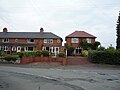
 Bungalows opposite Broad Oak Farm - geograph.org.uk - 2899739.jpg 640 × 425; 65 KB
-
 Cattle, Lower Nobut - geograph.org.uk - 5096339.jpg 640 × 480; 81 KB
-
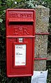 Close up, Elizabeth II postbox on Hill Lane, Middleton Green - geograph.org.uk - 5098513.jpg 1,811 × 2,937; 1.18 MB
-

-
 Cross Roads at Amesbury - geograph.org.uk - 2675001.jpg 640 × 428; 67 KB
-
-
 Cuckoo Lane Farm up for Sale - geograph.org.uk - 2675039.jpg 640 × 428; 113 KB
-
 Dodsleigh Lane, Dods Leigh - geograph.org.uk - 5096440.jpg 640 × 480; 119 KB
-
 Dodsleigh Lane, Dods Leigh - geograph.org.uk - 5098531.jpg 3,648 × 2,736; 2.01 MB
-
 Driveway to Hayes House Farm - geograph.org.uk - 2676600.jpg 640 × 428; 88 KB
-

-
 Elizabeth II postbox, Dods Leigh - geograph.org.uk - 5098524.jpg 640 × 480; 120 KB
-
 Emerging crop east of Bearsbrook - geograph.org.uk - 6676265.jpg 1,600 × 1,201; 535 KB
-
 Entering Church Leigh - geograph.org.uk - 5096388.jpg 640 × 432; 46 KB
-
 Entrance to Ashcroft Park - geograph.org.uk - 2676616.jpg 640 × 428; 79 KB
-
-
 Farm Conversions at Hobbhill - geograph.org.uk - 2676640.jpg 640 × 428; 56 KB
-
 Farm Track that joins two Roads - geograph.org.uk - 2673277.jpg 640 × 428; 110 KB
-
 Farmland at Field - geograph.org.uk - 6676217.jpg 1,600 × 1,200; 552 KB
-
 Farmland near the Bents - geograph.org.uk - 6675497.jpg 1,600 × 1,200; 413 KB
-
 Farmland north of Crossways Farm - geograph.org.uk - 6674175.jpg 1,600 × 1,200; 415 KB
-
 Farmland south of Crossways Farm - geograph.org.uk - 6675409.jpg 1,600 × 1,199; 257 KB
-
 Farmland west of Parkhall Lane - geograph.org.uk - 5096374.jpg 640 × 480; 49 KB
-
 Field entrance off Hothill Lane - geograph.org.uk - 5096463.jpg 640 × 480; 85 KB
-
 Field entrance off Leigh Lane - geograph.org.uk - 5096425.jpg 640 × 480; 101 KB
-
 Field entrance off Parkhall Lane - geograph.org.uk - 5096380.jpg 640 × 480; 71 KB
-
 Field entrance, Painleyhill - geograph.org.uk - 5096466.jpg 640 × 480; 71 KB
-
 Field north of Fole Farm - geograph.org.uk - 6674129.jpg 1,600 × 1,200; 471 KB
-
 Field west of Fole Farm - geograph.org.uk - 6674135.jpg 1,600 × 1,200; 507 KB
-
 Fieldmill Farm, Field - geograph.org.uk - 6676238.jpg 1,600 × 1,200; 498 KB
-
 Flooding on a lane south-west of Withington - geograph.org.uk - 6675462.jpg 1,600 × 1,200; 446 KB
-
 Fole Lane - geograph.org.uk - 3404253.jpg 640 × 427; 116 KB
-
 Fole Lane at Fole Farm - geograph.org.uk - 6674118.jpg 1,600 × 1,200; 435 KB
-
 Footpath and Stile to Bearsbrook - geograph.org.uk - 2673263.jpg 428 × 640; 126 KB
-
 Footpath over fields, Nobut - geograph.org.uk - 5096346.jpg 640 × 480; 68 KB
-
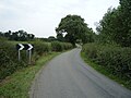
 Fork in the Road at Withington Green - geograph.org.uk - 2675014.jpg 640 × 428; 105 KB
-
 Former goods shed - Lower Leigh - geograph.org.uk - 5496618.jpg 640 × 427; 108 KB
-

-
 Gappy hedge, west of Hothill Lane - geograph.org.uk - 6675629.jpg 1,600 × 1,200; 484 KB
-
 Grass field, west side of Hothill Lane - geograph.org.uk - 6675645.jpg 1,600 × 1,200; 485 KB
-
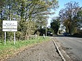
 Gratwich Lane and village sign - geograph.org.uk - 2148077.jpg 640 × 480; 133 KB
-
 Grazing and hedgerow - geograph.org.uk - 5096421.jpg 640 × 480; 52 KB
-
 Grazing and hedgerow - geograph.org.uk - 5096429.jpg 640 × 480; 54 KB
-
 Grazing beside the River Blithe - geograph.org.uk - 5096412.jpg 640 × 480; 66 KB
-
 Grazing near New Farm - geograph.org.uk - 5096366.jpg 640 × 480; 65 KB
-
 Grazing near Painley Hill Farm - geograph.org.uk - 5096475.jpg 640 × 480; 46 KB
-
 Grazing near the River Blithe - geograph.org.uk - 5096444.jpg 640 × 480; 52 KB
-
 Grazing north of Hill Lane - geograph.org.uk - 5096432.jpg 640 × 480; 70 KB
-
 Grazing off Leigh Lane - geograph.org.uk - 5096422.jpg 640 × 480; 49 KB
-
 Grazing off Moor Lane, Leigh - geograph.org.uk - 5096407.jpg 640 × 480; 63 KB
-
 Grazing, Dods Leigh - geograph.org.uk - 5096441.jpg 640 × 480; 66 KB
-
 Grazing, Lower Nobut - geograph.org.uk - 5096340.jpg 640 × 480; 59 KB
-
 Grazing, Painleyhill - geograph.org.uk - 5096469.jpg 640 × 480; 66 KB
-
 Guard Dogs at New Farm - geograph.org.uk - 2674992.jpg 640 × 428; 89 KB
-
 Heading east on Hill Lane - geograph.org.uk - 5096433.jpg 640 × 480; 58 KB
-
 Heading south west on Hothill Lane - geograph.org.uk - 5096455.jpg 640 × 480; 77 KB
-
 Hill Lane - geograph.org.uk - 5096431.jpg 640 × 480; 79 KB
-
 Hill Lane near Lion Farm - geograph.org.uk - 5096428.jpg 640 × 480; 75 KB
-
 Hill Lane, Middleton Green - geograph.org.uk - 5098515.jpg 3,648 × 2,736; 2.23 MB
-
 Hothill Lane - geograph.org.uk - 5096451.jpg 640 × 480; 74 KB
-
 Hothill Lane - geograph.org.uk - 6675487.jpg 1,600 × 1,200; 457 KB
-

-

-
 Hothill Lane, heading north-west - geograph.org.uk - 6675623.jpg 1,600 × 1,200; 525 KB
-
 Hothill Lane, heading north-west - geograph.org.uk - 6675679.jpg 1,600 × 1,200; 487 KB
-
 Hothill Lane, heading south-east - geograph.org.uk - 6675508.jpg 1,600 × 1,200; 467 KB
-
 Hothill Lane, heading south-east - geograph.org.uk - 6675674.jpg 1,600 × 1,200; 610 KB
-
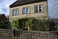
 House in Church Leigh - geograph.org.uk - 5096401.jpg 640 × 480; 74 KB
-
 House in Lower Leigh - geograph.org.uk - 5098500.jpg 3,648 × 2,736; 1.53 MB
-
 House in Lower Nobut - geograph.org.uk - 2899749.jpg 640 × 425; 63 KB
-
 House on Dodsleigh Lane - geograph.org.uk - 5096437.jpg 640 × 480; 74 KB
-
 House on Painleyhill Farm - geograph.org.uk - 2676591.jpg 640 × 428; 66 KB
-
 House on the bend in Lower Nobut - geograph.org.uk - 2899759.jpg 640 × 425; 77 KB
-
 House opposite a Footpath at Godstone - geograph.org.uk - 2674844.jpg 640 × 428; 101 KB
-
 House, Chebsey Bank, Lower Leigh - geograph.org.uk - 5096403.jpg 640 × 480; 72 KB
-
 Houses in Upper Nobut - geograph.org.uk - 2899780.jpg 640 × 425; 97 KB
-
 Houses, Church Leigh - geograph.org.uk - 5096400.jpg 640 × 480; 54 KB
-

-

-
 Lane from Withington Green to Fole - geograph.org.uk - 6675416.jpg 1,600 × 1,200; 474 KB
-
 Lane near Broadoak Farm - geograph.org.uk - 5096338.jpg 640 × 480; 86 KB
-
 Lane near New Farm - geograph.org.uk - 5096372.jpg 640 × 480; 67 KB
-
 Lane near Nobut Hall - geograph.org.uk - 5096361.jpg 640 × 480; 106 KB
-
 Lane near the River Blithe - geograph.org.uk - 5096446.jpg 640 × 480; 72 KB
-
 Lane near Valley View, Nobut - geograph.org.uk - 5096352.jpg 640 × 480; 77 KB
-
 Lane, Chebsey Bank, Lower Leigh - geograph.org.uk - 5096405.jpg 640 × 480; 101 KB
-
 Lane, Lower Nobut - geograph.org.uk - 5096341.jpg 640 × 480; 74 KB
-
 Lane, Nobut - geograph.org.uk - 5096348.jpg 640 × 480; 94 KB
-
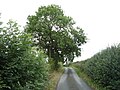
 Lane-side oak - geograph.org.uk - 3404281.jpg 640 × 427; 103 KB
-
 Lay-by beside A50 and power cables - geograph.org.uk - 3592700.jpg 1,024 × 778; 93 KB
-
 Lay-by with emergency telephone on A50 - geograph.org.uk - 3592714.jpg 1,024 × 583; 65 KB
-
 Leigh Lane - geograph.org.uk - 5096420.jpg 640 × 480; 76 KB
-
 Leigh Lane - geograph.org.uk - 5096426.jpg 640 × 480; 101 KB
-
 Leigh Methodist Church - geograph.org.uk - 5096438.jpg 640 × 480; 75 KB
-
 Level crossing on Leigh Lane - geograph.org.uk - 5096415.jpg 640 × 480; 61 KB
-
 Level crossing on Leigh Lane - geograph.org.uk - 5096416.jpg 640 × 480; 66 KB
-

-
 Looking Down the Road to Withington - geograph.org.uk - 2674858.jpg 640 × 428; 109 KB
-

-
 Milepost at SK 02053322.jpg 492 × 701; 65 KB
-
 Milepost at SK 03453391.jpg 492 × 701; 68 KB
-
 Milepost outside Park View.jpg 492 × 701; 67 KB
-

-
 Moor House, Field - geograph.org.uk - 6676224.jpg 1,600 × 1,200; 580 KB
-
 Moor Lane, Leigh - geograph.org.uk - 5096411.jpg 640 × 480; 96 KB
-
 Moor Lane, Lower Leigh - geograph.org.uk - 5096409.jpg 640 × 480; 95 KB
-
 Morrilow Heath. Buttercup-filled meadow - geograph.org.uk - 3522260.jpg 1,024 × 768; 377 KB
-
 Muddy puddle beside Fole Lane - geograph.org.uk - 3404261.jpg 640 × 427; 141 KB
-
 Network Rail's access point OB45 - geograph.org.uk - 6675489.jpg 1,600 × 1,200; 666 KB
-
 Newish houses in Withington - geograph.org.uk - 6675469.jpg 1,600 × 1,200; 418 KB
-
 Old farm building, Broad View - geograph.org.uk - 5096337.jpg 640 × 480; 81 KB
-
 Old farm building, Upper Nobut - geograph.org.uk - 5096358.jpg 640 × 480; 82 KB
-
 On the lane leaving Lower Nobut - geograph.org.uk - 2899770.jpg 640 × 425; 63 KB
-
 One Stile with Two Finger Posts - geograph.org.uk - 2675009.jpg 640 × 428; 117 KB
-
 Painley Hill Farm - geograph.org.uk - 5096474.jpg 640 × 480; 52 KB
-
 Painleyhill Farm - geograph.org.uk - 5096467.jpg 640 × 480; 63 KB
-
 Parkhall Lane - geograph.org.uk - 5096385.jpg 640 × 480; 50 KB
-
 Pasture below Hothill Farm - geograph.org.uk - 6675638.jpg 1,600 × 1,200; 399 KB
-
 Power lines cross the A50 - geograph.org.uk - 2342122.jpg 640 × 480; 50 KB
-
 Power lines north-west of Fole Farm - geograph.org.uk - 6674132.jpg 1,600 × 1,200; 566 KB
-
 Raddle Lane - geograph.org.uk - 5096435.jpg 640 × 480; 98 KB
-
 Rail Line under Hothill Lane - geograph.org.uk - 2676538.jpg 640 × 428; 85 KB
-
 Railway towards Crewe - geograph.org.uk - 5096418.jpg 640 × 480; 89 KB
-
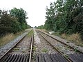 Railway towards Derby - geograph.org.uk - 5096417.jpg 640 × 480; 108 KB
-
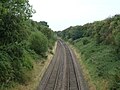 Railway towards Derby - geograph.org.uk - 5096448.jpg 640 × 480; 84 KB
-

-

-
 Relocated signal box, Lower Leigh - geograph.org.uk - 5575476.jpg 640 × 436; 119 KB
-
 River Tean alongside grazing land - geograph.org.uk - 2899881.jpg 640 × 425; 93 KB
-

-
 Roadside tree, Hothill Lane - geograph.org.uk - 6675662.jpg 1,600 × 1,200; 581 KB
-
 Rose Cottage, Dods Leigh - geograph.org.uk - 5096439.jpg 640 × 480; 53 KB
-

-
 Rusty railings beside Leigh Bank in 1998 - geograph.org.uk - 3213929.jpg 816 × 535; 161 KB
-
 Severn Trent Water infrastructure - geograph.org.uk - 6675452.jpg 1,600 × 1,200; 519 KB
-
 Short lay-by beside A50 - geograph.org.uk - 3592704.jpg 1,024 × 559; 79 KB
-
 Side Road Meeting the B5027 near Field - geograph.org.uk - 2673270.jpg 640 × 428; 116 KB
-
 Sign for the Star Inn, Church Leigh - geograph.org.uk - 5096395.jpg 573 × 640; 68 KB
-
 Silage field off Hothill Lane - geograph.org.uk - 5096449.jpg 640 × 480; 66 KB
-
 Steam engines being restored - geograph.org.uk - 5575487.jpg 640 × 427; 72 KB
-
 Stile Footpath and steps near the A50 - geograph.org.uk - 2899844.jpg 425 × 640; 134 KB
-
 Stone House Farmhouse.jpg 4,608 × 3,072; 10.48 MB
-
 Stubble field and power line - geograph.org.uk - 5096460.jpg 3,648 × 2,736; 1.69 MB
-
 Stubble field near Hothill Farm - geograph.org.uk - 5096457.jpg 640 × 480; 72 KB
-
 Stubble field, Nobut - geograph.org.uk - 5096342.jpg 640 × 480; 75 KB
-
 The A50 near Checkley - geograph.org.uk - 3404030.jpg 640 × 427; 70 KB
-
 The A50 with wooded embankment - geograph.org.uk - 3404036.jpg 640 × 427; 114 KB
-
 The Bridge over the River Blithe - geograph.org.uk - 2674873.jpg 640 × 407; 67 KB
-

-
 The lane from Fole to Withington - geograph.org.uk - 6674144.jpg 1,600 × 1,200; 571 KB
-
 The Lane from Gratwich towards Field - geograph.org.uk - 2673243.jpg 640 × 428; 107 KB
-

-
 The River Blithe east of Dods Leigh - geograph.org.uk - 5096443.jpg 640 × 480; 83 KB
-
 The Star Inn, Church Leigh - geograph.org.uk - 5096394.jpg 640 × 480; 61 KB
-
 The Star Public House, Church Leigh - geograph.org.uk - 2674953.jpg 640 × 428; 68 KB
-
 Track into young plantation, north of Withington Green - geograph.org.uk - 6675429.jpg 1,600 × 1,200; 520 KB
-
 Track to Headlands - geograph.org.uk - 6675654.jpg 1,600 × 1,200; 534 KB
-
 Track with trees - geograph.org.uk - 3404278.jpg 427 × 640; 130 KB
-
 Tree in a field, east of Hell Clough - geograph.org.uk - 6674153.jpg 1,600 × 1,200; 495 KB
-
 Trees along a field boundary, north of the B5027 - geograph.org.uk - 6676293.jpg 1,600 × 1,200; 520 KB
-
 Trees along Bear's Brook - geograph.org.uk - 6676288.jpg 1,600 × 1,200; 454 KB
-
 Trees growing along Bear's Brook - geograph.org.uk - 6676260.jpg 1,600 × 1,200; 543 KB
-
 Vehicle tracks at a field entrance - geograph.org.uk - 6674161.jpg 1,600 × 1,200; 610 KB
-
 Victorian postbox, Lower Leigh - geograph.org.uk - 5098498.jpg 1,398 × 2,884; 622 KB
-
 View north from Morrilow Heath - geograph.org.uk - 3522270.jpg 1,600 × 1,200; 419 KB
-
 View through a gap in the Hedge - geograph.org.uk - 2674820.jpg 640 × 428; 109 KB
-
 View through the gate towards field - geograph.org.uk - 2673252.jpg 640 × 428; 95 KB
-
 Waterlogged field, north of Bank Farm - geograph.org.uk - 6675688.jpg 1,600 × 1,200; 402 KB
-
 Waterlogged field, west of Painleyhill Farm - geograph.org.uk - 6675686.jpg 1,600 × 1,200; 364 KB


