Category:Leicester Abbey ruins
Jump to navigation
Jump to search
Grade I listed former building or structure in Leicester, United Kingdom | |||||
Upload media | |||||
Instance of | |||||
---|---|---|---|---|---|
Location | City of Leicester, Leicestershire, East Midlands, England | ||||
Headquarters location | |||||
Heritage designation |
| ||||
Inception |
| ||||
Dissolved, abolished or demolished date |
| ||||
| |||||
Media in category "Leicester Abbey ruins"
The following 111 files are in this category, out of 111 total.
-
Abbey Mills and the Grand Union Canal - geograph.org.uk - 5549112.jpg 800 × 600; 126 KB
-
Abbey Park Road in Leicester - geograph.org.uk - 5581850.jpg 800 × 630; 192 KB
-
Abbey Park Road looking westwards after River Soar bridge - geograph.org.uk - 5809721.jpg 4,583 × 2,839; 2.25 MB
-
Abbeyruins Leicester.jpg 720 × 480; 71 KB
-
Belgrave Road (the Golden Mile) - geograph.org.uk - 5640519.jpg 800 × 676; 168 KB
-
Benchmark on ^105 Parker Drive - geograph.org.uk - 5992754.jpg 1,024 × 683; 320 KB
-
Bridge remnants near St Margaret's Way - geograph.org.uk - 5809987.jpg 5,202 × 3,465; 3.95 MB
-
Canal and chimneys in Leicester - geograph.org.uk - 5912375.jpg 960 × 1,280; 1.28 MB
-
Canal and chimneys in Leicester - geograph.org.uk - 5912437.jpg 960 × 1,280; 1.29 MB
-
Canal and Friday Street Bridge in Leicester - geograph.org.uk - 5912405.jpg 1,280 × 960; 1.53 MB
-
Canal arm to Memory Lane Wharf in Leicester - geograph.org.uk - 5912781.jpg 1,440 × 1,018; 1.67 MB
-
Canal arm to Memory Lane Wharf in Leicester - geograph.org.uk - 5912810.jpg 1,440 × 1,027; 1.67 MB
-
Canalside chimney in Leicester - geograph.org.uk - 5912452.jpg 873 × 1,280; 1.17 MB
-
Canalside chimneys in Leicester - geograph.org.uk - 5912441.jpg 960 × 1,280; 1.13 MB
-
Canalside chimneys in Leicester - geograph.org.uk - 5912445.jpg 960 × 1,280; 1.02 MB
-
Canalside factory in Leicester - geograph.org.uk - 5913589.jpg 960 × 1,280; 1.35 MB
-
Canalside industry in Leicester - geograph.org.uk - 5913801.jpg 960 × 1,280; 1.22 MB
-
Cardinal Thomas Wolsey (geograph 2167927).jpg 800 × 531; 167 KB
-
Cave's Walk at Abbey Park - geograph.org.uk - 5608551.jpg 800 × 535; 192 KB
-
Cavendish House and ruins c1906.jpg 6,536 × 4,264; 7.19 MB
-
Charter Street Footbridge - geograph.org.uk - 5652035.jpg 800 × 475; 75 KB
-
Chimney (detail) in Leicester - geograph.org.uk - 5912449.jpg 960 × 1,280; 1.43 MB
-
Chimney at the Abbey Meadows - geograph.org.uk - 5640482.jpg 615 × 800; 81 KB
-
Chinese Garden at Abbey Park, Leicester - geograph.org.uk - 5608538.jpg 800 × 519; 186 KB
-
Constructing houses at the Abbey Meadows - geograph.org.uk - 5606162.jpg 800 × 486; 135 KB
-
Constructing houses at the Abbey Meadows - geograph.org.uk - 5683615.jpg 800 × 594; 101 KB
-
Construction at the Abbey Meadows - geograph.org.uk - 5606174.jpg 800 × 450; 93 KB
-
Diddimix - geograph.org.uk - 3589857.jpg 1,306 × 979; 339 KB
-
Disused arm of the Grand Union Canal - geograph.org.uk - 5581980.jpg 800 × 577; 153 KB
-
Disused arm of the Grand Union Canal - geograph.org.uk - 5581991.jpg 800 × 629; 182 KB
-
Footbridge crossing the River Soar - geograph.org.uk - 5606131.jpg 800 × 479; 107 KB
-
Former Abbey Mill in Leicester - geograph.org.uk - 5914099.jpg 960 × 1,280; 1.39 MB
-
Former Abbey Mill in Leicester - geograph.org.uk - 5914103.jpg 1,280 × 1,280; 2.03 MB
-
Former water tower at Abbey Meadows - geograph.org.uk - 5843004.jpg 640 × 370; 65 KB
-
Grand Union Canal from St Margaret's Way bridge - geograph.org.uk - 5810008.jpg 5,202 × 3,465; 3.27 MB
-
Grand Union Canal in Leicester - geograph.org.uk - 5912149.jpg 1,280 × 960; 1.58 MB
-
Grand Union Canal in Leicester - geograph.org.uk - 5912156.jpg 960 × 1,280; 1.45 MB
-
Grand Union Canal in Leicester - geograph.org.uk - 5912345.jpg 1,029 × 1,280; 1.31 MB
-
Grand Union Canal in Leicester - geograph.org.uk - 5912364.jpg 1,440 × 1,080; 1.65 MB
-
Grand Union Canal in Leicester - geograph.org.uk - 5912723.jpg 1,280 × 960; 1.81 MB
-
Grand Union Canal in Leicester - geograph.org.uk - 5915838.jpg 1,280 × 1,280; 1.71 MB
-
Grand Union Canal-Soar Navigation in Leicester - geograph.org.uk - 5913777.jpg 1,280 × 960; 1.22 MB
-
Grand Union Canal-Soar Navigation in Leicester - geograph.org.uk - 5913789.jpg 1,280 × 870; 1.43 MB
-
Grand Union Canal-Soar Navigation in Leicester - geograph.org.uk - 5913797.jpg 1,440 × 1,080; 1.64 MB
-
Grand Union Canal-Soar Navigation in Leicester - geograph.org.uk - 5916042.jpg 1,280 × 841; 1.28 MB
-
Hoardings along Abbey Meadows Road - geograph.org.uk - 5606176.jpg 800 × 499; 109 KB
-
Junction of Blackbird Road and Parker Drive - geograph.org.uk - 5987576.jpg 1,024 × 683; 140 KB
-
Leicester Abbey - Remainscross inn lewis - geograph.org.uk - 2167934.jpg 800 × 531; 107 KB
-
Leicester Abbey from west.jpg 19,294 × 2,243; 8.47 MB
-
Leicester Abbey nave and cloister.jpg 3,000 × 2,008; 988 KB
-
Leicester Abbey Plan (cropped).jpg 341 × 362; 37 KB
-
Leicester Abbey Plan.jpg 397 × 440; 42 KB
-
Leicester Abbey Remains - geograph.org.uk - 2167948.jpg 800 × 531; 112 KB
-
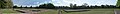
Leicester Abbey ruins from south.jpg 2,889 × 1,187; 1.49 MB
-
Leicester Abbey ruins west of cloister.jpg 2,500 × 1,674; 1.86 MB
-
Leicester College Abbey Park Campus - geograph.org.uk - 5912930.jpg 960 × 1,280; 1.42 MB
-
Leicester skyline from the canal towpath - geograph.org.uk - 5912901.jpg 960 × 1,280; 1.44 MB
-
Lime Kiln Lock in Leicester - geograph.org.uk - 5912820.jpg 960 × 1,280; 1.58 MB
-
Lime Kiln Lock in Leicester - geograph.org.uk - 5912983.jpg 960 × 1,280; 1.62 MB
-
Memory Lane Arm in Leicester - geograph.org.uk - 5916983.jpg 1,016 × 1,280; 1.6 MB
-
Memory Lane Canal Arm in Leicester - geograph.org.uk - 5913010.jpg 1,440 × 969; 1.35 MB
-
Memory Lane Wharf in Leicester - geograph.org.uk - 5582092.jpg 800 × 517; 109 KB
-
Memory Lane Wharf in Leicester - geograph.org.uk - 5582100.jpg 800 × 600; 106 KB
-
New bridge over the River Soar - geograph.org.uk - 5809709.jpg 5,202 × 3,465; 2.35 MB
-
New houses at Wolsey Island - geograph.org.uk - 5606158.jpg 800 × 485; 109 KB
-
New houses at Wolsey Island - geograph.org.uk - 5606170.jpg 800 × 412; 113 KB
-
New houses at Wolsey Island - geograph.org.uk - 5606178.jpg 800 × 445; 112 KB
-
New houses at Wolsey Island - geograph.org.uk - 5842995.jpg 640 × 358; 54 KB
-
New houses at Wolsey Island - geograph.org.uk - 5932005.jpg 640 × 415; 93 KB
-
New housing at Abbey Meadows - geograph.org.uk - 5652211.jpg 800 × 487; 67 KB
-
New housing at Wolsey Island - geograph.org.uk - 5842942.jpg 640 × 370; 54 KB
-
New housing at Wolsey Island - geograph.org.uk - 5842989.jpg 640 × 401; 46 KB
-
Nissan-Renault dealership beside the A6 - geograph.org.uk - 5987534.jpg 1,024 × 683; 187 KB
-
Old railway viaduct, off Slater Street, Leicester - geograph.org.uk - 5810004.jpg 5,202 × 3,465; 2.55 MB
-
Path and signpost at Abbey Park - geograph.org.uk - 5608549.jpg 800 × 606; 181 KB
-
Path in Abbey Park - geograph.org.uk - 5809733.jpg 5,202 × 3,465; 4.6 MB
-
Path under construction at Abbey Park - geograph.org.uk - 5606127.jpg 800 × 524; 111 KB
-
River Soar and bridge abutment - geograph.org.uk - 5809994.jpg 5,202 × 3,465; 3.21 MB
-
River Soar and the National Space Centre - geograph.org.uk - 5809715.jpg 5,202 × 3,465; 4.97 MB
-
River Soar bridge in Abbey Park - geograph.org.uk - 5809961.jpg 5,202 × 3,465; 3.37 MB
-
River Soar in Leicester - geograph.org.uk - 5548686.jpg 599 × 800; 118 KB
-
River Soar. Ashes scattering site. - geograph.org.uk - 5809698.jpg 5,202 × 3,465; 5.49 MB
-
St Mark's Church in Leicester - geograph.org.uk - 5913001.jpg 960 × 1,280; 1.31 MB
-
The former Woodsman Bar ^ Grill - geograph.org.uk - 6034877.jpg 800 × 574; 122 KB
-
Towpath along the Grand Union Canal - geograph.org.uk - 5606116.jpg 800 × 522; 163 KB
-
Tree lined path in Abbey Park, Leicester - geograph.org.uk - 5931996.jpg 640 × 449; 184 KB
-
W Brewin ^ Co Ltd's factory, 145 Parker Drive - geograph.org.uk - 5992743.jpg 1,024 × 683; 171 KB
-
Waste ground at Abbey Meadows - geograph.org.uk - 5549126.jpg 800 × 546; 116 KB
-
Wolsey chimney at Wolsey Island - geograph.org.uk - 5932014.jpg 383 × 640; 42 KB
-
Wolsey chimney from River Soar footpath - geograph.org.uk - 5809704.jpg 5,202 × 3,465; 4.5 MB
-
^105 Parker Drive at Stadium Place junction - geograph.org.uk - 5992764.jpg 1,024 × 683; 150 KB
Categories:
- Abbey Park, Leicester
- Grade I listed buildings in Leicester
- Scheduled monuments in Leicester
- Monasteries of Augustinian Canons in England
- Augustinian abbeys in the United Kingdom
- Augustinian monasteries established in the 1140s
- Monasteries established in 1143
- Abbeys in Leicestershire
- Ruins of monasteries in England