Category:Ledston
Jump to navigation
Jump to search
village in the United Kingdom  | |||||
| Upload media | |||||
| Instance of | |||||
|---|---|---|---|---|---|
| Location | Leeds, West Yorkshire, Yorkshire and the Humber, England | ||||
| Population |
| ||||
 | |||||
Subcategories
This category has the following 5 subcategories, out of 5 total.
Media in category "Ledston"
The following 200 files are in this category, out of 255 total.
(previous page) (next page)-
 A bench by the riverside path, RSPB Fairburn Ings - geograph.org.uk - 4881679.jpg 1,067 × 1,600; 342 KB
-
 A walk from Glass Houghton ^58 - geograph.org.uk - 1996974.jpg 800 × 600; 300 KB
-
 A walk from Glass Houghton ^59 - geograph.org.uk - 1996980.jpg 800 × 600; 344 KB
-
 A walk from Glass Houghton ^60 - geograph.org.uk - 1996985.jpg 800 × 600; 289 KB
-
 A walk from Glass Houghton ^61 - geograph.org.uk - 1996997.jpg 800 × 600; 340 KB
-
 A walk from Glass Houghton ^63 - geograph.org.uk - 1997013.jpg 800 × 600; 228 KB
-
 A walk from Glass Houghton ^65 - geograph.org.uk - 1997042.jpg 800 × 600; 249 KB
-
-
 A63 towards Selby - geograph.org.uk - 2754979.jpg 640 × 480; 44 KB
-
 A656 (Roman road) heading north - geograph.org.uk - 2627721.jpg 1,600 × 1,200; 506 KB
-
 A656 viewed from Landfill Entrance - geograph.org.uk - 6506963.jpg 1,024 × 768; 211 KB
-

-
 Aire ^ Calder Navigation at Castleford - geograph.org.uk - 4445861.jpg 1,600 × 1,062; 1.13 MB
-

-
 Arrow Lane near Fairburn Ings - geograph.org.uk - 3163619.jpg 2,048 × 1,536; 717 KB
-
 Autumn colours, Ledston Park - geograph.org.uk - 1041076.jpg 640 × 444; 308 KB
-
 Autumnal avenue, Ledston Park - geograph.org.uk - 1041080.jpg 472 × 640; 457 KB
-
 Back Newton Lane - geograph.org.uk - 1113580.jpg 640 × 429; 66 KB
-
 Back Newton Lane - geograph.org.uk - 121919.jpg 640 × 479; 150 KB
-
 Back Newton Lane - geograph.org.uk - 3481431.jpg 2,048 × 1,536; 621 KB
-
 Back Newton Lane - geograph.org.uk - 6509251.jpg 1,024 × 768; 278 KB
-
 Back Newton Lane - geograph.org.uk - 6509255.jpg 1,024 × 768; 313 KB
-
 Back Newton Lane Junction with Claypit Lane - geograph.org.uk - 6509256.jpg 1,024 × 768; 193 KB
-
 Back Newton Lane towards Fairburn - geograph.org.uk - 2628627.jpg 1,600 × 1,200; 538 KB
-
 Back Newton Lane towards Fairburn - geograph.org.uk - 2628638.jpg 1,600 × 1,200; 537 KB
-
 Barns at Sheepcote Farm - geograph.org.uk - 4444149.jpg 1,600 × 1,062; 1.1 MB
-
 Barns at Sheepcote Farm - geograph.org.uk - 4444173.jpg 1,600 × 1,062; 738 KB
-
 Barring the way - geograph.org.uk - 3229047.jpg 3,312 × 2,118; 1.65 MB
-
 Below the salt - geograph.org.uk - 2301424.jpg 1,024 × 768; 156 KB
-

-
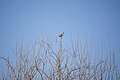
 Birds on a wire - geograph.org.uk - 1106872.jpg 469 × 640; 257 KB
-

-

-
 Bridleway heading South towards the A63 - geograph.org.uk - 6534253.jpg 5,184 × 3,456; 7.46 MB
-
 Buildings at Sheepcote Farm - geograph.org.uk - 3725073.jpg 1,600 × 1,200; 477 KB
-
 Buildings at Warren House Farm - geograph.org.uk - 6291287.jpg 1,024 × 768; 139 KB
-
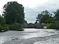
 Bulholme Lock - geograph.org.uk - 3163611.jpg 2,048 × 1,536; 608 KB
-
 Bulholme Lock Castleford - geograph.org.uk - 2869280.jpg 4,288 × 3,216; 3.46 MB
-
 Bulholme Lock Castleford - geograph.org.uk - 3028447.jpg 3,066 × 2,058; 1.06 MB
-

-
 Bullholme Lock, Aire ^ Calder Navigation - geograph.org.uk - 4445834.jpg 1,600 × 1,062; 760 KB
-
 Bullholme Lock, Aire ^ Calder Navigation - geograph.org.uk - 4445844.jpg 1,600 × 1,062; 995 KB
-
 Bullholme locks - geograph.org.uk - 6017645.jpg 4,608 × 3,072; 3.3 MB
-
 Bullholme locks Castleford - geograph.org.uk - 5663754.jpg 4,608 × 3,456; 3.93 MB
-
 Carr along Lin Dike - geograph.org.uk - 6421104.jpg 1,600 × 1,200; 747 KB
-
 Cattle Field south of Ledston - geograph.org.uk - 6506820.jpg 1,024 × 768; 195 KB
-
 Claypit Lane towards Ledsham - geograph.org.uk - 2628643.jpg 1,600 × 1,200; 627 KB
-

-
 Communication hub, Main Street - geograph.org.uk - 2301404.jpg 1,024 × 768; 141 KB
-
 Converted barge - geograph.org.uk - 5663759.jpg 4,608 × 3,456; 3.04 MB
-
 Cows at Newton Ings - geograph.org.uk - 6558501.jpg 1,024 × 768; 149 KB
-
 Disused iron railway bridge - geograph.org.uk - 5651850.jpg 4,608 × 3,456; 3.79 MB
-
-
 Don't wave your rod around^ - geograph.org.uk - 266623.jpg 640 × 480; 67 KB
-
 Double stile over fenced hedge - geograph.org.uk - 2849205.jpg 1,024 × 768; 201 KB
-
 Eggs for sale at Sheepcote Farm - geograph.org.uk - 4444157.jpg 1,600 × 1,062; 628 KB
-

-

-
 Entrance to Park House Farm - geograph.org.uk - 1113573.jpg 640 × 376; 55 KB
-
 Entrance to Peckfield landfill site - geograph.org.uk - 6291299.jpg 1,024 × 768; 196 KB
-
 Entrance to Sheepcote farmyard - geograph.org.uk - 2849197.jpg 1,024 × 768; 152 KB
-
 Farmland north of Warren House - geograph.org.uk - 3775645.jpg 1,024 × 768; 129 KB
-
 Farmland north-east of Peckfield Bar - geograph.org.uk - 3775643.jpg 1,024 × 768; 161 KB
-
 Farmland off Back Newton Lane - geograph.org.uk - 2628624.jpg 1,600 × 1,200; 326 KB
-
 Farmland off Claypit Lane - geograph.org.uk - 2628640.jpg 1,600 × 1,200; 413 KB
-
 Farmland off the A63 - geograph.org.uk - 2754975.jpg 640 × 480; 39 KB
-
 Fenced gallop alongside Long Plantation - geograph.org.uk - 2849208.jpg 1,024 × 768; 193 KB
-
 Field adjacent to Ledston Mill Lane - geograph.org.uk - 6506799.jpg 1,024 × 768; 282 KB
-
 Field adjacent to Ledston Mill Lane - geograph.org.uk - 6506976.jpg 1,024 × 768; 194 KB
-

-
 Field adjacent to Ridge Road near Peckfield - geograph.org.uk - 6506954.jpg 1,024 × 768; 127 KB
-
 Field entrance off Back Newton Lane - geograph.org.uk - 6506931.jpg 1,024 × 768; 200 KB
-
 Field entrance, North Park - geograph.org.uk - 2628632.jpg 1,600 × 1,200; 569 KB
-
 Field North of Back Newton Lane - geograph.org.uk - 6509252.jpg 1,024 × 768; 148 KB
-
 Field off Back Newton Lane - geograph.org.uk - 6507001.jpg 1,024 × 768; 210 KB
-
 Field off Ledston Mill Lane - geograph.org.uk - 6506842.jpg 1,024 × 768; 195 KB
-
 Field South of Ledston - geograph.org.uk - 6506812.jpg 1,024 × 768; 261 KB
-
 Field south of the A63 at Peckfield - geograph.org.uk - 6290636.jpg 1,024 × 768; 175 KB
-
 Field to the South of Back Newton Lane - geograph.org.uk - 6506993.jpg 1,024 × 768; 177 KB
-
 Field to the West of Wellington Plantation - geograph.org.uk - 6535230.jpg 5,184 × 3,456; 6.82 MB
-
 Fields near Sheepcote Farm - geograph.org.uk - 4444126.jpg 1,600 × 1,062; 1.29 MB
-
 Fields southwest of Ledston - geograph.org.uk - 3731204.jpg 640 × 480; 62 KB
-
 Fishing platforms, Newton Lane Pond, Allerton Bywater - geograph.org.uk - 4880036.jpg 1,600 × 1,200; 801 KB
-
 Flooded road - geograph.org.uk - 3021543.jpg 3,661 × 2,318; 3.15 MB
-
 Footbridge over Ledston Beck - geograph.org.uk - 3662722.jpg 4,288 × 3,216; 4.21 MB
-
 Footpath and gallop alongside Long Plantation - geograph.org.uk - 2849203.jpg 1,024 × 768; 194 KB
-
 Footpath approaching Sheepcote Farm - geograph.org.uk - 2849194.jpg 1,024 × 768; 140 KB
-
 Footpath at Ling Close Wood - geograph.org.uk - 3725082.jpg 1,600 × 1,200; 740 KB
-
 Footpath footbridge on the way to Ledston Luck - geograph.org.uk - 2846800.jpg 1,024 × 768; 210 KB
-
 Footpath in Peckfield Plantation - geograph.org.uk - 2754988.jpg 640 × 480; 129 KB
-
 Footpath to Ledston Luck - geograph.org.uk - 2846765.jpg 1,024 × 768; 113 KB
-
-
 Frozen Ings - geograph.org.uk - 696800.jpg 480 × 640; 46 KB
-
 Grazing Cattle at Ledston - geograph.org.uk - 3662716.jpg 3,513 × 2,520; 2.17 MB
-
 Grazing land off Ledston Mill Lane - geograph.org.uk - 2627697.jpg 1,600 × 1,200; 618 KB
-
 Grazing land off the A656 - geograph.org.uk - 2627718.jpg 1,600 × 1,200; 444 KB
-
 Grazing sheep, off Ledston Mill Lane - geograph.org.uk - 2301375.jpg 1,024 × 768; 146 KB
-
 Green Lane and Mary Pannel wood - geograph.org.uk - 1056317.jpg 640 × 441; 261 KB
-
 Green Lane, Ledston - geograph.org.uk - 1056302.jpg 455 × 640; 273 KB
-
 Green Lane, Ledston - geograph.org.uk - 2301426.jpg 1,024 × 768; 160 KB
-
 Greening field - geograph.org.uk - 2301358.jpg 1,024 × 768; 190 KB
-
 Haystacks, Warren House Farm - geograph.org.uk - 6291290.jpg 1,024 × 768; 144 KB
-
 Hedge following a nameless beck - geograph.org.uk - 2846814.jpg 1,024 × 768; 175 KB
-
 House at Sheepcote Farm - geograph.org.uk - 3725077.jpg 1,600 × 1,200; 429 KB
-
 House near Sheepcote Farm - geograph.org.uk - 4444143.jpg 1,600 × 1,062; 695 KB
-
 In Wellington Plantation - geograph.org.uk - 6535222.jpg 5,184 × 3,456; 6.91 MB
-
 Ings Lane, approaching Newton Lane, Allerton Bywater - geograph.org.uk - 4880022.jpg 1,200 × 1,600; 683 KB
-
 Iron Bridge - geograph.org.uk - 435508.jpg 640 × 480; 90 KB
-
 Iron Bridge - geograph.org.uk - 559819.jpg 640 × 480; 111 KB
-

-
 Lake off Newton Lane - geograph.org.uk - 2627690.jpg 1,600 × 1,200; 323 KB
-
 Lane leading up to the rear of Ledston Hall - geograph.org.uk - 2775853.jpg 2,917 × 3,687; 3.13 MB
-
 Large Barge in Bulholme Lock Castleford - geograph.org.uk - 2281589.jpg 3,648 × 2,736; 2.78 MB
-
 Large barge leaving Bullhome Locks Castleford - geograph.org.uk - 5649815.jpg 4,608 × 3,072; 3.31 MB
-
 Ledston - Ledston Estate Ride.jpg 640 × 428; 381 KB
-
 Ledston - Ledston Mill Lane - geograph.org.uk - 1634353.jpg 640 × 457; 74 KB
-
 Ledston - Ledston Mill Lane - geograph.org.uk - 1634368.jpg 640 × 456; 84 KB
-
 Ledston - Village sign - geograph.org.uk - 1634336.jpg 640 × 457; 83 KB
-
 Ledston Ings - geograph.org.uk - 790517.jpg 640 × 480; 69 KB
-
 Ledston Luck Junction off Ridge Road (A656) - geograph.org.uk - 6506752.jpg 1,024 × 768; 220 KB
-
 Ledston Mill Lane - geograph.org.uk - 2301360.jpg 1,024 × 768; 148 KB
-
 Ledston Mill Lane - geograph.org.uk - 2301388.jpg 1,024 × 768; 174 KB
-
 Ledston Mill Lane heading north - geograph.org.uk - 2627703.jpg 1,600 × 1,200; 493 KB
-
 Ledston Park - geograph.org.uk - 319134.jpg 640 × 480; 89 KB
-
 Ledston Village near Castleford - geograph.org.uk - 2775845.jpg 3,260 × 2,830; 1.84 MB
-
 Ledston water pump - geograph.org.uk - 2775848.jpg 2,908 × 4,077; 3.07 MB
-
 Lin Dike Hide, from Arrow Lane, Fairburn Ings - geograph.org.uk - 4879435.jpg 1,024 × 768; 186 KB
-
 Lin Dike looking east from Ledston Mill Lane (geograph 6506769).jpg 1,024 × 768; 245 KB
-
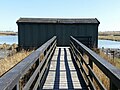
 Lin Dyke Hide - geograph.org.uk - 435498.jpg 640 × 480; 93 KB
-
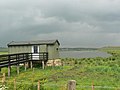
 Lin Dyke hide - geograph.org.uk - 657060.jpg 640 × 468; 82 KB
-
 Lin Dyke Hide, Newton Ings - geograph.org.uk - 790519.jpg 640 × 480; 74 KB
-
 Looking Back - geograph.org.uk - 5973061.jpg 4,608 × 3,072; 3.59 MB
-
 Looking upstream to Bullholme Lock - geograph.org.uk - 4580325.jpg 1,024 × 768; 169 KB
-
 Main Street, Ledston - geograph.org.uk - 1056295.jpg 640 × 456; 237 KB
-
-
 Manor Park, Ledston - geograph.org.uk - 2301399.jpg 1,024 × 768; 171 KB
-
 Milepost at SE 429 314, Ledston.jpg 480 × 640; 374 KB
-
 Multiple Pylons off A656 - geograph.org.uk - 6506755.jpg 1,024 × 768; 123 KB
-
 Nameboard and door, Lin Dike Hide, Fairburn Ings - geograph.org.uk - 4879444.jpg 1,024 × 958; 115 KB
-
 Newfield Farm - geograph.org.uk - 127173.jpg 640 × 479; 103 KB
-
 Newton Ings - geograph.org.uk - 657054.jpg 640 × 455; 65 KB
-
 Newton Ings - geograph.org.uk - 790520.jpg 640 × 480; 54 KB
-
 Newton Lane floods - geograph.org.uk - 667393.jpg 428 × 640; 105 KB
-
 Newton Lane heading west - geograph.org.uk - 2627692.jpg 1,600 × 1,200; 446 KB
-
 Newton Lane Pond, Allerton Bywater - geograph.org.uk - 4880026.jpg 1,200 × 1,600; 485 KB
-
 Newton Lane Pond, Allerton Bywater - geograph.org.uk - 4880030.jpg 1,200 × 1,600; 596 KB
-
 Newton Lane towards the A656 - geograph.org.uk - 2627712.jpg 1,600 × 1,200; 652 KB
-
 Newton Priory ruins - geograph.org.uk - 523356.jpg 640 × 452; 93 KB
-
 North end of the Castleford Viaduct - geograph.org.uk - 6034173.jpg 1,600 × 900; 403 KB
-

-
 Older Ledston semis - geograph.org.uk - 2301408.jpg 1,024 × 768; 142 KB
-

-

-

-

-
-

-

-

-

-

-
-

-
-

-

-
 Out of work - geograph.org.uk - 555661.jpg 640 × 474; 91 KB
-
 Park House Farm - geograph.org.uk - 127174.jpg 640 × 479; 135 KB
-
 Path alongside Long Plantation - geograph.org.uk - 4444254.jpg 1,600 × 1,062; 858 KB
-
 Path at Sheepcote Farm - geograph.org.uk - 4444178.jpg 1,600 × 1,062; 1.29 MB
-
 Path heading towards Wellington Plantation - geograph.org.uk - 6535209.jpg 5,184 × 3,456; 5.74 MB
-
 Path junction at Wellington Plantation - geograph.org.uk - 3163686.jpg 2,048 × 1,536; 549 KB
-
 Path through the wood - geograph.org.uk - 2301385.jpg 1,024 × 768; 258 KB
-
 Path through Wellington Plantation - geograph.org.uk - 6290628.jpg 1,024 × 768; 466 KB
-
 Path towards Wellington Plantation - geograph.org.uk - 4444118.jpg 1,600 × 1,062; 1.04 MB
-
 Path towards Wellington Plantation - geograph.org.uk - 4444122.jpg 1,600 × 1,062; 1.01 MB
-
-
 Peckfield Bar - geograph.org.uk - 223606.jpg 640 × 429; 62 KB
-
 Peckfield Common - geograph.org.uk - 6290632.jpg 1,024 × 768; 253 KB
-
 Peckfield landfill site - geograph.org.uk - 6291296.jpg 1,024 × 768; 136 KB
-
 Peckfield Plantation - geograph.org.uk - 2754983.jpg 640 × 480; 69 KB
-
 Pit Lane, off Selby Road - geograph.org.uk - 6291291.jpg 1,024 × 768; 200 KB
-
 Pit Stop Cafe Car Park - geograph.org.uk - 6506747.jpg 1,024 × 768; 154 KB
-
 Please close the gate - geograph.org.uk - 3229014.jpg 3,216 × 4,288; 2.58 MB
-
 Ploughed field south of Sheepcote Wood - geograph.org.uk - 2846834.jpg 1,024 × 768; 161 KB
-
 Power lines crossing near Ledston, West Yorkshire (7th July 2015).JPG 5,152 × 3,864; 7.9 MB
-
 Power lines in Peckfield Plantation - geograph.org.uk - 4444107.jpg 1,600 × 1,062; 1.32 MB
-
 Pylon with a purpose - geograph.org.uk - 2301341.jpg 1,024 × 768; 106 KB
-
 Pylons over Allerton Bywater Ings - geograph.org.uk - 1481305.jpg 640 × 480; 70 KB
-
 Railway viaduct, RSPB Fairburn Ings - geograph.org.uk - 6421085.jpg 1,600 × 1,200; 581 KB
-
 Reclamation of former chemical works - geograph.org.uk - 5648145.jpg 4,608 × 3,072; 2.42 MB
-
 Renovated barge - geograph.org.uk - 6354082.jpg 4,288 × 3,216; 1.63 MB
-
 Riverside path towards Castleford - geograph.org.uk - 4445792.jpg 1,600 × 1,062; 944 KB
-
 Riverside path, RSPB Fairburn Ings - geograph.org.uk - 4881690.jpg 1,600 × 1,067; 690 KB
-
 Riverside path, RSPB Fairburn Ings - geograph.org.uk - 4881754.jpg 1,600 × 1,067; 661 KB
-
 RSPB Fairburn Ings reserve - geograph.org.uk - 2006277.jpg 640 × 413; 79 KB
-
 Sheepcote Farmhouse.jpg 1,600 × 1,062; 502 KB
-
 Snowdrops next to footpath near Ledston Hall - geograph.org.uk - 2775857.jpg 2,877 × 3,962; 3.37 MB
-
-
 Spoonbill Flash, RSPB Fairburn Ings - geograph.org.uk - 6421113.jpg 1,825 × 1,026; 225 KB


_heading_north_-_geograph.org.uk_-_2627721.jpg)


_-_geograph.org.uk_-_6506752.jpg)


.jpg)


.jpg)

_-_geograph.org.uk_-_4880623.jpg)
_-_geograph.org.uk_-_4880696.jpg)
_-_geograph.org.uk_-_4880701.jpg)
_-_geograph.org.uk_-_4880149.jpg)
_-_geograph.org.uk_-_4880706.jpg)
_-_geograph.org.uk_-_4880710.jpg)
_-_geograph.org.uk_-_4880715.jpg)
_-_geograph.org.uk_-_4880631.jpg)
_-_geograph.org.uk_-_4880636.jpg)
_-_geograph.org.uk_-_4880640.jpg)
_-_geograph.org.uk_-_4880642.jpg)
_-_geograph.org.uk_-_4880670.jpg)
_-_geograph.org.uk_-_4880672.jpg)
_-_geograph.org.uk_-_4880679.jpg)
_-_geograph.org.uk_-_4880688.jpg)


.JPG)


,_Fairburn_Ings_-_geograph.org.uk_-_4879456.jpg)
