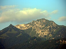
Category:Le Merdasson
Jump to navigation
Jump to search
| Object location | | View all coordinates using: OpenStreetMap |
|---|
mountain of the Vaud Prealps, Switzerland | |||||
| Upload media | |||||
| Instance of | |||||
|---|---|---|---|---|---|
| Location |
| ||||
| Mountain range | |||||
| Elevation above sea level |
| ||||
 | |||||
Media in category "Le Merdasson"
The following 11 files are in this category, out of 11 total.
-
Dent de Jaman seen from Le Merdasson - panoramio.jpg 5,184 × 3,456; 6.55 MB
-
Dent de Jaman vom Rochers de Naye,jpg.jpg 4,000 × 3,000; 4.37 MB
-
Derby de Jaman.jpg 5,184 × 3,456; 6.52 MB
-
ETH-BIB-Caux-LBS H1-014340.tif 6,828 × 4,630; 90.64 MB
-
ETH-BIB-Glion, Caux, Rochers, de, Naye-LBS H1-011102.tif 6,547 × 4,507; 84.64 MB
-
Itinéraires freeride.jpg 3,008 × 2,000; 1.11 MB
-
Les pléiades 73.jpg 4,592 × 3,056; 7.65 MB
-
Panorama depuis le sommet du Merdasson (La Perche).jpg 13,323 × 2,100; 12.99 MB
-
Rochers de Naye (12952111833).jpg 5,184 × 3,456; 4.98 MB
-
Rochers de Naye Blick von Clarens.jpg 3,072 × 2,304; 1.13 MB
-
View onto the Lake of Geneva - panoramio.jpg 5,184 × 3,456; 9.36 MB


