Category:Language-neutral SVG maps
Jump to navigation
Jump to search
Subcategories
This category has the following 6 subcategories, out of 6 total.
S
Media in category "Language-neutral SVG maps"
The following 107 files are in this category, out of 107 total.
-
1936-05-09.svg 940 × 477; 1.15 MB
-
ABU TV Song Festival 2013 map.svg 1,150 × 870; 1.03 MB
-
Achaemenid (greatest extent).svg 553 × 553; 337 KB
-
Administrative divisions of Taiwan 2016.svg 700 × 850; 990 KB
-
Western Alps - Regions after Rochlitz & Bacher 2006 blank.svg 641 × 828; 1.27 MB
-
Anglican Diocese in Europe map.svg 2,100 × 1,525; 141 KB
-
Antarctica interglacial hg.svg 512 × 512; 273 KB
-
Arabic Varieties Map.svg 2,051 × 1,151; 2.08 MB
-
Astraios Orthographic Map.svg 512 × 341; 1.5 MB
-
Austroasiatic.svg 725 × 604; 307 KB
-
Bangsamoro Republik locator map.svg 1,000 × 500; 1.03 MB
-
Barro, Noia.svg 618 × 616; 224 KB
-
Battle Trebia-numbers.svg 999 × 755; 92 KB
-
Belgien Wahlkreise 2024.svg 569 × 495; 446 KB
-
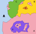
Berbers (W N Africa).svg 859 × 444; 534 KB
-
Boa, Noia, Galicia.svg 618 × 616; 224 KB
-
BOBLME Project member countries (orthographic projection).svg 541 × 541; 376 KB
-
Brussels-Capital Region blank.svg 404 × 420; 202 KB
-
Burger King map Hong Kong.svg 1,298 × 1,016; 244 KB
-
Carte administrative des Provinces Maritimes du Canada.svg 2,928 × 2,106; 900 KB
-
Carte des domaines de Chōshū, Saga, Tosa et Satsuma.svg 570 × 570; 1.94 MB
-
Carte topographique des Provinces Maritimes du Canada.svg 2,928 × 2,106; 973 KB
-
Countries where Signal provides domain fronting.svg 940 × 415; 1.45 MB
-
Countries where Telegram is blocked 2018-04-16.svg 2,714 × 1,198; 1.19 MB
-
Countries where Telegram is blocked.svg 2,714 × 1,198; 1.45 MB
-
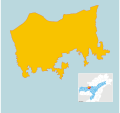
Datong, Yilan.svg 724 × 527; 36 KB
-
Derbyshire Council election, 2013 map.svg 1,267 × 2,054; 80 KB
-
Diagrama enclave exclave.svg 1,600 × 1,500; 81 KB
-
Dialects of Sindhi language-neutral.svg 323 × 392; 65 KB
-
Enclave exclave diagram.svg 1,600 × 1,500; 81 KB
-
Enclave.svg 256 × 200; 13 KB
-
EU visa countries.svg 940 × 415; 1.6 MB
-
Eurasian Economic Union.svg 2,754 × 1,398; 1.06 MB
-
Euro outside.svg 474 × 454; 388 KB
-
Exclave.svg 256 × 200; 18 KB
-
Fontevraud Abbey map-blank.svg 2,650 × 2,258; 69 KB
-
GliwiceBlankMap.svg 1,518 × 1,652; 70 KB
-
GS-50 projection with lines of constant scale.svg 3,278 × 2,310; 343 KB
-
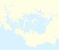
Gulf of Morbihan location map-blank.svg 2,626 × 2,224; 807 KB
-
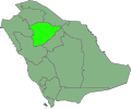
Ha'il حائل.svg 613 × 508; 298 KB
-
Hadhrami Arabic.svg 600 × 380; 92 KB
-
Hagi.svg 744 × 1,052; 619 KB
-
Hameau de la Reine.svg 3,315 × 3,307; 230 KB
-
Hamilton 1950–1955, Lanarkshire (UK Parliament constituency).svg 104 × 123; 114 KB
-
Hautes-Pyrénées communes location map.svg 675 × 881; 247 KB
-
Hautes-Pyrénées department location map.svg 675 × 881; 793 KB
-
Hautes-Pyrénées department relief location map.jpg 675 × 881; 253 KB
-
Hawaii Constitutional Amendment 2.svg 274 × 160; 11 KB
-
Homs blank subdistricts.svg 700 × 400; 86 KB
-
India Mizoram location map.svg 782 × 1,481; 452 KB
-
IR2012map2.svg 500 × 1,052; 34 KB
-
Isfahan city map.svg 2,963 × 2,787; 293 KB
-
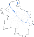
JR Yahiko Line linemap.svg 700 × 782; 13 KB
-
Krummes Elsass.svg 698 × 1,143; 347 KB
-
Lenguas mon-jemer.svg 600 × 531; 282 KB
-
Liverpoolone.svg 1,052 × 744; 202 KB
-
Location of Krasnogvardejskij raion (Stavropolskij kraj).svg 512 × 397; 192 KB
-
Loop49StatusMap.svg 803 × 655; 43 KB
-
Lorient arrondissement location map.svg 860 × 1,392; 894 KB
-
Lorient arrondissement relief location map.svg 860 × 1,392; 2.55 MB
-
LousameSVG.svg 509 × 509; 127 KB
-
Mainland farms of Avaldsnes county.svg 1,666 × 3,710; 5.59 MB
-
Map of Efate Island.svg 3,900 × 2,990; 455 KB
-
Map of Puilaurens castle without description.svg 744 × 438; 154 KB
-
Map of Puilaurens castle.svg 750 × 431; 171 KB
-
Map of Wisconsin highlighting the Milwaukee-Racine-Waukesha CSA.svg 4,747 × 5,087; 104 KB
-
Mapa municipal de Catalunya consultes independentistes.svg 425 × 400; 783 KB
-
Maya civilization location map-blank.svg 1,800 × 1,500; 1.49 MB
-
Mesoamerica topographic map-blank.svg 4,200 × 2,800; 1.55 MB
-
Mount Rainier Hazard Map-blank.svg 1,059 × 1,266; 2.42 MB
-
Msk all districts 2011.svg 3,594 × 4,069; 250 KB
-
Noia, Noia, Galicia.svg 618 × 616; 224 KB
-
Obre, Noia.svg 618 × 616; 224 KB
-
Oceans base map.svg 2,362 × 752; 4.06 MB
-
OJWs SVG cropping test.svg 1,662 × 1,864; 249 KB
-
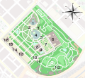
Parc de la Ciutadella map.svg 629 × 583; 783 KB
-
Parc naturel de la mer de Corail.svg 2,920 × 2,191; 498 KB
-
PlanThaborPartie.svg 800 × 560; 49 KB
-
Population density of Taiwan by district-without legend.svg 960 × 1,300; 1.36 MB
-
Provinzen von Burkina Faso.svg 992 × 709; 1.93 MB
-
PT-exCCFL(eletricos).svg 5,160 × 2,940; 1.5 MB
-
Queens Park Oval - Trinidad map.svg 500 × 500; 3 KB
-
Rennes carte generale.svg 477 × 384; 25 KB
-
Repartition hirondelle Népal.svg 400 × 600; 1.3 MB
-
Roman-empire-395AD.svg 648 × 481; 541 KB
-
Roo, Noia, Galicia.svg 618 × 616; 224 KB
-
Saint-Barthélemy quartiers map.svg 1,275 × 855; 153 KB
-
San Miguelito.svg 1,505 × 878; 496 KB
-
Sanaani Arabic.svg 600 × 380; 91 KB
-
Scottish Parliament election, 2016 - Conservative vote share.svg 895 × 1,143; 648 KB
-
Skalpaflói.svg 878 × 910; 87 KB
-
Soviet topographic map codes.svg 251 × 172; 342 KB
-
Südtaiwan-Wissenschaftspark Standorte.svg 700 × 850; 965 KB
-
Territorial claims against Guyana.svg 627 × 922; 424 KB
-
The Amazing Race Norge 1 map.svg 1,000 × 786; 845 KB
-
The battle of the Atlantic 1941 map.svg 1,420 × 1,696; 434 KB
-
Transylvania and associated areas.svg 1,958 × 1,380; 1.38 MB
-
Tuamotu relief location map.svg 1,797 × 1,319; 550 KB
-
Udalguri District Map.svg 512 × 480; 250 KB
-
Val-de-Marne communes location map 2013-02.svg 1,028 × 834; 145 KB
-
Val-de-Marne department location map 2013-02.svg 1,028 × 834; 145 KB
-
Val-de-Marne department relief location map 2013-02.jpg 1,028 × 834; 398 KB
-
WAGGGS-WOSM-Western Hemisphere.svg 415 × 330; 2.03 MB
-
Île-aux-Moines commune map-blank.svg 480 × 640; 27 KB
-
Île-d'Arz commune map-blank.svg 480 × 640; 44 KB
-
Îles Australes relief location map.svg 1,438 × 840; 150 KB


