Category:Landschaftsschutzgebiet Obere Saale
Jump to navigation
Jump to search
| Diese Kategorie repräsentiert ein Schutzgebiet nach Naturschutzrecht in Deutschland. |
|---|
| Diese Kategorie wurde nach einem klaren Schema angelegt, sie sollte nicht verschoben, gelöscht oder umkategorisiert werden. Sie ist unter anderem in dieser Uploadkarte hinterlegt. Beschreibung und Hintergründe auf der Seite des Wikiprojekts |
| Foto zu Wiki Loves Earth hochladen! - Seite von Wiki Loves Earth Deutschland |
This is the category of the protected area listed at WDPA under the ID 20840
|
Deutsch: Landschaftsschutzgebiet „Obere Saale“, LSG 51 im Saale-Orla-Kreis und im Landkreis Saalfeld-Rudolstadt, Thüringen
protected area in Germany  | |||||
| Upload media | |||||
| Instance of | |||||
|---|---|---|---|---|---|
| Location | |||||
| IUCN protected areas category | |||||
| Inception |
| ||||
| Area |
| ||||
 | |||||
Subcategories
This category has the following 4 subcategories, out of 4 total.
H
N
- Naturschutzgebiet Bleiberg (7 F)
- Naturschutzgebiet Kobersfelsen (16 F)
T
- Talsperre Walsburg (2 F)
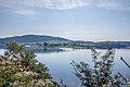
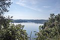
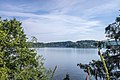
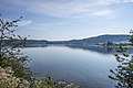
Media in category "Landschaftsschutzgebiet Obere Saale"
The following 65 files are in this category, out of 65 total.
-
 Acker nahe Burgk (Obere Saale).jpg 3,456 × 2,304; 4.58 MB
-
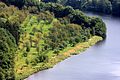
 Am nordwestlichen Ende des Bleilochstausees 2.jpg 6,000 × 4,000; 11.6 MB
-
 Am nordwestlichen Ende des Bleilochstausees.jpg 4,000 × 6,000; 11.35 MB
-
 Bleilochstausee (nördlicher Teil) 2.jpg 6,000 × 4,000; 10.44 MB
-
 Bleilochstausee (nördlicher Teil) 3.jpg 6,000 × 4,000; 10.25 MB
-
 Bleilochstausee (nördlicher Teil) 4.jpg 6,000 × 4,000; 8.52 MB
-
 Bleilochstausee (nördlicher Teil) 5.jpg 6,000 × 4,000; 13.5 MB
-
 Bleilochstausee (nördlicher Teil) 6.jpg 6,000 × 4,000; 12.23 MB
-
 Bleilochstausee (nördlicher Teil) 7.jpg 6,000 × 4,000; 10.65 MB
-
 Bleilochstausee (nördlicher Teil) 8.jpg 6,000 × 4,000; 10.46 MB
-
 Bleilochstausee (nördlicher Teil) 9.jpg 6,000 × 4,000; 6.85 MB
-
 Bleilochstausee (nördlicher Teil).jpg 6,000 × 4,000; 9.05 MB
-
 Bleilochstausee von der Brücke des Friedens aus 2.jpg 6,000 × 4,000; 7.62 MB
-
 Bleilochstausee von der Brücke des Friedens aus.jpg 10,913 × 4,085; 6.93 MB
-
 Bleilochstausee von nordöstlich von Saalburg aus 2.jpg 6,000 × 4,000; 7.87 MB
-
 Bleilochstausee von nordöstlich von Saalburg aus 3.jpg 6,000 × 4,000; 9.86 MB
-
 Bleilochstausee von nordöstlich von Saalburg aus 4.jpg 6,000 × 4,000; 12.03 MB
-
 Bleilochstausee von nordöstlich von Saalburg aus 5.jpg 6,000 × 4,000; 7.15 MB
-
 Bleilochstausee von nordöstlich von Saalburg aus 6.jpg 6,000 × 4,000; 10.69 MB
-
 Bleilochstausee von nordöstlich von Saalburg aus.jpg 6,000 × 4,000; 7.79 MB
-
 Blick auf den Bleilochstausee von Kloster aus.jpg 6,000 × 4,000; 9.69 MB
-
 Blick ins Tal neben der Staumauer an der Bleilochtalsperre.jpg 6,000 × 4,000; 12.49 MB
-
 Blick vom Weg am Bleilochstausee zum Bühl bei Röppisch.jpg 4,000 × 6,000; 14.62 MB
-
 Blick von der Brücke bei Gräfenwarth.jpg 5,772 × 3,347; 5.57 MB
-
 Blick von der Staumauer an der Bleilochtalsperre über das Kraftwerk zum Bleiberg.jpg 6,000 × 4,000; 10.42 MB
-
 Impatiens glandulifera am Bleilochstausee.jpg 3,372 × 3,179; 3.72 MB
-
 Kraftwerk an der Bleilochtalsperre.jpg 6,000 × 4,000; 10.86 MB
-
 Kühe am Pöritzscher Ufer.jpg 6,000 × 4,000; 10.87 MB
-
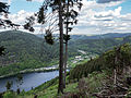 LSG Obere Saale Blick ins Saaletal zum Stausee Eichicht und Hohenwarte DE-TH.jpg 4,288 × 3,217; 3.79 MB
-
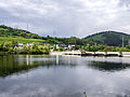 LSG Obere Saale Eichicht Stausee und Pumpspeicherwerk Hohenwarte I DE-TH.jpg 3,491 × 2,619; 4.25 MB
-

-

-
-
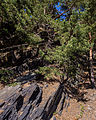 LSG Obere Saale Steilhang an der K 181 1 DE-TH.jpg 2,904 × 3,637; 4.61 MB
-
 LSG Obere Saale Steilhang an der K 181 2 DE-TH.jpg 2,864 × 3,579; 4.57 MB
-
 LSG Obere Saale Steilhang an der K 181 3 DE-TH.jpg 3,964 × 2,972; 4.76 MB
-
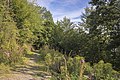
 Oberland-Radweg bei Gräfenwarth.jpg 4,000 × 6,000; 14.44 MB
-
 Orchidee am Bleilochstausee 2.jpg 6,000 × 4,000; 6.74 MB
-
 Saale im Thüringer Schiefergebirge.jpg 3,952 × 2,634; 3.84 MB
-
 Saaleschleife bei Burgk (Obere Saale).jpg 3,456 × 2,304; 4.42 MB
-
 Seitenarm des Bleilochstausees 2.jpg 6,000 × 4,000; 12.94 MB
-
 Seitenarm des Bleilochstausees.jpg 6,000 × 4,000; 10.82 MB
-
 Streuobstwiese bei Burgkhammer (Obere Saale).jpg 3,456 × 2,304; 4.97 MB
-
 Wald am Bleichlochstausee nordöstlich von Röppisch.jpg 6,000 × 4,000; 10.73 MB
-
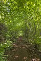
 Wanderweg am Westufer der Bleichlochtalsperre 01.jpg 6,000 × 4,000; 15.3 MB
-
 Wanderweg am Westufer der Bleichlochtalsperre 02.jpg 6,000 × 4,000; 13.47 MB
-
 Wanderweg am Westufer der Bleichlochtalsperre 03.jpg 6,000 × 4,000; 15.19 MB
-
 Wanderweg am Westufer der Bleichlochtalsperre 04.jpg 4,000 × 6,000; 15.73 MB
-
 Wanderweg am Westufer der Bleichlochtalsperre 05.jpg 4,000 × 6,000; 14.2 MB
-
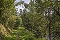
 Wanderweg am Westufer der Bleichlochtalsperre 06.jpg 6,000 × 4,000; 12.09 MB
-
 Wanderweg am Westufer der Bleichlochtalsperre 07.jpg 6,000 × 4,000; 14.71 MB
-
 Wanderweg am Westufer der Bleichlochtalsperre 08.jpg 4,000 × 6,000; 12.25 MB
-
 Wanderweg am Westufer der Bleichlochtalsperre 09.jpg 6,000 × 4,000; 14.1 MB
-
 Wanderweg am Westufer der Bleichlochtalsperre 10.jpg 6,000 × 4,000; 14.89 MB
-
 Wanderweg am Westufer der Bleichlochtalsperre 11.jpg 4,000 × 6,000; 12.94 MB
-
 Wanderweg am Westufer der Bleichlochtalsperre 12.jpg 4,000 × 6,000; 13.36 MB
-
 Wanderweg am Westufer der Bleichlochtalsperre 13.jpg 6,000 × 4,000; 15.33 MB
-
 Wanderweg am Westufer der Bleichlochtalsperre 14.jpg 6,000 × 4,000; 14.11 MB
-
 Wanderweg am Westufer der Bleichlochtalsperre 15.jpg 4,000 × 6,000; 16.04 MB
-
 Wanderweg am Westufer der Bleichlochtalsperre 16.jpg 4,000 × 6,000; 15.47 MB
-
 Wanderweg am Westufer der Bleichlochtalsperre 17.jpg 6,000 × 4,000; 11.26 MB
-
 Weg von der Bleichlochtalsperre zur Schmiedekuppe.jpg 4,000 × 6,000; 11.27 MB
-
 Ziegenrück-saale-movement.jpg 2,000 × 1,328; 2.34 MB
-
 Ziegenrück-saale.jpg 2,000 × 1,329; 2.56 MB
-
 Ziegenrück-waterfall.jpg 2,000 × 1,328; 2.03 MB
.jpg)


_2.jpg)
_3.jpg)
_4.jpg)
_5.jpg)
_6.jpg)
_7.jpg)
_8.jpg)
_9.jpg)
.jpg)


.jpg)


.jpg)


