Category:Landsat images of New Zealand
Jump to navigation
Jump to search
Media in category "Landsat images of New Zealand"
The following 10 files are in this category, out of 10 total.
-
 CBD Tunnel Landsat 7 Image Auckland.jpg 1,000 × 660; 160 KB
-
 Central Connector Landsat 7 Image Auckland.jpg 1,000 × 660; 162 KB
-
 Christchurch New Zealand NASA Satellite.JPG 542 × 405; 58 KB
-
 Dunedin, New Zealand location map.PNG 421 × 436; 236 KB
-
 DunedinSatmap.png 440 × 441; 331 KB
-
 LANDSAT 2005 Slipper Island Whakahau.jpg 516 × 400; 90 KB
-
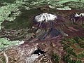 MtRuapehu 23oct2002.jpg 4,500 × 3,375; 3.2 MB
-
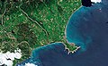
 Māhia Peninsula landsat.jpg 1,280 × 948; 83 KB
-
 Powerful Earthquake Exposes New Land Near Kaikoura.jpeg 1,663 × 1,021; 2.26 MB
-
 Tongariro NP satellite.jpg 656 × 692; 348 KB


