Category:Landsat images of Japan
Jump to navigation
Jump to search
Media in category "Landsat images of Japan"
The following 62 files are in this category, out of 62 total.
-
Akashi-Strait 1.png 1,194 × 900; 690 KB
-
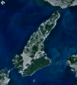
Awaji-island 1.png 903 × 995; 372 KB
-
Harima-Nada 1.png 1,203 × 921; 755 KB
-
Ise bay (cropped).png 339 × 232; 196 KB
-
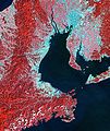
Ise bay landsat.jpg 359 × 426; 125 KB
-
Ise bay.png 454 × 394; 462 KB
-
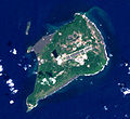
Iwo-to landsat1999.jpg 1,251 × 1,148; 193 KB
-
Japaneq oli 20240117 lrg noto peninsula.jpg 1,811 × 1,392; 1.72 MB
-
Japaneq oli2 20220110 lrg noto peninsula.jpg 1,811 × 1,392; 1.35 MB
-
Kasumigaura landsat (cropped).jpg 670 × 456; 74 KB
-
Kasumigaura landsat.jpg 1,024 × 768; 167 KB
-
Kawasaki city.png 4,500 × 3,000; 27.03 MB
-
Kii-Channel 1.png 1,140 × 901; 507 KB
-
Kitan-Strait 1.png 1,274 × 936; 682 KB
-
Kohama island 01.jpg 758 × 488; 48 KB
-
Lake biwa.jpg 1,024 × 1,399; 176 KB
-
Lake hamana landsat.jpg 903 × 712; 158 KB
-
Lake masyu landsat.jpg 644 × 563; 80 KB
-
Lake Shumarinai Landsat 01.jpg 2,326 × 1,745; 2.84 MB
-
Lake syunkusitakara landsat.jpg 1,024 × 1,064; 643 KB
-
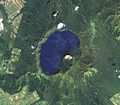
Lake towada landsat.jpg 608 × 614; 99 KB
-
Landsat Aogashima Island.jpg 250 × 197; 72 KB
-
Landsat Hachijojima Island.jpg 649 × 474; 67 KB
-
Landsat image of Fuji-go-ko.jpg 1,118 × 521; 197 KB
-
Landsat IzuOshima Island.jpg 600 × 830; 197 KB
-
Landsat Kozushima Island.jpg 295 × 358; 26 KB
-
Landsat Mikurajima Island.jpg 241 × 301; 21 KB
-
Landsat Miyakejima Island.jpg 436 × 454; 32 KB
-
Landsat Niijima and Shikinejima Island.jpg 409 × 541; 39 KB
-
Landsat Takamatsu -Yashima 01.jpg 421 × 503; 62 KB
-
Landsat Toshima Island.jpg 112 × 140; 15 KB
-
Landsat View, Tokyo, Japan - Flickr - NASA Goddard Photo and Video.jpg 980 × 1,111; 1.73 MB
-
Landsat-Shingashi-View 01.jpg 430 × 234; 52 KB
-
LandsatView - Aomori, Goshogawara, Jusan lake april 2014.JPG 859 × 699; 74 KB
-
LandsatView - Enshū sea, Japan 2015 (fr).jpg 481 × 266; 52 KB
-
Lattice shelterbelt in Konsen plateau Japan.png 1,082 × 720; 1.57 MB
-
Minami-Io-jima Landsat.jpg 508 × 348; 34 KB
-
Mizuhomachi-Landsat001.jpg 345 × 381; 44 KB
-
Musashino Plateau.jpg 1,093 × 930; 308 KB
-
Narita International Airport landsat.jpg 450 × 240; 65 KB
-
Naruto-Strait 1.png 1,156 × 873; 557 KB
-
Nastudomari Pen 01.jpg 1,244 × 758; 128 KB
-
Osaka-Bay 1.png 938 × 949; 502 KB
-
Port of Kawasaki Landsat.jpg 620 × 495; 67 KB
-
Port of Yokohama Landsat.jpg 1,190 × 675; 179 KB
-
Port of yokosuka landsat.jpg 386 × 505; 46 KB
-
Sanbanze landsat.jpg 320 × 231; 57 KB
-
Shutoken chikeizu01.png 1,600 × 858; 1.21 MB
-
Syodoshima landsat.jpg 892 × 677; 152 KB
-
Tokyo 2016 07 07 (33597397906).jpg 3,404 × 1,801; 2.49 MB
-
Tokyo Bay 432 751enh pan crop 15 (31354167511).jpg 4,911 × 5,823; 30.75 MB
-
Tokyo Bay 432 pan crop 15 (30628321724).jpg 4,911 × 5,823; 28.25 MB
-
Tokyo L7 lrg.jpg 1,000 × 1,000; 511 KB
-
Tokyo Landsat.jpg 1,000 × 782; 897 KB
-
Tokyo port ca.1986.jpg 840 × 604; 330 KB
-
Tokyo2 Landsat.jpg 384 × 300; 39 KB
-
Tokyobay landsat.jpg 461 × 791; 63 KB
-
TokyoPort Chubo 1986.jpg 134 × 140; 15 KB
-
TsugaruPeninsulaJpLandsat.jpg 849 × 796; 140 KB
-
Tsurumi.png 1,300 × 1,350; 3.65 MB
-
Uraga channel landsat.jpg 282 × 375; 17 KB
-
Yokohama Landsat.jpg 1,500 × 2,100; 803 KB

