Category:Land use in North Rhine-Westphalia
Jump to navigation
Jump to search
Federal states of Germany:
Subcategories
This category has the following 5 subcategories, out of 5 total.
Media in category "Land use in North Rhine-Westphalia"
The following 21 files are in this category, out of 21 total.
-
Borgholzhausen Nutzung.png 992 × 892; 164 KB
-
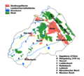
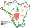
Falk Oberdorf Flächennutzung Kreis Herford.jpg 953 × 763; 90 KB
-
Falk Oberdorf Flächennutzung Minden-Lübbecke.jpg 953 × 763; 82 KB
-
Falk Oberdorf Flächennutzung NRW.jpg 953 × 763; 92 KB
-
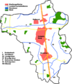
Falk Oberdorf Kernstadt Flächennutzung.png 645 × 703; 88 KB
-
Flaechennutzung MH 2006.svg 700 × 500; 7 KB
-
Flaechennutzung-MH-2009.png 2,048 × 1,321; 261 KB
-
Halle (Westfalen) - land utilization.svg 1,020 × 915; 541 KB
-
Halle Nutzung.png 1,020 × 915; 220 KB
-
Kreis-Herford-Nutzung.png 550 × 365; 105 KB
-
Land use duisburg.png 644 × 392; 26 KB
-
Langenberg (Kreis Gütersloh) - land utilization.svg 572 × 658; 370 KB
-
Langenberg Nutzung.png 1,143 × 1,316; 197 KB
-
Moers Flächennutzung.jpg 558 × 370; 29 KB
-
RB Detmold Flaechennutzung.png 341 × 264; 12 KB
-
Rodinghausen.png 405 × 453; 59 KB
-
Schwelm Nutzung.jpg 639 × 913; 108 KB
-
Siedlungs- und Verkehrsfläche Wetter (Ruhr) 1994-heute.png 1,357 × 1,067; 76 KB
-
Steinhagen Nutzung.png 986 × 738; 157 KB
-
Werther (Westf.) - land utilization.svg 860 × 807; 277 KB
-
Werther Nutzung.png 860 × 807; 143 KB


