Category:Land of Moravia (1918–1928)
Jump to navigation
Jump to search
The Land of Moravia was one of three "lands" (země), also known as district units (obvody), along with Bohemia and Silesia, that constituted the highest-level administrative divisions of the First Czechoslovak Republic, between 1918 and 1928.
country in Czechoslovakia in the years 1918-1928   | |||||
| Upload media | |||||
| Instance of | |||||
|---|---|---|---|---|---|
| Location | Czechoslovakia | ||||
| Capital | |||||
| Inception |
| ||||
| Dissolved, abolished or demolished date |
| ||||
| Population |
| ||||
| Area |
| ||||
| Replaced by |
| ||||
 | |||||
Subcategories
This category has the following 6 subcategories, out of 6 total.
1
Media in category "Land of Moravia (1918–1928)"
The following 14 files are in this category, out of 14 total.
-
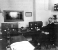 Hlasatelna brněnského rozhlasu.gif 600 × 515; 303 KB
-
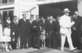 Masaryk a Absolon v Brně.gif 600 × 386; 212 KB
-
 Morava a moravské enklávy ve Slezsku.png 3,662 × 2,104; 648 KB
-
 Morava a změna hranice po připojení Dyjského trojúhelníku.png 3,662 × 2,104; 645 KB
-
 Morava a změna hranice po připojení Valticka.png 3,662 × 2,104; 645 KB
-
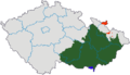
 Morava po roce 1920 na mapě Česka.png 3,662 × 2,104; 634 KB
-
 Moravia, moravian enclaves in Silesia, and change of moravian borders in 1920.png 3,662 × 2,104; 635 KB
-
 Okresní úřad Vyškov.gif 600 × 364; 213 KB
-
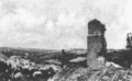 Otaslavice hrad 20.gif 889 × 549; 189 KB
-
 První automobilová stříkačka Ivančice.gif 803 × 600; 554 KB
-
 Právo stanné 1920.gif 355 × 600; 130 KB
-
 Spontánní manifestace 29 10 1918.gif 600 × 415; 260 KB
-
 Vladimír Klofáč v Hranicích.gif 600 × 386; 223 KB
-
 Základní kámen Právnické fakulty Brno.gif 610 × 394; 111 KB


