Category:Labels of walking route E3 in Czechia
Jump to navigation
Jump to search
Subcategories
This category has the following 3 subcategories, out of 3 total.
Media in category "Labels of walking route E3 in Czechia"
The following 13 files are in this category, out of 13 total.
-
 EB-sign.svg 744 × 744; 2 KB
-
 Karlovy Vary, na Doubské vyhlídce.jpg 2,136 × 2,848; 1.39 MB
-
 Kořenov, Martinské údolí, rozcestník.jpg 2,048 × 1,536; 664 KB
-
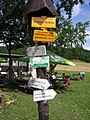
 Nové Město u Mikulova, u transformátoru, rozcestník.jpg 2,448 × 3,264; 1.18 MB
-
 Rozcestník Jizerka-chata Pyramida (01).jpg 1,536 × 2,048; 441 KB
-
 Rozcestník Jizerka-chata Pyramida.jpg 2,048 × 1,536; 629 KB
-
 Rozcestník Jizerka-Mořina (01).jpg 2,048 × 1,536; 631 KB
-
 Rozcestník Jizerka-Mořina (02).jpg 1,536 × 2,048; 411 KB
-
 Rozcestník Jizerka-Mořina (03).jpg 1,536 × 2,048; 579 KB
-
 Sneznik rozc.JPG 930 × 1,347; 227 KB
-
 Turistický rozcestník Pod Jelením vrchem v Krušných horách.jpg 1,512 × 2,016; 1.95 MB
-
 Voitsdorf Wegweiser.jpg 860 × 1,276; 187 KB
-
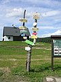
 Walking route E3 sign - Jeseniky, Czech Republic 11.jpg 2,842 × 2,594; 3.12 MB


.jpg)

.jpg)
.jpg)
.jpg)


