Category:Labeled maps of administrative divisions of Germany
Jump to navigation
Jump to search
Subcategories
This category has only the following subcategory.
Media in category "Labeled maps of administrative divisions of Germany"
The following 24 files are in this category, out of 24 total.
-
Bayern Gemeindegrenzen 1892 NEF.jpg 11,530 × 11,823; 61.58 MB
-
Bayern Gemeindegrenzen 1892 nordost.jpg 11,300 × 11,000; 12.46 MB
-
Bayern Gemeindegrenzen 1892 nordwest.jpg 10,280 × 10,930; 11.89 MB
-
Bayern Gemeindegrenzen 1892 südost.jpg 11,320 × 11,010; 12.22 MB
-
Bayern Gemeindegrenzen 1892 südwest.jpg 10,370 × 11,000; 10 MB
-
Bayern Gemeindegrenzen 1892 v2.jpg 21,340 × 21,760; 60.53 MB
-
Bayern Gemeindegrenzen 1892 Übersicht.jpg 4,389 × 4,569; 7.02 MB
-
BRD.png 2,152 × 2,537; 928 KB
-
Deutsche Metropolregionen.svg 754 × 1,000; 692 KB
-
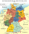
Deutschland politisch 2010.png 756 × 998; 173 KB
-
Deutschland politisch bunt.png 757 × 1,002; 199 KB
-
Deutschland politische Karte.svg 2,105 × 2,980; 337 KB
-
Deutschlandkarte3.png 2,038 × 2,685; 1.03 MB
-
German Provinces in Punjabi.PNG 594 × 802; 116 KB
-
Germany Input Administrative Boundaries (5457755572).jpg 2,524 × 3,209; 829 KB
-
Karte Metropolregionen-sr-ijek.svg 512 × 680; 1.04 MB
-
Karte Metropolregionen-sr-lat-ijek.svg 512 × 680; 1.05 MB
-
Karte Metropolregionen-sr-lat.svg 512 × 680; 1.05 MB
-
Karte Metropolregionen-sr.svg 512 × 680; 1.04 MB
-
Map germany with coats-of-arms.png 1,971 × 2,668; 675 KB
-
Karte Metropolregionen.svg 1,878 × 2,493; 1.4 MB
-
Neugliederungsvorschlag mit 9 Länder Fussionen und Änderungen.png 500 × 646; 30 KB
-
Němska politisce 2010.png 756 × 998; 237 KB
-
VDeutschland Laender.png 200 × 272; 23 KB


