Category:LAC-30
Jump to navigation
Jump to search
Contains media showing lunar surface features from LAC quadrangle #30.
- Latitude range: 32° N to 48° N
- Longitude range: 106° E to 130° E
Media in category "LAC-30"
The following 24 files are in this category, out of 24 total.
-
Becquerel-color.jpg 288 × 381; 69 KB
-
Cantor sattelite craters map.jpg 1,212 × 759; 82 KB
-
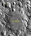
H G Wells sattelite craters map.jpg 784 × 891; 143 KB
-
Harriot sattelite craters map.jpg 992 × 742; 70 KB
-
Kidinnu sattelite craters map.jpg 701 × 542; 32 KB
-
Normal cantor LROC.jpg 400 × 389; 25 KB
-
Normal harriot LROC.jpg 400 × 380; 29 KB
-
Normal kidinnu-clem1.jpg 385 × 400; 34 KB
-
Normal millikan-clem1.jpg 400 × 399; 36 KB
-
Normal petrie-clem1.jpg 400 × 383; 25 KB
-
Normal rayet-clem1.jpg 400 × 368; 23 KB
-
Normal segers-clem1.jpg 366 × 400; 20 KB
-
Normal sisakyan-clem1.jpg 400 × 357; 25 KB
-
Normal tesla-clem1.jpg 399 × 372; 30 KB
-
Normal van-maanen.jpg 400 × 373; 29 KB
-
Petrie sattelite craters map.jpg 539 × 395; 38 KB
-
Rayet sattelite craters map.jpg 790 × 960; 78 KB
-
Segers sattelite craters map.jpg 556 × 776; 72 KB
-
Sisakyan sattelite craters map.jpg 694 × 525; 78 KB
-
Sumner LROC.jpg 439 × 441; 73 KB
-
Sumner sattelite craters map.jpg 1,093 × 654; 78 KB
-
Tesla sattelite craters map.jpg 588 × 507; 51 KB
-
Vanmaanen-k.jpg 617 × 665; 102 KB
-
Vanmaanen-letter.jpg 661 × 458; 128 KB


