Category:LAC-21
Jump to navigation
Jump to search
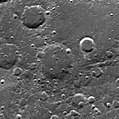
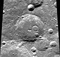
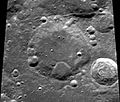
Contains media showing lunar surface features from LAC quadrangle #21.
- Latitude range: 48° N to 64° N
- Longitude range: 110° W to 80° W
Media in category "LAC-21"
The following 18 files are in this category, out of 18 total.
-
Boole satellite craters map 2.jpg 1,098 × 677; 41 KB
-
Langley sattelite craters map.jpg 977 × 600; 205 KB
-
Normal Boole LO-IV-190M LTVT.jpg 373 × 400; 33 KB
-
Normal cannizzaro-large.jpg 400 × 398; 31 KB
-
Normal omar-khayyam-clem1.jpg 397 × 400; 29 KB
-
Normal paneth-clem1.jpg 400 × 383; 29 KB
-
Normal poczobutt-clem1.jpg 400 × 316; 30 KB
-
Normal regnault-clem1.jpg 400 × 381; 28 KB
-
Normal smoluchowski-clem1.jpg 400 × 340; 28 KB
-
Normal Volta-Repsold LO-IV-188M LTVT.jpg 373 × 400; 36 KB
-
Poczobutt sattelite craters map.jpg 1,408 × 1,216; 189 KB
-
Regnault sattelite craters map.jpg 508 × 490; 25 KB
-
Smoluchowski sattelite craters map.jpg 1,153 × 687; 109 KB
-
Stokes LAC21.jpg 378 × 367; 32 KB
-
Volta + Galvani + Repsold - LROC - WAC.jpg 1,000 × 1,000; 251 KB
-
Xenophanes - LROC - WAC.jpg 1,000 × 1,000; 267 KB
-
Zsigmondy LRO WAC.jpg 433 × 448; 77 KB
-
Zsigmondy sattelite craters map.jpg 1,035 × 1,096; 76 KB


