Category:Kunashir
Jump to navigation
Jump to search
English: Kunashir Island
日本語: 国後島
Русский: Кунашир
island in South Kuril Islands | |||||
| Upload media | |||||
| Instance of | |||||
|---|---|---|---|---|---|
| Part of |
| ||||
| Location |
| ||||
| Located in or next to body of water | |||||
| Capital | |||||
| Significant event |
| ||||
| Width |
| ||||
| Length |
| ||||
| Highest point | |||||
| Population |
| ||||
| Area |
| ||||
| Elevation above sea level |
| ||||
 | |||||
Subcategories
This category has the following 11 subcategories, out of 11 total.
C
- Cape Stolbchaty (28 F)
D
- Devil's Finger, Kunashir (1 F)
G
- Golovnin (8 F)
M
- Mendeleev (volcano) (35 F)
N
P
- Ptichy Waterfall (2 F)
R
- Ruyobetsu, Hokkaido (2 F)
T
- Tyatya (11 F)
Y
- Yuzhno-Kurilsk (17 F)
Media in category "Kunashir"
The following 62 files are in this category, out of 62 total.
-
Chrysorithrum flavomaculata.jpg 2,053 × 1,434; 538 KB
-
Dmitry Medvedev in Kuriles 1 November 2010-1.jpeg 650 × 434; 52 KB
-
Dmitry Medvedev in Kuriles 1 November 2010-10.jpeg 650 × 434; 71 KB
-
Dmitry Medvedev in Kuriles 1 November 2010-2.jpeg 650 × 434; 64 KB
-
Dmitry Medvedev in Kuriles 1 November 2010-3.jpeg 650 × 434; 59 KB
-
Dmitry Medvedev in Kuriles 1 November 2010-4.jpeg 289 × 434; 37 KB
-
Dmitry Medvedev in Kuriles 1 November 2010-5.jpeg 650 × 434; 62 KB
-
Dmitry Medvedev in Kuriles 1 November 2010-6.jpeg 650 × 434; 67 KB
-
Dmitry Medvedev in Kuriles 1 November 2010-7.jpeg 650 × 434; 62 KB
-
Dmitry Medvedev in Kuriles 1 November 2010-8.jpeg 650 × 434; 52 KB
-
Dmitry Medvedev in Kuriles 1 November 2010-9.jpeg 650 × 434; 64 KB
-
Hokkaido Nemuro Br 16cl.GIF 768 × 429; 7 KB
-
Hokkaido Nemuro Br 16cl.png 768 × 429; 6 KB
-
Hokkaido Season Winter Summer 2008.png 6,216 × 1,968; 10.5 MB
-
Hoppo.png 384 × 215; 4 KB
-
Island-Kunashiri.jpg 700 × 525; 245 KB
-
Keibitai.jpg 397 × 240; 81 KB
-
Kunashir banner.jpg 2,100 × 300; 474 KB
-
Kunashir Is.JPG 2,816 × 1,880; 673 KB
-
Kunashir Island (Kunashirito) Relief Map, SRTM-1.jpg 2,800 × 2,100; 1.21 MB
-
Kunashir Island 2010.jpeg 650 × 434; 66 KB
-
Kunashir Island.jpg 1,280 × 811; 225 KB
-
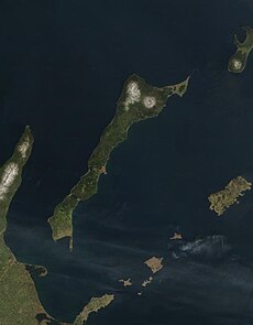
Kunashir Terra cut.jpg 595 × 762; 128 KB
-
Kunashir topomap.png 876 × 909; 281 KB
-
Kunashir.jpg 987 × 628; 249 KB
-
Kunashir01.JPG 4,224 × 3,168; 3.81 MB
-
Kunashiri District in Nemuro Subprefecture.gif 600 × 344; 37 KB
-
Kunashiri-to Island.JPG 2,592 × 1,944; 1.15 MB
-
KunashirMap.png 4,320 × 4,320; 12.71 MB
-
Kuril-Islands-Northern-Territories-of-Japan-Map.png 1,787 × 917; 415 KB
-
Kuriles Kunashir.PNG 365 × 235; 4 KB
-
Kurili Hokkaido from Kunashir.jpg 756 × 567; 26 KB
-
Map of Nemuro-Kunashiri Strait ja.svg 960 × 640; 538 KB
-
Mt Tomari at kunasir Is.JPG 2,816 × 1,880; 1.99 MB
-
North 4 islands.png 768 × 429; 13 KB
-
Northern-Territories-of-Japan-Map-日本の北方領土の地図.png 1,787 × 917; 414 KB
-
Plestiodon finitimus 53060866.jpg 2,048 × 1,367; 3.6 MB
-
Rausu Kunashiri Observatory Deck 3.jpg 4,000 × 3,000; 4.65 MB
-
Rausu Kunashiri Observatory Deck 4.jpg 4,000 × 3,000; 3.99 MB
-
Sea of Okhotsk Season Winter Summer 2008.jpg 6,256 × 6,126; 8.89 MB
-
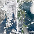
Shiretoko Peninsula and Kunashir seasonal ice comparison 2008.jpg 540 × 709; 103 KB
-
ShiretokoFromKunashir.jpg 1,469 × 951; 392 KB
-
Southern-Kuril-Islands-ISS-Space.png 1,920 × 1,080; 1.75 MB
-
USSR map NK 55-1 Nemuro.jpg 5,000 × 3,801; 5.56 MB
-
USSR map NL 55-10 Rausu.jpg 5,000 × 3,847; 2.94 MB
-
View of Kunashir from Shiretoko 20140811.jpg 3,872 × 2,592; 3.13 MB
-
Водопад Птичий.png 1,400 × 933; 2.78 MB
-
Вулкан Руруй (с вулкана Тятя).jpg 1,101 × 892; 305 KB
-
Вулкан Руруй (с самолета).jpg 1,504 × 1,000; 744 KB
-
Вулкан Руруй (с Южно-Курильска).jpg 1,387 × 1,451; 448 KB
-
Дорога к селу Отрада.jpg 1,024 × 683; 121 KB
-
Кунашир10.jpg 1,280 × 819; 179 KB
-
Кунашир6.jpg 1,280 × 811; 217 KB
-
Кунашир7.jpg 655 × 1,024; 171 KB
-
Кунаширский сфинкс.jpg 683 × 1,024; 387 KB
-
Медведь у водопада Птичий.png 1,200 × 799; 1.81 MB
-
О. Кунашир, Горячий ключ.jpg 2,400 × 1,600; 4.58 MB
-
Панорама Отрады.jpg 1,024 × 281; 90 KB
-
Проливы Курильских островов Юг.png 1,146 × 780; 616 KB
-
乳呑路墓地跡.JPG 3,456 × 4,608; 3.43 MB
-
国後島 - panoramio (2).jpg 1,600 × 1,200; 266 KB
-
武佐岳からの国後島.jpg 3,845 × 2,564; 1.18 MB


