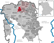
Category:Krombach
Jump to navigation
Jump to search
municipality of Germany | |||||
| Upload media | |||||
| Instance of |
| ||||
|---|---|---|---|---|---|
| Part of |
| ||||
| Named after | |||||
| Location | Aschaffenburg district, Lower Franconia, Bavaria, Germany | ||||
| Head of government |
| ||||
| Population |
| ||||
| Area |
| ||||
| Elevation above sea level |
| ||||
| Different from | |||||
| official website | |||||
 | |||||
Subcategories
This category has the following 11 subcategories, out of 11 total.
*
2
- 2017 in Krombach (15 F)
B
C
D
- Degen-Weg (12 F)
K
- Kahl in Krombach (4 F)
O
- Oberschur (1 F)
W
- Womburg (1 F)
Media in category "Krombach"
The following 16 files are in this category, out of 16 total.
-
DEU Krombach COA.svg 512 × 559; 178 KB
-
Wappen Krombach Unterfranken.png 171 × 190; 30 KB
-
Alter Steinbruch Krombach.jpg 2,736 × 3,648; 6.95 MB
-
Erdkröte bei Krombach.jpg 3,648 × 2,736; 5.43 MB
-
Gemeinde Krombach (Unterfranken) (Details).svg 1,325 × 1,753; 621 KB
-
Gemeinde Krombach (Unterfranken).png 984 × 1,317; 46 KB
-
Gemeinde Krombach (Unterfranken).svg 1,235 × 1,636; 91 KB
-
Kahlwiese Krombach (2).jpg 3,648 × 2,736; 5.78 MB
-
Kahlwiese Krombach.jpg 2,736 × 3,648; 5.91 MB
-
Krombach um 1850.JPG 498 × 724; 77 KB
-
Krombach, Friedhoftor 1.jpg 2,889 × 1,869; 1.02 MB
-
Krombach.svg 1,242 × 1,643; 108 KB
-
Schöneberg (Krombach).jpg 5,184 × 3,456; 10 MB
-
Wassertretanlage Krombach.jpg 3,648 × 2,736; 5.56 MB
-
Weg zur Ruine Hauenstein.jpg 3,648 × 2,736; 5.48 MB


