Category:Knight's Hill (West Norwood)
Jump to navigation
Jump to search
Street in the London Borough of Lambeth _-_geograph.org.uk_-_1658415.jpg) | |||||
| Upload media | |||||
| Instance of | |||||
|---|---|---|---|---|---|
| Part of | |||||
| Location | London Borough of Lambeth, Greater London, London, England | ||||
| Connects with | |||||
 | |||||
Subcategories
This category has the following 2 subcategories, out of 2 total.
W
- West Norwood railway station (33 F)
Media in category "Knight's Hill (West Norwood)"
The following 10 files are in this category, out of 10 total.
-
 Image taken from page 926 of 'Old and New London, etc' (11189334543).jpg 1,683 × 1,262; 1.05 MB
-
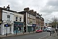 23-45 Knight's Hill - geograph.org.uk - 3323768.jpg 640 × 429; 137 KB
-
 44-64 Knight's Hill - geograph.org.uk - 3323789.jpg 640 × 523; 177 KB
-
 Houses, Knight's Hill - geograph.org.uk - 1617812.jpg 640 × 500; 99 KB
-
 Knight's Hill, A215 - geograph.org.uk - 3661252.jpg 640 × 430; 79 KB
-
 Knight's Hill, West Norwood - geograph.org.uk - 5154489.jpg 1,024 × 768; 157 KB
-
 Knights Hill, West Norwood - geograph.org.uk - 3137938.jpg 640 × 480; 134 KB
-
 The Jews' Hospital, Lower Norwood. Wellcome L0004807.jpg 1,776 × 1,152; 1,015 KB
-
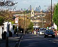 View down Knight's Hill (1) - geograph.org.uk - 1658415.jpg 640 × 522; 177 KB
-
 View down Knight's Hill (2) - geograph.org.uk - 1658470.jpg 505 × 640; 145 KB
.jpg)


_-_geograph.org.uk_-_1658470.jpg)