Category:Kingsland, Herefordshire
Jump to navigation
Jump to search
village in Herefordshire, England, UK  | |||||
| Upload media | |||||
| Instance of | |||||
|---|---|---|---|---|---|
| Location | Herefordshire, West Midlands, England | ||||
| Population |
| ||||
 | |||||
Cymraeg: Pentref yn Swydd Henffordd, Gorllewin Canolbarth Lloegr, Lloegr ydy Kingsland, Herefordshire.
English: Kingsland is a small village and civil parish in the English county of Herefordshire. It is located north-west of Leominster. The population of the civil parish at the 2011 census was 986.
Français : Kingsland est un village anglaise situeé dans le comté d' Herefordshire, à 5 km au nord-ouest de Leominster. Derrière de l'eglise, il y a les vestiges d'une motte castrale.
Polski: Kingsland – wieś i civil parish w Anglii, w hrabstwie Herefordshire. W 2011 roku civil parish liczyła 986 mieszkańców. Kingsland jest wspomniana w Domesday Book (1086) jako Lene.

Subcategories
This category has the following 11 subcategories, out of 11 total.
Media in category "Kingsland, Herefordshire"
The following 200 files are in this category, out of 228 total.
(previous page) (next page)-
 "There is a lot of water about" - geograph.org.uk - 3273856.jpg 640 × 480; 282 KB
-
 'Hazeldene' - Shirl Heath, Herefordshire - geograph.org.uk - 365904.jpg 640 × 480; 127 KB
-

-

-
 A winding English road - geograph.org.uk - 1814763.jpg 640 × 480; 165 KB
-
 A4110 by Arrow Mill - geograph.org.uk - 5606227.jpg 1,600 × 1,000; 759 KB
-
 A4110 east of Longmoor - geograph.org.uk - 3738843.jpg 3,423 × 2,495; 1.06 MB
-
 A4110 enters Shirl Heath - geograph.org.uk - 3738217.jpg 3,760 × 2,281; 1.05 MB
-
 A4110 junction with Hereford Lane - geograph.org.uk - 3739429.jpg 3,484 × 2,414; 836 KB
-
 A4110 junction with Hereford Lane - geograph.org.uk - 4276360.jpg 1,024 × 767; 117 KB
-
 A4110 junction with un-named lane to Cobnash - geograph.org.uk - 3738853.jpg 3,417 × 2,435; 1.42 MB
-
 A4110 north of Kingsland - geograph.org.uk - 2144379.jpg 640 × 480; 32 KB
-
 A4110 north of Kingsland - geograph.org.uk - 2555711.jpg 640 × 480; 106 KB
-
 A4110 passes entrance to Mortimer Park - geograph.org.uk - 3739437.jpg 3,473 × 2,517; 980 KB
-
 A4110 passes Showers Cottage - geograph.org.uk - 3738874.jpg 3,366 × 2,491; 1.16 MB
-
 A4110, Lawton Cross - geograph.org.uk - 4423877.jpg 800 × 533; 406 KB
-
 Access Track To Club Hall - geograph.org.uk - 1758968.jpg 640 × 480; 181 KB
-
 Angel House (Kingsland) - geograph.org.uk - 5689950.jpg 3,264 × 2,448; 1.72 MB
-
 Angel House (Viewed from Millennium Green ^ Kingsland) - geograph.org.uk - 5689952.jpg 3,264 × 2,448; 2.47 MB
-
 Angel House, Kingsland - geograph.org.uk - 2183945.jpg 3,896 × 2,181; 5.09 MB
-
 Apple orchard - geograph.org.uk - 5050071.jpg 800 × 531; 164 KB
-
 Apple orchard in early May near Ledicot - geograph.org.uk - 2932941.jpg 4,752 × 3,168; 4.43 MB
-
 Approaching Basket's Gate Crossroads - geograph.org.uk - 1758957.jpg 640 × 480; 127 KB
-
 Approaching the Kingsland crossroads - geograph.org.uk - 5629039.jpg 1,600 × 901; 654 KB
-
 Approaching Whitehouse Aston - geograph.org.uk - 5158650.jpg 800 × 600; 156 KB
-
 Arrow Bridge - geograph.org.uk - 4423886.jpg 800 × 533; 463 KB
-
 Arrow Bridge over the River Arrow in Arrow Green - geograph.org.uk - 4276403.jpg 1,024 × 768; 156 KB
-
 Arrow Bridge, Arrow Green - geograph.org.uk - 3381727.jpg 4,320 × 3,240; 3.02 MB
-
 Aston Lane - geograph.org.uk - 1758973.jpg 640 × 480; 138 KB
-
 B4360 at Cobnash - geograph.org.uk - 2144238.jpg 640 × 480; 61 KB
-
 B4360 at Cobnash - geograph.org.uk - 2555677.jpg 640 × 480; 164 KB
-
 B4360 at the Wesleyan Chapel - geograph.org.uk - 2555704.jpg 640 × 480; 148 KB
-
 B4360 junction west of Mousenatch Farm - geograph.org.uk - 3812592.jpg 3,648 × 2,736; 1.7 MB
-
 B4360 Langford - geograph.org.uk - 1248532.jpg 640 × 480; 89 KB
-
 B4360 near Holgate Farm - geograph.org.uk - 2555691.jpg 640 × 480; 111 KB
-
 B4360 passes The Poor House - geograph.org.uk - 3812582.jpg 3,648 × 2,736; 1.72 MB
-
 B4360 towards Kingsland - geograph.org.uk - 5679430.jpg 1,600 × 901; 669 KB
-
 B4360, Cobnash - geograph.org.uk - 2144260.jpg 640 × 480; 77 KB
-
 B4360, Kingsland - geograph.org.uk - 2144320.jpg 640 × 480; 38 KB
-
 B4529 looking towards Lawton - geograph.org.uk - 4276399.jpg 1,600 × 1,200; 1.4 MB
-
 B4529 northeast of Lawton Marsh - geograph.org.uk - 3738049.jpg 3,224 × 2,289; 1.13 MB
-
 Battle of Mortimer's Cross monument (Kingsland) - geograph.org.uk - 6694681.jpg 1,920 × 1,080; 1.06 MB
-
 Black and white buildings in Kingsland - geograph.org.uk - 4276374.jpg 1,024 × 768; 129 KB
-
 Blackthorn - geograph.org.uk - 5210127.jpg 1,024 × 683; 492 KB
-
 Blocked off gate - geograph.org.uk - 4413550.jpg 800 × 533; 447 KB
-
 Border Oak Designs Offices (Kingsland) - geograph.org.uk - 5689870.jpg 3,264 × 2,448; 2.26 MB
-

-
 Brick and timber house in Kingsland - geograph.org.uk - 4276365.jpg 1,024 × 769; 125 KB
-
 Bridge parapet - geograph.org.uk - 4909825.jpg 2,048 × 1,536; 1.6 MB
-
 Bridge parapet for Pinsley Brook - geograph.org.uk - 4276380.jpg 1,024 × 769; 185 KB
-
 Brook Bridge - geograph.org.uk - 388281.jpg 640 × 480; 151 KB
-
 Brook Bridge - geograph.org.uk - 6210837.jpg 1,024 × 683; 189 KB
-
 Brook Bridge near Kingsland - geograph.org.uk - 2932932.jpg 4,752 × 3,168; 3.47 MB
-
 Bungalows along the B4360, Kingsland - geograph.org.uk - 2555707.jpg 640 × 480; 141 KB
-
 Calves near Basket's Gate - geograph.org.uk - 2382102.jpg 640 × 480; 282 KB
-
 Cattle, Shirl Heath - geograph.org.uk - 2691859.jpg 640 × 480; 96 KB
-
 Cereal crop - geograph.org.uk - 802676.jpg 640 × 480; 94 KB
-
 Cider apple orchard - geograph.org.uk - 5631530.jpg 1,600 × 901; 708 KB
-
 Cobnash Industrial Estate - geograph.org.uk - 5632232.jpg 1,600 × 901; 701 KB
-
 Cobnash Mill - geograph.org.uk - 5679428.jpg 1,600 × 901; 672 KB
-
 Concrete farm track - geograph.org.uk - 5632178.jpg 1,600 × 901; 642 KB
-
 Country Lane near Cobnash - geograph.org.uk - 2144304.jpg 640 × 480; 114 KB
-
 Country Track near Cobnash - geograph.org.uk - 2144293.jpg 640 × 480; 90 KB
-
 Course of old railway, Kingsland - geograph.org.uk - 4028181.jpg 3,872 × 2,592; 4.78 MB
-
 Cultivated field north of the Lugg - geograph.org.uk - 5632163.jpg 1,600 × 901; 686 KB
-
 Drive to Arrow Mill - geograph.org.uk - 5637560.jpg 1,600 × 901; 702 KB
-
 Drumlin near Yarpole - geograph.org.uk - 2382109.jpg 640 × 480; 269 KB
-
 Eardisland, that way - geograph.org.uk - 1814765.jpg 640 × 480; 80 KB
-
 Entrance to Kingsland - geograph.org.uk - 3240538.jpg 640 × 453; 60 KB
-
 Farm Buildings at Lawton - geograph.org.uk - 1814766.jpg 640 × 480; 157 KB
-
 Farm buildings in Cobnash - geograph.org.uk - 2555680.jpg 640 × 480; 188 KB
-
 Farm track - geograph.org.uk - 944636.jpg 640 × 480; 99 KB
-
 Field at Cobnash - geograph.org.uk - 2144252.jpg 640 × 480; 56 KB
-
 Field off the track to Mousenatch - geograph.org.uk - 2555689.jpg 640 × 480; 174 KB
-
 Field out of use - geograph.org.uk - 3273866.jpg 640 × 480; 317 KB
-
 Fields at Cobnash - geograph.org.uk - 2144282.jpg 640 × 480; 40 KB
-
 Fields near Cobnash - geograph.org.uk - 2144310.jpg 640 × 480; 66 KB
-
 Finger post at Brook Bridge - geograph.org.uk - 5631540.jpg 1,600 × 901; 653 KB
-
 Flooded gateway - geograph.org.uk - 3273848.jpg 640 × 480; 287 KB
-
 Formerly pollarded tree in Shirl Heath - geograph.org.uk - 4276389.jpg 1,024 × 769; 178 KB
-
 Gathering pens, Aston (Eyton) - geograph.org.uk - 2381158.jpg 640 × 480; 287 KB
-
 Give Way^ - geograph.org.uk - 1814764.jpg 640 × 480; 197 KB
-
 Grassland on the Lugg floodplain. - geograph.org.uk - 5631532.jpg 1,600 × 901; 629 KB
-
 Hereford Lane at Lower Cross Farm - geograph.org.uk - 2931252.jpg 4,752 × 3,168; 3.69 MB
-
 Hereford Lane, near Kingsland - geograph.org.uk - 2144358.jpg 640 × 480; 45 KB
-
 In the footsteps of the Romans - geograph.org.uk - 2555762.jpg 640 × 480; 186 KB
-
 Kingsland Church of England Primary School - geograph.org.uk - 5689931.jpg 3,264 × 2,448; 1.76 MB
-
 Kingsland Farm - panoramio.jpg 800 × 533; 54 KB
-
 Kingsland Post Office (Viewed from Millennium Green) - geograph.org.uk - 5689959.jpg 3,264 × 2,448; 1.76 MB
-
 Kingsland post office - geograph.org.uk - 2555697.jpg 640 × 480; 162 KB
-
 Kingsland Post Office - geograph.org.uk - 5689947.jpg 3,264 × 2,448; 1.88 MB
-
 Kingsland Post Office ^ Angel House (Kingsland) - geograph.org.uk - 5689982.jpg 3,264 × 2,448; 1.88 MB
-
 Kingsland Sawmills, near Leonminster - geograph.org.uk - 2747636.jpg 640 × 480; 68 KB
-
 Kingsland stables and Border Oak sawmills - geograph.org.uk - 4909837.jpg 2,048 × 1,536; 1.59 MB
-
 Kingsland Village Hall (Viewed from Kingsland Castle) - geograph.org.uk - 5689854.jpg 3,264 × 2,448; 2.34 MB
-
 Kingsland, Crossroads - geograph.org.uk - 4560148.jpg 4,608 × 3,456; 6.26 MB
-

-

-
 Kingsland, village store-post office - geograph.org.uk - 2201167.jpg 640 × 480; 69 KB
-
 Knapp Farm, Aston - geograph.org.uk - 1758980.jpg 640 × 480; 143 KB
-
 Lambs, Street - geograph.org.uk - 5210124.jpg 1,024 × 683; 381 KB
-
 Lane at Cobnash - geograph.org.uk - 2144272.jpg 640 × 480; 75 KB
-
 Lane from Street Court - geograph.org.uk - 2581009.jpg 2,048 × 1,536; 1.99 MB
-
 Lane from Street court - geograph.org.uk - 944640.jpg 640 × 480; 102 KB
-
 Lane junction near Vernalls Cottage - geograph.org.uk - 2555758.jpg 640 × 480; 138 KB
-
 Lane Junction South Of Aston - geograph.org.uk - 1758986.jpg 640 × 480; 148 KB
-
 Lane near Becknell House - geograph.org.uk - 5632243.jpg 1,600 × 901; 675 KB
-
 Lane To Bicton Near Croft Castle - geograph.org.uk - 1759059.jpg 640 × 480; 205 KB
-
 Lane to Eyton - geograph.org.uk - 5632182.jpg 1,600 × 901; 623 KB
-
 Lane to Lugg Green - geograph.org.uk - 5632177.jpg 1,600 × 901; 720 KB
-
 Lawton Cross - geograph.org.uk - 4413561.jpg 800 × 533; 327 KB
-
 Lawton Cross - geograph.org.uk - 4423865.jpg 800 × 533; 390 KB
-
 Lawton Summit - geograph.org.uk - 1814767.jpg 640 × 480; 172 KB
-
 Lawton's Cross - geograph.org.uk - 3273863.jpg 640 × 480; 235 KB
-
 Longford, Kingsland - geograph.org.uk - 3628620.jpg 640 × 480; 316 KB
-
 Looking east from Hazeldene - geograph.org.uk - 2581010.jpg 2,048 × 1,536; 1.93 MB
-

-
 Luctonians club house - geograph.org.uk - 5632118.jpg 1,600 × 902; 599 KB
-
 Luctonians RFC - geograph.org.uk - 3573759.jpg 640 × 480; 199 KB
-
 Luctonians rugby ground - geograph.org.uk - 5632115.jpg 1,600 × 901; 626 KB
-
 Lugg flood plain - geograph.org.uk - 2459303.jpg 640 × 359; 202 KB
-
 Lugg flood plain - geograph.org.uk - 3277069.jpg 640 × 480; 273 KB
-
 Lugg flood plain - geograph.org.uk - 4413391.jpg 800 × 533; 311 KB
-
 Lugg Green Road - geograph.org.uk - 3273401.jpg 640 × 480; 287 KB
-
 Lugg Valley Fieldscape - geograph.org.uk - 1759004.jpg 640 × 480; 182 KB
-
 Main access to Street Court - geograph.org.uk - 2581006.jpg 2,048 × 1,536; 2.41 MB
-
 Markhams Garage Ltd. (Kingsland) - geograph.org.uk - 5689937.jpg 3,264 × 2,448; 1.96 MB
-
 Middle Barns - geograph.org.uk - 5210117.jpg 1,024 × 683; 309 KB
-
 Millennium Green (Kingsland) (geograph 5689967).jpg 3,264 × 2,448; 2.23 MB
-
-
 Modern farm track - geograph.org.uk - 5632242.jpg 1,600 × 901; 664 KB
-
 Molehills, Kingsland - geograph.org.uk - 3273829.jpg 640 × 480; 337 KB
-
 Morris minor at Shirl Heath - geograph.org.uk - 5637543.jpg 1,600 × 901; 723 KB
-
 Mortimer Meadow (Kingsland) - geograph.org.uk - 6493561.jpg 2,560 × 1,440; 1.75 MB
-
 New Housing Completed (Kingsland) - geograph.org.uk - 5784352.jpg 4,096 × 2,160; 3.58 MB
-
 New Housing Completed (Kingsland) - geograph.org.uk - 5784358.jpg 4,096 × 2,835; 4.71 MB
-
 New Housing Completed (Kingsland) - geograph.org.uk - 5796561.jpg 4,096 × 3,072; 5.27 MB
-
 New Housing Completed (Kingsland) - geograph.org.uk - 6485641.jpg 1,920 × 1,080; 1.03 MB
-
 New Housing Completed (Kingsland) - geograph.org.uk - 6485655.jpg 1,554 × 1,080; 533 KB
-
 New Housing Completed (Kingsland) - geograph.org.uk - 6485663.jpg 1,920 × 1,080; 1.03 MB
-
 New Housing Development (Kingsland) - geograph.org.uk - 5689922.jpg 3,264 × 2,448; 2.72 MB
-
 New Housing Development (Kingsland) - geograph.org.uk - 5689925.jpg 3,264 × 2,448; 1.84 MB
-
 New Housing Development (Kingsland) - geograph.org.uk - 5689928.jpg 3,264 × 2,448; 2.21 MB
-
 No More Phone Box - geograph.org.uk - 1758977.jpg 640 × 480; 209 KB
-
 Oak tree - geograph.org.uk - 5632173.jpg 1,600 × 901; 588 KB
-
 Oak tree at a lane junction - geograph.org.uk - 5631525.jpg 1,600 × 901; 699 KB
-
 Oak tree in pasture - geograph.org.uk - 5632168.jpg 1,600 × 901; 680 KB
-
 Oaker Wood - geograph.org.uk - 2382118.jpg 640 × 480; 386 KB
-
 Oaker Wood - geograph.org.uk - 2382127.jpg 640 × 480; 335 KB
-
 Oaks, early November morning - geograph.org.uk - 5606223.jpg 1,600 × 735; 683 KB
-
 Oilseed rape crop - geograph.org.uk - 2691865.jpg 640 × 480; 76 KB
-
 One week after the super moon (geograph 5679426).jpg 1,600 × 901; 680 KB
-
 Orchard near Kingsland - geograph.org.uk - 3273397.jpg 640 × 480; 269 KB
-
 Orchard trees - geograph.org.uk - 802662.jpg 640 × 480; 125 KB
-
 Orchard, Cobnash - geograph.org.uk - 3628630.jpg 640 × 480; 328 KB
-
 Orchard, Lime - geograph.org.uk - 5210107.jpg 1,024 × 683; 431 KB
-
 Orchard, Street - geograph.org.uk - 5210109.jpg 1,024 × 683; 353 KB
-
 Park House (Kingsland) - geograph.org.uk - 5689878.jpg 3,264 × 2,448; 2.18 MB
-
 Pasture near Halford Hall - geograph.org.uk - 2382093.jpg 640 × 480; 275 KB
-
 Path through a tree - geograph.org.uk - 3628625.jpg 480 × 640; 115 KB
-
 Peaceful pastures, 2017 - geograph.org.uk - 5631509.jpg 1,600 × 901; 647 KB
-
 Pinsley Brook - geograph.org.uk - 4413387.jpg 800 × 533; 430 KB
-
 Pinsley Brook from Brook Bridge near Kingsland - geograph.org.uk - 2932136.jpg 4,752 × 3,168; 4.85 MB
-
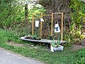 Plant stall - geograph.org.uk - 2381145.jpg 640 × 480; 378 KB
-
 Ploughed field opposite Knapp Farm - geograph.org.uk - 5158656.jpg 800 × 600; 158 KB
-

-
 River Arrow - geograph.org.uk - 4413574.jpg 800 × 533; 428 KB
-
 River Arrow - geograph.org.uk - 4423893.jpg 800 × 533; 407 KB
-
 River Arrow - geograph.org.uk - 4909834.jpg 2,048 × 1,536; 1 MB
-
 River Lugg - geograph.org.uk - 2010496.jpg 640 × 480; 162 KB
-
 River Lugg - geograph.org.uk - 388251.jpg 640 × 480; 135 KB
-
 River Lugg at Lugg Green, 1 - geograph.org.uk - 5632130.jpg 1,600 × 901; 692 KB
-
 River Lugg at Lugg Green, 2 - geograph.org.uk - 5632134.jpg 1,600 × 901; 718 KB
-
 Setting Super Moon - geograph.org.uk - 5677720.jpg 1,600 × 902; 582 KB
-
 Sheep pasture, Street - geograph.org.uk - 5210122.jpg 1,024 × 683; 267 KB
-
 Sheep, Aston - geograph.org.uk - 2459304.jpg 640 × 480; 293 KB
-
 Sheepfold on the Lugg meadows - geograph.org.uk - 585192.jpg 640 × 480; 124 KB
-
 Shirl Heath, aerial 2018 - geograph.org.uk - 5843737.jpg 800 × 533; 107 KB
-
 Sign at Kingsland Church of England Primary School - geograph.org.uk - 5689933.jpg 3,264 × 2,448; 1.67 MB
-
 Speed humps on the drive to Street Court - geograph.org.uk - 2581008.jpg 2,048 × 1,536; 2.19 MB
-
 St. Michael ^ All Angels Church (Kingsland) - geograph.org.uk - 6719927.jpg 4,032 × 3,024; 2.76 MB
-
 Stack of timber - geograph.org.uk - 5632158.jpg 1,600 × 901; 659 KB
-
 Stoneleigh (Viewed from Millennium Green ^ Kingsland) - geograph.org.uk - 5689974.jpg 3,264 × 2,448; 1.73 MB
-
 Stream, Cholstrey - geograph.org.uk - 4423845.jpg 800 × 533; 474 KB
-
 Street, aerial 2018 - geograph.org.uk - 5843724.jpg 800 × 469; 88 KB
-
 The B4360 Road (Kingsland) - geograph.org.uk - 5784326.jpg 1,920 × 1,080; 1,005 KB
-
 The green shoots of next year's crop - geograph.org.uk - 5158668.jpg 800 × 600; 174 KB
-
 The lane to Ledicot - geograph.org.uk - 2932130.jpg 4,752 × 3,168; 4.19 MB
-
 The Pinsley Brook - geograph.org.uk - 5631535.jpg 1,600 × 1,091; 856 KB
-
 The Pinsley Brook - geograph.org.uk - 6342266.jpg 3,323 × 2,209; 2.72 MB
-
 The Poor House (Kingsland) - geograph.org.uk - 5689909.jpg 3,264 × 2,448; 1.25 MB
-
 The rich pastures of the Lugg - geograph.org.uk - 801212.jpg 640 × 480; 72 KB
-
 Track near Club Hall - geograph.org.uk - 5158665.jpg 800 × 600; 176 KB
-
 Track to Lawton Bury Farm - geograph.org.uk - 3948509.jpg 4,320 × 3,240; 3.54 MB
-
 Track to Street Court - geograph.org.uk - 2581005.jpg 2,048 × 1,536; 1.5 MB
-
 Uncultivated headland - geograph.org.uk - 5632180.jpg 1,600 × 901; 741 KB
-
 Village scene, Kingsland - geograph.org.uk - 2555701.jpg 640 × 480; 155 KB
-
 Waterloo Crossing - geograph.org.uk - 6340740.jpg 3,370 × 2,178; 2.17 MB
-
 Waterloo Mill (Cobnash) - geograph.org.uk - 6493585.jpg 2,294 × 1,016; 904 KB
-
 Waterloo Mill, Cobnash - geograph.org.uk - 6340139.jpg 3,678 × 1,996; 1.47 MB


_-_geograph.org.uk_-_5689950.jpg)
_-_geograph.org.uk_-_5689952.jpg)


_-_geograph.org.uk_-_6694681.jpg)


_-_geograph.org.uk_-_5689870.jpg)


_-_geograph.org.uk_-_2381158.jpg)


_-_geograph.org.uk_-_5689959.jpg)


_-_geograph.org.uk_-_5689982.jpg)


_-_geograph.org.uk_-_5689854.jpg)


_-_geograph.org.uk_-_5689937.jpg)

_(geograph_5689967).jpg)
_-_geograph.org.uk_-_5689988.jpg)


_-_geograph.org.uk_-_6493561.jpg)
_-_geograph.org.uk_-_5784352.jpg)
_-_geograph.org.uk_-_5784358.jpg)
_-_geograph.org.uk_-_5796561.jpg)
_-_geograph.org.uk_-_6485641.jpg)
_-_geograph.org.uk_-_6485655.jpg)
_-_geograph.org.uk_-_6485663.jpg)
_-_geograph.org.uk_-_5689922.jpg)
_-_geograph.org.uk_-_5689925.jpg)
_-_geograph.org.uk_-_5689928.jpg)


.jpg)


_-_geograph.org.uk_-_5689878.jpg)


_-_geograph.org.uk_-_6719927.jpg)

_-_geograph.org.uk_-_5689974.jpg)


_-_geograph.org.uk_-_5784326.jpg)


_-_geograph.org.uk_-_5689909.jpg)


_-_geograph.org.uk_-_6493585.jpg)
