Category:Kingsdown, Dover
Jump to navigation
Jump to search
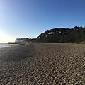
English: Kingsdown is a village immediately to the south of Walmer, itself south of Deal, on the English Channel coast of Kent. There is also a West Kingsdown in Kent. There is a butcher shop, a hairdresser, a newsagent and a post office on the main Upper Street. There is also a large expanse which used to be a scout camp, and a golf course.
Nederlands: Kingsdown is een plaats aan het kanaal in het bestuurlijke gebied Dover, in het Engelse graafschap Kent. De plaats telt 1964 inwoners.
village in Dover, Kent, England, UK | |||||
| Upload media | |||||
| Instance of | |||||
|---|---|---|---|---|---|
| Location | Ringwould with Kingsdown, Dover, Kent, South East England, England | ||||
 | |||||
Subcategories
This category has the following 2 subcategories, out of 2 total.
K
Z
- Zetland Arms, Kingsdown (4 F)
Media in category "Kingsdown, Dover"
The following 66 files are in this category, out of 66 total.
-
'Access Land' sign on cliff walk - geograph.org.uk - 1505495.jpg 640 × 480; 145 KB
-
A Terrible-Shipwreck 12th February 1870 at Kingsdown near Deal.jpg 482 × 380; 188 KB
-
A Terrible-Shipwreck 12th February 1870 at Kingsdown near Deal.png 482 × 380; 307 KB
-
Beach huts and boats, Kingsdown beach - geograph.org.uk - 1503480.jpg 640 × 467; 198 KB
-
Beach Huts at Kingsdown, Kent - geograph.org.uk - 680162.jpg 640 × 423; 80 KB
-
Beach huts on the seafront at Kingsdown - geograph.org.uk - 1097148.jpg 640 × 480; 202 KB
-
Beach near Kingsdown - geograph.org.uk - 489021.jpg 640 × 430; 61 KB
-
Campbells garage, Cliff Road - geograph.org.uk - 1097435.jpg 640 × 480; 133 KB
-
Church Cliff, northern end - geograph.org.uk - 1097399.jpg 640 × 480; 177 KB
-
Groyne near Kingsdown - geograph.org.uk - 2369934.jpg 3,072 × 2,304; 2.38 MB
-
Houses on South Road, Kingsdown - geograph.org.uk - 1097203.jpg 640 × 480; 197 KB
-
Kingsdown Beach (37962264094).jpg 1,510 × 2,014; 1.47 MB
-
Kingsdown Beach (38663203442).jpg 1,749 × 1,749; 1.18 MB
-
Kingsdown beach - geograph.org.uk - 1097198.jpg 640 × 480; 195 KB
-
Kingsdown beach - geograph.org.uk - 1189401.jpg 640 × 480; 99 KB
-
Kingsdown Beach - geograph.org.uk - 1408529.jpg 640 × 426; 131 KB
-
Kingsdown Beach.jpg 3,456 × 2,688; 9.47 MB
-
Kingsdown Leas - geograph.org.uk - 2727210.jpg 640 × 430; 112 KB
-
Kingsdown Park chalet village - geograph.org.uk - 1503462.jpg 640 × 480; 172 KB
-
Kingsdown Recreational Ground - geograph.org.uk - 2370050.jpg 3,072 × 2,304; 2.07 MB
-
Kingsdown Toilets - geograph.org.uk - 2380197.jpg 3,072 × 2,304; 3.36 MB
-
Kingsdown Village Hall - geograph.org.uk - 1503419.jpg 640 × 370; 186 KB
-
Kingsdown, the beach - panoramio.jpg 1,000 × 750; 298 KB
-
Looking S along shoreline, Kingsdown - geograph.org.uk - 1097165.jpg 640 × 480; 185 KB
-
Metal detectors near Kingsdown - geograph.org.uk - 2380175.jpg 3,072 × 2,304; 2.72 MB
-
National Cycle Network marker post - geograph.org.uk - 485540.jpg 480 × 640; 83 KB
-
Oldstairs Bay and white cliffs beyond - geograph.org.uk - 1503558.jpg 640 × 480; 144 KB
-
Path below the cliffs, Kingsdown - geograph.org.uk - 485416.jpg 640 × 480; 41 KB
-
Scene on Deal Beach February 13, 1870.jpg 646 × 417; 62 KB
-
Sea wall near Kingsdown - geograph.org.uk - 2369858.jpg 3,072 × 2,304; 2.01 MB
-
Summer Sea Shore Flora, Kingsdown - geograph.org.uk - 347092.jpg 640 × 480; 116 KB
-
Swedish Whitebeam, Kingsdown Kent - geograph.org.uk - 1503575.jpg 640 × 480; 226 KB
-
Terrace houses, Kingsdown - geograph.org.uk - 1408519.jpg 640 × 426; 94 KB
-
The cliff and beach near Kingsdown - geograph.org.uk - 348615.jpg 640 × 480; 153 KB
-
The King's Head pub, Kingsdown - geograph.org.uk - 1503413.jpg 640 × 471; 147 KB
-
The Rising Sun pub - geograph.org.uk - 1097418.jpg 640 × 480; 183 KB
-
The sea wall near Kingsdown - geograph.org.uk - 485464.jpg 640 × 480; 47 KB
-
Undercliffe Road, Kingsdown - geograph.org.uk - 2370012.jpg 3,072 × 2,304; 2.91 MB
-
Upper Street, Kingsdown - geograph.org.uk - 485190.jpg 640 × 480; 55 KB
-
View along Church Cliff - geograph.org.uk - 1097340.jpg 640 × 480; 203 KB
-
View of the sea, Kingsdown - geograph.org.uk - 1479522.jpg 640 × 426; 94 KB
-
View W along South Road, Kingsdown - geograph.org.uk - 1097185.jpg 640 × 480; 212 KB
-
Village newsagent and store, Kingsdown - geograph.org.uk - 1503448.jpg 640 × 480; 175 KB
-
Viper's Bugloss (Echium vulgare) - geograph.org.uk - 486060.jpg 480 × 640; 69 KB
-
Well Cottage, Kingsdown, Kent.jpg 697 × 986; 134 KB
-
Wellington Road on Kingsdown shore - geograph.org.uk - 1097264.jpg 640 × 480; 158 KB
-
Wing foiling Gear.jpg 3,610 × 2,031; 8.12 MB
-
Beach at Oldstairs Bay - geograph.org.uk - 1408522.jpg 640 × 426; 103 KB
-
Beach Flora - geograph.org.uk - 578746.jpg 640 × 480; 120 KB
-
Cottages near Kingsdown beach, Kent. - geograph.org.uk - 714888.jpg 423 × 640; 67 KB
-
Fishermens Cottages, Kingsdown - geograph.org.uk - 347131.jpg 480 × 640; 126 KB
-
Flint shingle on Kingsdown beach - geograph.org.uk - 236772.jpg 640 × 480; 75 KB
-
Looking N along Cliffe Road - geograph.org.uk - 485547.jpg 640 × 480; 71 KB
-
Looking SW along Oldstairs Road - geograph.org.uk - 485525.jpg 640 × 480; 71 KB
-
The beach at Oldstairs Bay - geograph.org.uk - 485520.jpg 640 × 480; 54 KB


