Category:Kings Norton
Jump to navigation
Jump to search
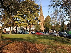
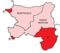
Kings Norton is an area in south Birmingham, England, anciently in the county of Worcestershire.
Main Wikipedia article: Kings Norton.
area of Birmingham, West Midlands, England, UK | |||||
| Upload media | |||||
| Instance of | |||||
|---|---|---|---|---|---|
| Location |
| ||||
| Different from | |||||
 | |||||
Subcategories
This category has the following 7 subcategories, out of 7 total.
Media in category "Kings Norton"
The following 68 files are in this category, out of 68 total.
-
133 Moneyhull Hall Road - geograph.org.uk - 1239788.jpg 640 × 389; 64 KB
-
A shopping precinct at Hawkesley - geograph.org.uk - 1374671.jpg 640 × 425; 88 KB
-
Bus, Redditch Road, Kings Norton.JPG 3,648 × 2,736; 3.54 MB
-
Camp Lane - geograph.org.uk - 1240912.jpg 595 × 640; 96 KB
-
Chalgrove Avenue, King's Norton - geograph.org.uk - 1139872.jpg 640 × 480; 198 KB
-
Crabmill Lane - geograph.org.uk - 175742.jpg 640 × 480; 324 KB
-
Equiniti offices, Kings Norton.JPG 3,648 × 2,736; 3.47 MB
-
Alf Farman.jpg 100 × 150; 2 KB
-
Front of bus, Pershore Road South, Kings Norton.JPG 2,736 × 3,648; 3.48 MB
-
Grass, Kings Norton Park.JPG 3,648 × 2,736; 3.61 MB
-
Henry Martin Pope - Nailor's Workshop King's Norton - 1908V135.jpg 3,658 × 2,653; 2.01 MB
-
Hobb's House, Kings Norton.JPG 3,648 × 2,736; 3.59 MB
-
King's Norton Park - geograph.org.uk - 1069465.jpg 640 × 480; 108 KB
-
King's Norton play area - geograph.org.uk - 1068056.jpg 640 × 480; 91 KB
-
King's Norton Police Station - geograph.org.uk - 175082.jpg 640 × 480; 316 KB
-
Kings Norton Business Centre.JPG 3,648 × 2,736; 3.59 MB
-
Kings Norton Church. - geograph.org.uk - 7376.jpg 640 × 480; 166 KB
-
Kings Norton Green.JPG 3,264 × 2,448; 3.12 MB
-
Kings Norton Park sign.JPG 2,736 × 3,648; 3.62 MB
-
Kings norton park.jpg 597 × 400; 90 KB
-
Kings Norton Primary School (32590377168).jpg 5,184 × 3,456; 5.56 MB
-
Kings Norton Royal British Legion Youth Marching Band 2006.jpg 640 × 480; 112 KB
-
KN&N Parish Map.jpg 378 × 336; 13 KB
-
KN&NUD Parish Map.jpg 319 × 420; 31 KB
-
Listed Tree? (geograph 2108396).jpg 3,648 × 2,736; 2.24 MB
-
Motor House and Stable Buildings at Primrose Hill, Birmingham.png 1,145 × 694; 1.3 MB
-
NEWM 4359 (15003935854).jpg 2,592 × 1,944; 2.69 MB
-
Play area in King's Norton Park - geograph.org.uk - 1069466.jpg 640 × 480; 115 KB
-
Rea Valley cycling route sign, Kings Norton.JPG 2,736 × 3,648; 3.52 MB
-
Rear of bus, Pershore Road South, Kings Norton.JPG 3,648 × 2,736; 3.52 MB
-
Redditch sign, A441, Kings Norton.JPG 3,648 × 2,736; 3.49 MB
-
River Rea flood weir - geograph.org.uk - 175077.jpg 640 × 480; 389 KB
-
Roundabout, A441, Kings Norton.JPG 3,648 × 2,736; 3.54 MB
-
Silver Street - geograph.org.uk - 175735.jpg 639 × 480; 205 KB
-
Staple Lodge Road - geograph.org.uk - 175045.jpg 640 × 480; 417 KB
-
Steps (46462744881).jpg 3,456 × 5,184; 5.02 MB
-
Street Atlas of Birmingham - 1939 - Sheet 24 - Kings Norton.jpg 1,000 × 773; 293 KB
-
The Green, Kings Norton 2.JPG 3,648 × 2,736; 3.57 MB
-
The Green, Kings Norton.JPG 3,648 × 2,736; 3.46 MB
-
The Navigation, King's Norton - geograph.org.uk - 175079.jpg 640 × 480; 299 KB
-
Wast Hills Tunnel north portal 65.jpg 6,000 × 4,000; 11.45 MB
-
Wast Hills Tunnel north portal 75.jpg 6,000 × 4,000; 11.46 MB
-
Wasthill Tunnel Northern portal - geograph.org.uk - 2544.jpg 640 × 480; 64 KB
-
Wychall Reservoir.jpg 2,560 × 1,920; 1.01 MB
-
Bay Tree Farm - geograph.org.uk - 175667.jpg 639 × 481; 242 KB
-
Bleakhouse Farm - geograph.org.uk - 154014.jpg 640 × 480; 300 KB
-
Crabtree Farm - geograph.org.uk - 175672.jpg 640 × 480; 301 KB
-
Daffs in Wythall - geograph.org.uk - 154024.jpg 640 × 480; 326 KB
-
Glenfield House - geograph.org.uk - 175743.jpg 640 × 480; 274 KB
-
Headley Technology Park - geograph.org.uk - 175738.jpg 640 × 480; 321 KB
-
Hobbis House, West Heath - geograph.org.uk - 151872.jpg 640 × 480; 268 KB
-
Houndsfield Lane, Drakes Cross - geograph.org.uk - 175737.jpg 640 × 480; 295 KB
-
King's Norton Cemetery - geograph.org.uk - 175670.jpg 640 × 480; 305 KB
-
Kingswood Unitarian Meeting House - geograph.org.uk - 175733.jpg 640 × 480; 392 KB
-
Recreation ground at Staple Lodge Road - geograph.org.uk - 175073.jpg 640 × 480; 274 KB
-
Riding stables - geograph.org.uk - 154067.jpg 640 × 480; 324 KB
-
View from Crabmill Lane - geograph.org.uk - 175741.jpg 640 × 480; 318 KB
-
View towards Walker's Heath - geograph.org.uk - 175740.jpg 639 × 479; 276 KB
-
Wythall road transport museum - geograph.org.uk - 154031.jpg 640 × 480; 315 KB
-
Wythall Royal British Legion - geograph.org.uk - 175736.jpg 639 × 477; 218 KB


