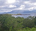
Category:Kilbrannan Sound
Jump to navigation
Jump to search
sound in between Kintyre and Arran, Argyll and Bute, Scotland, UK | |||||
| Upload media | |||||
| Instance of | |||||
|---|---|---|---|---|---|
| Location | Argyll and Bute, Scotland | ||||
| Tributary |
| ||||
 | |||||
Media in category "Kilbrannan Sound"
The following 43 files are in this category, out of 43 total.
-
Allt a Bhuic Meets the Sea. - geograph.org.uk - 348312.jpg 640 × 480; 106 KB
-
B842 near Grogport, Kintyre. - geograph.org.uk - 103848.jpg 640 × 480; 62 KB
-
B842 view over moorland - geograph.org.uk - 563833.jpg 640 × 480; 46 KB
-
Balliekine - geograph.org.uk - 1163247.jpg 640 × 428; 63 KB
-
Blackwaterfoot, Arran - geograph.org.uk - 816335.jpg 640 × 427; 173 KB
-
Brown Head, Arran - geograph.org.uk - 32561.jpg 640 × 480; 64 KB
-
Carradale Harbour - geograph.org.uk - 24015.jpg 640 × 480; 52 KB
-
Catacol Bay Hotel - geograph.org.uk - 16168.jpg 640 × 442; 81 KB
-
Cruise ship The World - geograph.org.uk - 58056.jpg 640 × 480; 102 KB
-
Fishing in Kilbrannan Sound - geograph.org.uk - 418909.jpg 640 × 434; 135 KB
-
Gormley Land Saddel Bay Arran.jpg 4,000 × 3,000; 4.42 MB
-
Kilbrannan Sound and Isle of Arran. - geograph.org.uk - 248932.jpg 640 × 480; 77 KB
-
Kilbrannan Sound. - geograph.org.uk - 180699.jpg 640 × 480; 108 KB
-
Kilbrannan Sound. - geograph.org.uk - 88817.jpg 640 × 480; 48 KB
-
Kilbrannon Sound - geograph.org.uk - 4271612.jpg 640 × 480; 26 KB
-
Ordnance Survey One-Inch Sheet 76 Kintyre, Published 1925.jpg 10,558 × 15,392; 14.21 MB
-
Pirnmill - looking south - geograph.org.uk - 1447186.jpg 640 × 479; 82 KB
-
Rocks south of Rubha Dearg-uillt - geograph.org.uk - 2559716.jpg 640 × 480; 83 KB
-
Rocks south of Rubha Dearg-uillt - geograph.org.uk - 2559724.jpg 640 × 480; 87 KB
-
Rocky headland of Rubha Dearg-uillt - geograph.org.uk - 2559755.jpg 640 × 480; 52 KB
-
Rocky shore north of Cour Bay - geograph.org.uk - 2559766.jpg 640 × 480; 90 KB
-
Rocky shore north of Cour Bay - geograph.org.uk - 2559771.jpg 640 × 480; 77 KB
-
Rocky shore north of Cour Bay - geograph.org.uk - 2559778.jpg 640 × 480; 87 KB
-
Ships on the Sound - geograph.org.uk - 3068097.jpg 640 × 478; 67 KB
-
Submarine and tender in Kilbrannan Sound - geograph.org.uk - 3761401.jpg 1,600 × 1,205; 232 KB
-
The north side of Eilean Grianain - geograph.org.uk - 2559681.jpg 640 × 480; 70 KB
-
The Otterard Rock east cardinal buoy - geograph.org.uk - 3095039.jpg 640 × 445; 61 KB
-
This is it^ - geograph.org.uk - 2070658.jpg 3,404 × 2,416; 2.55 MB
-
Thundergay View - geograph.org.uk - 5562105.jpg 640 × 407; 89 KB
-
Towards Beinn Bharrain - geograph.org.uk - 5562086.jpg 640 × 375; 83 KB
-
Whitefarland View - geograph.org.uk - 5574392.jpg 640 × 404; 101 KB
-
Island Ross. - geograph.org.uk - 347332.jpg 640 × 480; 44 KB


