Category:Khmer-language maps
Jump to navigation
Jump to search
Subcategories
This category has only the following subcategory.
K
Media in category "Khmer-language maps"
The following 24 files are in this category, out of 24 total.
-
Bagmati districts km.png 1,056 × 816; 2.47 MB
-
Bases along the Cambodian Vietnamese border 1970 km.svg 714 × 562; 203 KB
-
Burma (Myanmar) in 1530 km.png 474 × 939; 139 KB
-
Caledonides Km.jpg 2,625 × 1,755; 1.4 MB
-
Caledonides KM.png 2,625 × 1,755; 17.6 MB
-
Caledonides KM.svg 512 × 342; 47 KB
-
Cambodia anti-PRK border camps km.png 3,005 × 2,370; 948 KB
-
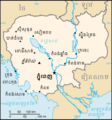
Cambodia sm04 km.png 330 × 355; 10 KB
-
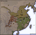
China 5 km.jpg 560 × 550; 98 KB
-
Chroy Chongvar Section Map.png 673 × 681; 46 KB
-
Europe countries map km 2.png 1,475 × 1,200; 451 KB
-
Europe countries map km.png 1,475 × 1,200; 292 KB
-
French Empire 1919-1939 km.png 998 × 524; 102 KB
-
Hercynides Km.jpg 2,292 × 1,543; 835 KB
-
Latitude and Longitude of the Earth-kn.svg 652 × 340; 40 KB
-
Map of Angkor Thom(Khmer).png 1,000 × 800; 120 KB
-
Map of Phnom Penh.png 1,300 × 1,596; 724 KB
-
Map-of-southeast-asia 1400 CE km.PNG 791 × 1,114; 291 KB
-
Map-of-southeast-asia 900 CE km.PNG 791 × 1,114; 244 KB
-
Mean Chey District Map.jpg 707 × 500; 137 KB
-
Political World Map - Khmer.jpg 16,008 × 8,944; 3.82 MB
-
Toungoo campaigns (1534–1547) km.png 750 × 752; 101 KB
-
Toungoo campaigns (1550–1565) km.png 545 × 939; 137 KB
-
Zones of Democratic Khmer.png 1,800 × 1,479; 555 KB


