Category:Khammam district

From Wikimedia Commons, the free media repository
Jump to navigation Jump to search

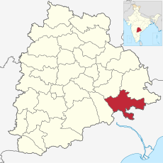
Khammam (Telugu: ఖమ్మం జిల్లా, Urdu: کھمم ضلع, Hindi: खम्मम ज़िला) is a district in Telangana state of India. It is named after its district headquarters Khammam town. The present name of Khammam is said to have been derived from the name of the temple 'Narsimhadri', later 'Stamba Sikhari' and then it was termed as 'Stambhadri'. The district shares boundaries with Suryapet, Mahabubabad, Bhadradri districts and with Andhra pradesh state.The river Godavari enters Khammam from Warangal district and flows nearly 250 km across the district.. 17°25′0″N 80°15′0″E / 17.41667°N 80.25°E / 17.41667; 80.25

<nowiki>Khammam; ખમ્મમ જિલ્લો; Khammam barrutia; Khammam; Districte de Khammam; Khammam; Khammam; ناحیه خمام; 坎曼縣; Khammam; ضلع کھمم; کھمم ضلع; خامام; खम्मम् मण्डलम्; खम्मम जिला; ఖమ్మం జిల్లా; ਖੰਮਮ ਜ਼ਿਲਾ; Khammam district; கம்மம் மாவட்டம்; distretto di Khammam; খম্মম জেলা; Khammam; खम्मम जिल्हा; Khammamin piirikunta; Khammam; Khammam; კჰამამი; Кхаммам; खम्मम् जिल्ला; Khammam; खम्मम जिला; Khammam; ഖമ്മം ജില്ല; Khammam; Khammam; Khammam; Khammam district; ଖମ୍ମମ ଜିଲ୍ଲା; カンマン県; ಖಮ್ಮಮ್ ಜಿಲ್ಲೆ; खम्मम जिल्ला; Khammam district; Khammam district; 坎曼县; ᱠᱷᱚᱢᱢᱚᱢ ᱦᱚᱱᱚᱛ; distretto dell'India; তেলেঙ্গানা রাজ্যের একটি জেলা; district de l'État indien du Telangana; distritu de la India; districte de Telangana, Índia; भारताच्या आंध्र प्रदेश राज्यातील एक जिल्हा.; Distrikt des indischen Bundesstaates Andhra Pradesh; ତେଲେଙ୍ଗାନାର ଜିଲ୍ଲା, ଭାରତ; شهرستانی در کشور هند; भारतको एक जिल्ला हो; округ в штате Телангана, Индия; ತೆಲೆಂಗಾಣ ರಾಜ್ಯದ ಜಿಲ್ಲೆ; തെലങ്കാനയിലെ ജില്ല; distrikt; తెలంగాణా రాష్ట్రానికి చెందిన జిల్లా; distrikt i India; district in India; तेलंगणराष्ट्रे एक: मण्डल:; आंध्र प्रदेश का जिला; ᱛᱮᱞᱮᱸᱜᱟᱱᱟ ᱨᱮᱱᱟᱜ ᱦᱚᱱᱚᱛ, ᱥᱤᱧᱚᱛ; distrito del estado de Andhra Pradesh, India; district of Telangana, India; distrito; 位于印度安得拉邦的县; தெலுங்கானாவில் உள்ள மாவட்டம்; distritu de Khammam; Khammam (distritu)</nowiki>
Khammam district 
district of Telangana, India
Upload media
Instance of
Location
Capital
Population
  • 2,797,370 (2011)
Area
  • 4,360 km²
Different from
official website
Map17° 00′ 25″ N, 81° 00′ 15″ E
Authority file
Wikidata Q15371
VIAF ID: 133791463
Library of Congress authority ID: n88000631
J9U ID: 987007564954205171
OpenStreetMap relation ID: 2022134
Edit infobox data on Wikidata

Subcategories

This category has the following 7 subcategories, out of 7 total.