Category:Keig, Aberdeenshire
Jump to navigation
Jump to search
English: Keig is a village within the local government area of Aberdeenshire Council in the North East of Scotland and is located within the Marr area of Aberdeenshire.
village in Aberdeenshire, Scotland, UK  | |||||
| Upload media | |||||
| Instance of | |||||
|---|---|---|---|---|---|
| Location |
| ||||
 | |||||
Media in category "Keig, Aberdeenshire"
The following 50 files are in this category, out of 50 total.
-
 A farm building at Old Keig - geograph.org.uk - 887486.jpg 640 × 465; 101 KB
-
 A house and stables - geograph.org.uk - 887553.jpg 640 × 436; 48 KB
-

-
 A Wetherby steading - geograph.org.uk - 887395.jpg 640 × 480; 69 KB
-
 Access to Pittendreigh - geograph.org.uk - 887439.jpg 640 × 480; 102 KB
-
 An older-looking part of Old Keig - geograph.org.uk - 887491.jpg 640 × 480; 83 KB
-
 Approach to Old Keig - geograph.org.uk - 887471.jpg 640 × 480; 68 KB
-
 Approach to Old Keig - geograph.org.uk - 887494.jpg 640 × 480; 50 KB
-
 Belfry of Keig Church - geograph.org.uk - 887414.jpg 480 × 640; 49 KB
-
 Bend in road - geograph.org.uk - 1046321.jpg 640 × 467; 81 KB
-
 Cairn Within the Barmkyn of Keig - geograph.org.uk - 1117119.jpg 640 × 480; 131 KB
-
 Cothiemuir stone circle - geograph.org.uk - 74029.jpg 640 × 424; 108 KB
-
 Driveway to Pittendreigh - geograph.org.uk - 887418.jpg 640 × 480; 106 KB
-
 Entrance to Keig cemetery - geograph.org.uk - 887435.jpg 640 × 527; 72 KB
-
 Entrance to Keig House - geograph.org.uk - 887438.jpg 640 × 480; 102 KB
-
 Entrance to Wood of North Keig - geograph.org.uk - 1117149.jpg 640 × 480; 84 KB
-
 Gate to the walled garden - geograph.org.uk - 887454.jpg 640 × 480; 118 KB
-
 Junction for 'The Lord's Throat' - geograph.org.uk - 1046306.jpg 640 × 450; 75 KB
-
 Keig cemetery wall - geograph.org.uk - 887405.jpg 640 × 487; 102 KB
-
 Keig Church - geograph.org.uk - 887424.jpg 640 × 480; 73 KB
-
 Keig Church and War Memorial - geograph.org.uk - 887451.jpg 640 × 448; 70 KB
-
 Keig churchyard - geograph.org.uk - 887428.jpg 480 × 640; 75 KB
-
 Keig Crossroads - geograph.org.uk - 887361.jpg 640 × 480; 74 KB
-
 Keig House - geograph.org.uk - 887370.jpg 640 × 480; 104 KB
-
 Keig School - geograph.org.uk - 258582.jpg 640 × 356; 62 KB
-
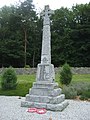 Keig War Memorial - geograph.org.uk - 887410.jpg 480 × 640; 97 KB
-
 KeigChurch.jpg 640 × 426; 54 KB
-
 Memorial to a victim of war - geograph.org.uk - 887404.jpg 269 × 640; 73 KB
-
 Mill of Keig - geograph.org.uk - 1046315.jpg 640 × 480; 88 KB
-
 North Keig - geograph.org.uk - 887512.jpg 640 × 480; 50 KB
-
 North Keig cottage - geograph.org.uk - 977485.jpg 640 × 480; 73 KB
-
 North Keig farmhouse - geograph.org.uk - 887514.jpg 640 × 480; 74 KB
-
 Old Keig farm - geograph.org.uk - 887489.jpg 640 × 439; 60 KB
-
 Old Keig plantation - geograph.org.uk - 977447.jpg 640 × 455; 86 KB
-
 Old Keig steadings - geograph.org.uk - 887488.jpg 640 × 470; 62 KB
-
 Ornamental gate, Keig Church - geograph.org.uk - 887407.jpg 640 × 480; 112 KB
-
 Perimeter Wall, Barmkyn of Keig - geograph.org.uk - 1117136.jpg 640 × 480; 133 KB
-
 Pittendreigh farm - geograph.org.uk - 887425.jpg 640 × 506; 83 KB
-
 Pittendreigh farmhouse - geograph.org.uk - 887420.jpg 640 × 480; 81 KB
-
 Putachie Cottage - geograph.org.uk - 1046333.jpg 640 × 480; 84 KB
-
 Road through Cothiemuir Wood - geograph.org.uk - 1046344.jpg 640 × 480; 121 KB
-
 Sign for Old Keig - geograph.org.uk - 887485.jpg 640 × 480; 125 KB
-
 Site of Old Keig stone circle - geograph.org.uk - 887498.jpg 640 × 480; 52 KB
-
 Smiddy Cottage, Keig - geograph.org.uk - 887365.jpg 640 × 480; 74 KB
-
 The grounds of Keig House - geograph.org.uk - 887392.jpg 640 × 463; 102 KB
-
 Track to a plantation near Old Keig. - geograph.org.uk - 887483.jpg 640 × 480; 79 KB
-
 Track to New Keig - geograph.org.uk - 977465.jpg 640 × 440; 64 KB
-
 View towards Keig - geograph.org.uk - 887466.jpg 640 × 480; 76 KB
-
 View towards the River Don at Keig - geograph.org.uk - 887463.jpg 640 × 480; 56 KB
-
 Wall and Cairn, Barmkyn of Keig - geograph.org.uk - 1117124.jpg 640 × 480; 119 KB


