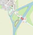
Category:Keersluis (Munnekezijl)
Jump to navigation
Jump to search
| Object location | | View all coordinates using: OpenStreetMap |
|---|
bridge in Netherlands | |||||
| Upload media | |||||
| Instance of | |||||
|---|---|---|---|---|---|
| Location | Munnekezijl, Noardeast-Fryslân, Friesland, Netherlands | ||||
| Heritage designation |
| ||||
 | |||||
Nederlands: Brug met Keersluis
|
This is a category about rijksmonument number 512870
|
| Address |
|
Media in category "Keersluis (Munnekezijl)"
The following 11 files are in this category, out of 11 total.
-
De keersluis van Munnekezijl 1.jpg 1,732 × 2,307; 1.93 MB
-
De keersluis van Munnekezijl 2.jpg 2,307 × 1,732; 2.22 MB
-
De keersluis van Munnekezijl 3.jpg 2,308 × 1,733; 1.51 MB
-
Exterieur OVERZICHT SLUIS (1881) - Munnekezijl - 20277306 - RCE.jpg 3,054 × 3,072; 3.79 MB
-
Exterieur OVERZICHT SLUIS - Munnekezijl - 20277307 - RCE.jpg 3,054 × 3,090; 3.28 MB
-
Exterieur OVERZICHT SLUIS - Munnekezijl - 20277309 - RCE.jpg 3,072 × 3,066; 3.87 MB
-
Exterieur OVERZICHT SPUISLUIS, BOVENAANZICHT - Munnekezijl - 20277308 - RCE.jpg 3,060 × 3,054; 3.59 MB
-
Exterieur OVERZICHT SPUISLUIS, BOVENAANZICHT - Munnekezijl - 20277310 - RCE.jpg 3,066 × 3,078; 3.74 MB
-
Munnekezijl De Schans keersluis.png 581 × 611; 178 KB
-
Muntsjesyl.JPG 3,264 × 2,448; 3.62 MB


