Category:Kasteel Het Nijenhuis
Jump to navigation
Jump to search
| Object location | | View all coordinates using: OpenStreetMap |
|---|
bridge in Netherlands | |||||
| Upload media | |||||
| Instance of | |||||
|---|---|---|---|---|---|
| Part of | |||||
| Location | Wijhe, Olst-Wijhe, Overijssel, Netherlands | ||||
| Street address |
| ||||
| Heritage designation |
| ||||
 | |||||
|
This is a category about rijksmonumentcomplex number 492353
|
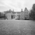
Hoofdgebouw:
|
This is a category about rijksmonument number 492703
|
Historische parkaanleg:
|
This is a category about rijksmonument number 492704
|
Westelijke bouwhuis:
|
This is a category about rijksmonument number 492706
|
Oostelijk bouwhuis:
|
This is a category about rijksmonument number 492707
|
Hoofdinrijhek:
|
This is a category about rijksmonument number 492708
|
Toegangsbrug met keermuur:
|
This is a category about rijksmonument number 492709
|
Brug over buitengracht:
|
This is a category about rijksmonument number 492710
|
Brug met keermuur bij erf van het westelijk bouwhuis:
|
This is a category about rijksmonument number 492711
|
Brug naar voormalige oostelijke nutstuin:
|
This is a category about rijksmonument number 492712
|
Twee pijlers aan de zuidzijde van het oostelijk bouwhuis:
|
This is a category about rijksmonument number 492713
|
Twee pijlers aan de zuidzijde van het westelijk bouwhuis:
|
This is a category about rijksmonument number 492714
|
Portierswoning:
|
This is a category about rijksmonument number 492715
|
Schuur:
|
This is a category about rijksmonument number 492716
|
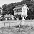
Duiventil:
|
This is a category about rijksmonument number 492717
|
Pijlers met brug:
|
This is a category about rijksmonument number 492718
|
volière:
|
This is a category about rijksmonument number 492719
|
Tuinhuis:
|
This is a category about rijksmonument number 492720
|
Dubbele dienstwoning:
|
This is a category about rijksmonument number 492721
|
Stal:
|
This is a category about rijksmonument number 492722
|
Dienstwoning:
|
This is a category about rijksmonument number 492723
|
Bakhuisje:
|
This is a category about rijksmonument number 492724
|
Moestuinmuur:
|
This is a category about rijksmonument number 492725
|
| Address |
|
Subcategories
This category has the following 2 subcategories, out of 2 total.
Media in category "Kasteel Het Nijenhuis"
The following 110 files are in this category, out of 110 total.
-
20150716 Duiventil Het Nijenhuis.jpg 4,768 × 3,576; 1.25 MB
-
20150716 Het Nijenhuis achterzijde.jpg 4,774 × 3,581; 1.66 MB
-
20150716 Het Nijenhuis1.jpg 4,896 × 3,672; 1.67 MB
-
20150716 Het Nijenhuis2.jpg 4,789 × 3,592; 1.85 MB
-
20150716 Het Nijenhuis3.jpg 4,766 × 3,575; 1.59 MB
-
8131 Wijhe, Netherlands - panoramio (1).jpg 1,375 × 2,048; 851 KB
-
8131 Wijhe, Netherlands - panoramio (10).jpg 1,375 × 2,048; 680 KB
-
8131 Wijhe, Netherlands - panoramio (11).jpg 2,048 × 1,375; 1.04 MB
-
8131 Wijhe, Netherlands - panoramio (12).jpg 2,048 × 1,375; 738 KB
-
8131 Wijhe, Netherlands - panoramio (13).jpg 2,048 × 1,375; 586 KB
-
8131 Wijhe, Netherlands - panoramio (14).jpg 2,048 × 1,375; 710 KB
-
8131 Wijhe, Netherlands - panoramio (15).jpg 2,048 × 1,375; 622 KB
-
8131 Wijhe, Netherlands - panoramio (16).jpg 1,375 × 2,048; 792 KB
-
8131 Wijhe, Netherlands - panoramio (17).jpg 2,048 × 1,375; 522 KB
-
8131 Wijhe, Netherlands - panoramio (18).jpg 2,048 × 1,375; 737 KB
-
8131 Wijhe, Netherlands - panoramio (19).jpg 2,048 × 1,375; 674 KB
-
8131 Wijhe, Netherlands - panoramio (2).jpg 2,048 × 1,375; 985 KB
-
8131 Wijhe, Netherlands - panoramio (20).jpg 2,048 × 1,375; 586 KB
-
8131 Wijhe, Netherlands - panoramio (21).jpg 1,375 × 2,048; 662 KB
-
8131 Wijhe, Netherlands - panoramio (22).jpg 2,048 × 1,375; 902 KB
-
8131 Wijhe, Netherlands - panoramio (23).jpg 2,048 × 1,375; 688 KB
-
8131 Wijhe, Netherlands - panoramio (24).jpg 1,375 × 2,048; 1.03 MB
-
8131 Wijhe, Netherlands - panoramio (25).jpg 2,048 × 1,375; 802 KB
-
8131 Wijhe, Netherlands - panoramio (26).jpg 2,048 × 1,375; 449 KB
-
8131 Wijhe, Netherlands - panoramio (27).jpg 1,375 × 2,048; 718 KB
-
8131 Wijhe, Netherlands - panoramio (28).jpg 2,048 × 1,375; 775 KB
-
8131 Wijhe, Netherlands - panoramio (29).jpg 1,375 × 2,048; 711 KB
-
8131 Wijhe, Netherlands - panoramio (3).jpg 2,048 × 1,375; 818 KB
-
8131 Wijhe, Netherlands - panoramio (30).jpg 2,048 × 1,375; 677 KB
-
8131 Wijhe, Netherlands - panoramio (31).jpg 2,048 × 1,375; 635 KB
-
8131 Wijhe, Netherlands - panoramio (34).jpg 4,896 × 3,264; 6.81 MB
-
8131 Wijhe, Netherlands - panoramio (35).jpg 4,896 × 3,264; 6.49 MB
-
8131 Wijhe, Netherlands - panoramio (36).jpg 4,896 × 3,264; 6.57 MB
-
8131 Wijhe, Netherlands - panoramio (37).jpg 4,896 × 3,264; 5.12 MB
-
8131 Wijhe, Netherlands - panoramio (38).jpg 4,896 × 3,264; 6.03 MB
-
8131 Wijhe, Netherlands - panoramio (39).jpg 4,896 × 3,264; 6.72 MB
-
8131 Wijhe, Netherlands - panoramio (4).jpg 2,048 × 1,375; 807 KB
-
8131 Wijhe, Netherlands - panoramio (40).jpg 4,896 × 3,264; 6.27 MB
-
8131 Wijhe, Netherlands - panoramio (41).jpg 4,896 × 3,264; 6.51 MB
-
8131 Wijhe, Netherlands - panoramio (42).jpg 4,896 × 3,264; 3.98 MB
-
8131 Wijhe, Netherlands - panoramio (43).jpg 4,896 × 3,264; 6.67 MB
-
8131 Wijhe, Netherlands - panoramio (5).jpg 2,048 × 1,375; 749 KB
-
8131 Wijhe, Netherlands - panoramio (6).jpg 2,048 × 1,375; 792 KB
-
8131 Wijhe, Netherlands - panoramio (7).jpg 1,375 × 2,048; 610 KB
-
8131 Wijhe, Netherlands - panoramio (8).jpg 2,048 × 1,375; 689 KB
-
8131 Wijhe, Netherlands - panoramio (9).jpg 2,048 × 1,375; 664 KB
-
8131 Wijhe, Netherlands - panoramio.jpg 2,048 × 1,375; 717 KB
-
Achtergevel - Wijhe - 20212588 - RCE.jpg 3,054 × 3,054; 2.47 MB
-
Achtergevel - Wijhe - 20212589 - RCE.jpg 3,066 × 3,066; 2.54 MB
-
Achtergevel en linker zijgevel en gracht - Heino - 20256257 - RCE.jpg 2,849 × 3,824; 1.54 MB
-
Dirk Hannema, oud directeur Museum Boymans, in Kasteel Nijenhuis in Heino, 1963.jpg 3,505 × 2,329; 1.07 MB
-
Draagkracht, Eilse van der Linden 2021.jpg 616 × 960; 90 KB
-
Duiventil - Wijhe - 20256269 - RCE.jpg 3,072 × 3,077; 2.94 MB
-
Duiventil - Wijhe - 20256270 - RCE.jpg 3,054 × 3,066; 3.34 MB
-
Duiventil - Wijhe - 20256271 - RCE.jpg 3,048 × 3,072; 3.83 MB
-
Exterieur - Wijhe - 20256268 - RCE.jpg 3,300 × 2,220; 2.5 MB
-
Exterieur met oost-gevel - Wijhe - 20256229 - RCE.jpg 2,637 × 2,107; 2.38 MB
-
Exterieur naar het zuid-westen - Wijhe - 20256228 - RCE.jpg 2,785 × 2,231; 2.85 MB
-
Exterieur voorzijde - Wijhe - 20256233 - RCE.jpg 2,646 × 2,104; 2.29 MB
-
Exterieur voorzijde - Wijhe - 20256234 - RCE.jpg 2,634 × 2,080; 2.49 MB
-
Exterieur voorzijde - Wijhe - 20256235 - RCE.jpg 2,670 × 2,093; 2.69 MB
-
Exterieur voorzijde - Wijhe - 20256236 - RCE.jpg 2,640 × 2,110; 2.39 MB
-
Exterieur zuid-gevel - Wijhe - 20256230 - RCE.jpg 2,645 × 2,097; 2.35 MB
-
Grote salon - Wijhe - 20256231 - RCE.jpg 2,123 × 2,634; 2.02 MB
-
Interieur grote salon - Wijhe - 20256237 - RCE.jpg 2,116 × 2,676; 1.32 MB
-
Interieur kamer 1e etage - Wijhe - 20256241 - RCE.jpg 2,094 × 2,646; 1.22 MB
-
Interieur kamer 3 - Wijhe - 20256246 - RCE.jpg 2,123 × 2,652; 1.37 MB
-
Interieur kamer nummer 5 - Wijhe - 20256248 - RCE.jpg 2,122 × 2,634; 1.33 MB
-
Interieur salon nummer 4 - Wijhe - 20256247 - RCE.jpg 2,664 × 2,122; 1.56 MB
-
Interieur trappenhuis - Heino - 20256261 - RCE.jpg 3,824 × 2,849; 1.92 MB
-
Interieur van de hal - Wijhe - 20256239 - RCE.jpg 2,116 × 2,652; 1.28 MB
-
Interieur van de hal - Wijhe - 20256240 - RCE.jpg 2,093 × 2,628; 1.29 MB
-
Interieur, gang - Heino - 20256262 - RCE.jpg 3,824 × 2,849; 1.85 MB
-
Interieur, stucwerkplafond met schilderstuk - Wijhe - 20351345 - RCE.jpg 3,020 × 3,020; 4.02 MB
-
Interieur,salon - Heino - 20256258 - RCE.jpg 3,824 × 2,849; 2.49 MB
-
Kasteel, reproductie foto - Wijhe - 20256253 - RCE.jpg 2,410 × 3,048; 1.99 MB
-
Linker zijgevel - Wijhe - 20212591 - RCE.jpg 3,066 × 3,065; 4.53 MB
-
Linker zijgevel, achtergevel en gracht - Heino - 20256264 - RCE.jpg 3,824 × 2,849; 3.54 MB
-
Nijenhuis brug.jpg 2,148 × 1,476; 453 KB
-
Nijenhuis-- Hoofdinrijhek en Portierswoning (Wijhe).jpg 4,896 × 3,264; 6.36 MB
-
Nijenhuis-- Portierswoning (Wijhe).jpg 4,896 × 3,264; 6.65 MB
-
Nijenhuis.jpg 2,086 × 1,415; 500 KB
-
Overzicht - Wijhe - 20256254 - RCE.jpg 3,110 × 3,070; 1.57 MB
-
Overzicht - Wijhe - 20256255 - RCE.jpg 3,110 × 3,077; 1.49 MB
-
Overzicht - Wijhe - 20256256 - RCE.jpg 3,110 × 3,047; 1.6 MB
-
Overzicht kasteeltuin langs het Grand Canal met beeld - Wijhe - 20351346 - RCE.jpg 3,007 × 3,038; 2.87 MB
-
Overzicht met toegangshek - Heino - 20256259 - RCE.jpg 3,824 × 2,849; 2.32 MB
-
Overzicht voorgevel met toegangsbrug en hoektoren - Wijhe - 20351343 - RCE.jpg 2,996 × 2,996; 2.4 MB
-
Overzicht voorgevel met toegangsbrug en hoektoren - Wijhe - 20351344 - RCE.jpg 2,990 × 3,032; 2.36 MB
-
Plafond in kamer nummer 1 - Wijhe - 20256245 - RCE.jpg 2,670 × 2,124; 1.38 MB
-
Plafond in kamer nummer 9 - Wijhe - 20256252 - RCE.jpg 2,116 × 2,676; 1.19 MB
-
Portiershuisje op de achtergrond.jpg 1,024 × 768; 228 KB
-
Rechter zijgevel - Wijhe - 20212592 - RCE.jpg 3,072 × 3,054; 2.43 MB
-
Rechtervleugel - Heino - 20256265 - RCE.jpg 2,849 × 3,824; 2.49 MB
-
Schouw - Wijhe - 20256232 - RCE.jpg 2,104 × 2,639; 1.31 MB
-
Schouw in grote salon - Wijhe - 20256238 - RCE.jpg 2,118 × 2,676; 1.3 MB
-
Schouw in kamer nummer 1 - Wijhe - 20256243 - RCE.jpg 2,134 × 2,652; 1.32 MB
-
Schouw in kamer nummer 1 - Wijhe - 20256244 - RCE.jpg 2,117 × 2,688; 1.32 MB
-
Schouw in kamer nummer 8 - Wijhe - 20256251 - RCE.jpg 2,122 × 2,646; 1.41 MB
-
Stucplafond kamer nummer 5 - Wijhe - 20256249 - RCE.jpg 2,104 × 2,658; 1.34 MB
-
Stucplafond kamer nummer 5 - Wijhe - 20256250 - RCE.jpg 2,105 × 2,664; 1.42 MB
-
Toegangshek 't Nijenhuis.JPG 2,958 × 1,922; 4.85 MB
-
Toegangshek en tuinvazen - Heino - 20256260 - RCE.jpg 3,824 × 2,849; 3.18 MB
-
Voorgevel - Wijhe - 20212587 - RCE.jpg 3,054 × 3,072; 2.74 MB
-
Voorgevel - Wijhe - 20212590 - RCE.jpg 3,030 × 3,042; 2.44 MB
-
Voorgevel met ophaalbrug, linker zijgevel en gracht - Heino - 20256266 - RCE.jpg 3,824 × 2,849; 2.25 MB
-
Voorgevel toestand vóór 1958 - Wijhe - 20256267 - RCE.jpg 3,296 × 2,228; 1.49 MB
-
Voorgevel, ingangspartij - Heino - 20256263 - RCE.jpg 2,849 × 3,824; 1.85 MB


