Category:Kartographer extension
Jump to navigation
Jump to search
MediaWiki extension | |||||
| Upload media | |||||
| Instance of | |||||
|---|---|---|---|---|---|
| Copyright license | |||||
| |||||
Media in category "Kartographer extension"
The following 49 files are in this category, out of 49 total.
-
Beispielvideo einfache Kartographerkarten mit dem VisualEditor erstellen.webm 3 min 9 s, 1,998 × 1,018; 85.12 MB
-
Beispielvideo Kartographerkarten mit Geoline über Wikidata in Wikitext 01.webm 6 min 1 s, 1,280 × 718; 98.41 MB
-
Beispielvideo komplexe Kartographerkarten erstellen mit VisualEditor und Wikitext.webm 7 min 28 s, 1,918 × 978; 441.01 MB
-
Cartes interactives - Wikipédia + OSM = ❤.pdf 1,500 × 843, 22 pages; 3.9 MB
-
Discovery FY2015-16 Q4 review.pdf 1,500 × 843, 16 pages; 1.37 MB
-
Discovery FY2016-17 Q1 review.pdf 1,500 × 843, 14 pages; 1.35 MB
-
Enlightening talk - OSM and Wikidata 003.jpg 4,608 × 2,592; 3.88 MB
-
Interaktive Karten mit Kartographer – Technische Wünsche Folien Wikicon 2021.pdf 3,000 × 1,687, 31 pages; 7.43 MB
-
Kartensaison Teaser.gif 1,032 × 734; 76.45 MB
-
Kartensaison Teaser.webm 22 s, 1,032 × 734; 6.75 MB
-
Kartographer Explore nearby destinations wih clusters.png 1,952 × 1,312; 2.24 MB
-
Kartographer map in an article with pending review (dummy content).png 608 × 782; 110 KB
-
Kartographer map in stable version of an article (dummy content).png 450 × 644; 251 KB
-
Kartographer mapframe example.png 505 × 392; 308 KB
-
Kartographer screenshot for WikiDaheim.png 1,467 × 284; 248 KB
-
Kartographer Show nearby articles wih clusters.png 1,952 × 1,312; 2.34 MB
-
Maki icons 7.2.png 954 × 998; 356 KB
-
Mapframe Kartographer demo.webm 24 s, 1,020 × 766; 2.5 MB
-
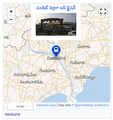
Mapframe usage example on telugu wikipedia.png 496 × 528; 235 KB
-
Maplink Kartographer demo.webm 21 s, 1,022 × 764; 2.13 MB
-
OsmVsWikimedia-wikiconv.pdf 1,654 × 1,239, 22 pages; 1.08 MB
-
Screenshot mapframe in article and full size.png 2,560 × 1,392; 1.71 MB
-
Screenshot of a map with color highlighting and a legend.png 914 × 908; 653 KB
-
Screenshot of Map Downtown Abbey filming locations 01.png 632 × 880; 324 KB
-
Screenshot of Map List of wildlife sanctuaries of India.png 1,476 × 1,314; 859 KB
-
Screenshot of map with colored geoshape.png 564 × 624; 365 KB
-
Screenshot of map with geoshape of monument MET.png 570 × 412; 322 KB
-
Screenshot of map with geoshape of monument 吉隆坡国际机场.png 834 × 880; 293 KB
-
Screenshot of map with geoshape.png 642 × 762; 250 KB
-
Screenshot of map with mask layer Salzburg.png 638 × 682; 284 KB
-
Screenshot of map with route aircraft route.png 526 × 410; 161 KB
-
Screenshot of map with route Route 66.png 658 × 458; 167 KB
-
Screenshot of map with several automatic counters.png 740 × 784; 253 KB
-
Screenshot of Map 解放路 (杭州).png 740 × 422; 134 KB
-
Screenshot of maplink Strasbourg.png 446 × 62; 12 KB
-
Screenshot of population map Occitanie.png 1,388 × 800; 787 KB
-
Screenshot of simple map Gardiners Island.png 704 × 622; 129 KB
-
Screenshot of simple map Սադնլար.png 938 × 734; 164 KB
-
Screenshot of species map (work in progress).png 474 × 486; 127 KB
-
Screenshot of species map.png 512 × 530; 183 KB
-
Screenshot of subway network Kuala Lumpur.png 886 × 1,386; 1.34 MB
-
Screenshot of subway network Tokyo.png 1,130 × 1,316; 1.62 MB
-
Simple Kartographer map with marker.png 532 × 540; 201 KB
-
Tools & extensions.pdf 1,500 × 1,125, 32 pages; 2.46 MB
-
WikiConference North America 2016 - Be bold and edit the map (with notes).pdf 2,095 × 1,562, 32 pages; 7.63 MB
-
Wikimania 2022 - Can We Interest You in Trying Something New Together.webm 28 min 50 s, 1,920 × 1,080; 383.32 MB
-
Wikimedia Creative Commons May 2016 speaker8.webm 7 min 45 s, 640 × 360; 19.31 MB
-
Wikipedia maps presentation - -sotmus 2016.pdf 1,500 × 843, 13 pages; 3.33 MB
-
WikiWeekendTirana2016 Presentation Maps in Articles.pdf 2,133 × 1,600, 13 pages; 3.56 MB


