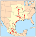
Category:Kansas City Southern Railway maps
Jump to navigation
Jump to search
Media in category "Kansas City Southern Railway maps"
The following 6 files are in this category, out of 6 total.
-
1893 Poor's Kansas City, Pittsburg and Gulf Railroad.jpg 2,612 × 4,074; 1.74 MB
-
Kansas City Southern Railway system map (US only).svg 1,400 × 800; 496 KB
-
Kansas City Southern Railway system map.svg 1,400 × 800; 543 KB
-
Kcsmap.png 298 × 300; 23 KB
-
Texmex-map.png 1,732 × 1,060; 3.11 MB


