Category:Kaibab Plateau
Jump to navigation
Jump to search
plateau in Coconino County, Arizona and Kane County, Utah in the United States | |||||
| Upload media | |||||
| Instance of | |||||
|---|---|---|---|---|---|
| Part of | |||||
| Location |
| ||||
| Highest point |
| ||||
| Elevation above sea level |
| ||||
 | |||||
Diné bizaad: Nátʼoh Dził.
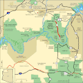
English: The Kaibab Plateau — the major plateau on the North Rim of the Grand Canyon.
- Its projecting north-south landform into the Grand Canyon causes the Colorado River to flow first southwest, and then due-west.
- The Kanab Plateau is adjacent on the west, with the Kanab Creek watershed-basin between them.
- The Vermilion Cliffs, surrounding the Paria Plateau, are adjacent on the east.
- The Kaibab Plateau is within the High Plateaus physiographic section, of the Colorado Plateau physiographic province.
Español: Meseta de Kaibab — alta Arizona.
Subcategories
This category has the following 17 subcategories, out of 17 total.
Media in category "Kaibab Plateau"
The following 28 files are in this category, out of 28 total.
-
Abies concolor Vista Encantada.jpg 898 × 1,516; 1.04 MB
-
Coming off Kaibab Plateau - Flickr - brewbooks (1).jpg 3,264 × 2,448; 3.62 MB
-
Coming off Kaibab Plateau - Flickr - brewbooks.jpg 2,592 × 2,054; 2.56 MB
-
GC SR overzicht.jpg 700 × 525; 135 KB
-
Grand Canyon National Park North Rim - Kaibab Squirrel 0188.jpg 3,456 × 2,670; 3.43 MB
-
Grand Canyon National Park North Rim - Kaibab Squirrel 0199.jpg 4,200 × 3,169; 2.91 MB
-
Grand Canyon National Park North Rim - Kaibab Squirrel 0216.jpg 2,924 × 3,456; 3.45 MB
-
Grand Staircase-big.jpg 1,700 × 483; 204 KB
-
Horses in Arizonia, Kaibab Plateau (3454068119).jpg 2,784 × 1,856; 883 KB
-
ISS058-E-1605 Grand Canyon Under Snow.jpeg 5,568 × 3,712; 5.3 MB
-
Kaibab Plateau (3556880349).jpg 2,048 × 1,536; 1.48 MB
-
Kaibab Plateau (3556880363).jpg 2,048 × 1,536; 2.47 MB
-
Kaibab Plateau (3556880367).jpg 2,048 × 1,536; 2.03 MB
-
Kaibab Plateau 100 2838 0225 edited-1.jpg 2,304 × 1,728; 814 KB
-
Kaibab Plateau-North Rim Parkway - Brilliant Skies and Cliffs - NARA - 7719790.jpg 2,560 × 1,920; 924 KB
-
Kaibab Plateau-North Rim Parkway - Canyon Crevices - NARA - 7719791.jpg 1,920 × 2,560; 1.1 MB
-
Map of Arizona NA.png 2,122 × 1,640; 2.25 MB
-
Map of Arizona Precipitation NA.png 1,073 × 781; 222 KB
-
National-atlas-arizona.png 764 × 588; 136 KB
-
Running Toward Grand Staircase (8023924909).jpg 3,000 × 2,400; 4.07 MB
-
Suillus kaibabensis Thiers 172971.jpg 3,648 × 2,736; 2.13 MB
-
Titan of Chasms-016.jpg 2,481 × 3,556; 4.94 MB


