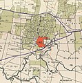
Category:Kafr 'Ana
Jump to navigation
Jump to search
village in Jaffa, Mandatory Palestine | |||||
| Upload media | |||||
| Instance of | |||||
|---|---|---|---|---|---|
| Location |
| ||||
| Dissolved, abolished or demolished date |
| ||||
| Population |
| ||||
| Area |
| ||||
| Replaced by | |||||
 | |||||
Media in category "Kafr 'Ana"
The following 13 files are in this category, out of 13 total.
-
Bat Yam 1945.jpg 890 × 685; 349 KB
-
Historical map series for the area of Kafr 'Ana (1870s).jpg 740 × 744; 139 KB
-
Historical map series for the area of Kafr 'Ana (1940s).jpg 740 × 744; 254 KB
-
Historical map series for the area of Kafr 'Ana (modern).jpg 740 × 744; 168 KB
-
IsraelOrYehuda FromAir.JPG 4,176 × 2,784; 3.35 MB
-
Kafr Ana land.jpg 2,608 × 1,952; 1.3 MB
-
Kafr ‘Ana.jpg 900 × 1,118; 504 KB
-
Kfana11.jpg 3,648 × 2,736; 3.3 MB
-
KFERANA11.jpg 3,648 × 2,736; 3.36 MB
-
Kufr 'Ana cropped.jpg 3,516 × 1,567; 1.62 MB
-
Misgadana.jpg 2,736 × 3,648; 2.66 MB
-
כפר עאנה1.jpg 2,936 × 2,202; 1.32 MB


