Category:June 2008 in Leicestershire
Jump to navigation
Jump to search
Deutsch: Bilder, die im Juni 2008 in Leicestershire aufgenommen worden sind. Bitte beachten Sie, dass dies weder das Datum des Uploads noch das Datum des Scannens eines Fotos ist.
English: Images/pictures taken in Leicestershire during June 2008. Note this is not the date of the upload, nor the date a photo was scanned.
Español: Fotografías o imágenes tomadas en Leicestershire durante junio 2008. No es la fecha de subida ni escaneo, sino la fecha en que las fotografías o imágenes se crearon.
Esperanto: Bildoj faritaj en Leicestershire en junio 2008. Tio ne estas la dato, kiam la bildoj estis alŝutitaj aŭ skanitaj.
Français : Photographies ou images prises en Leicestershire durant juin 2008. Ce n'est pas la date du téléchargement ou du scan.
Galego: Fotografías ou imaxes tomadas en Leicestershire durante xuño 2008. Non é a data de subida nin escaneamento, senón a data na que se crearon as fotografías ou imaxes.
Italiano: Fotografie o immagini scattate a Leicestershire nel giugno 2008. Nota bene: la data non si riferisce né a quella di upload né a quella in cui la foto è stata digitalizzata.
Norsk bokmål: Bilder tatt i Leicestershire i løpet av juni 2008. Merk at dette ikke er datoen for opplasting, eller når et bilde har blitt skannet.
Norsk nynorsk: Bilete teke i Leicestershire i løpet av juni 2008. Merk at dette ikkje er datoen for opplasting, eller når eit bilete har vorte skanna.
Русский: Изображения, сделанные в Leicestershire в течение июнь 2008 (не дата загрузки изображения).
Українська: Зображення, зроблені в Leicestershire протягом червень 2008. Зауважте, що це не дата завантаження чи дата сканування фотографії.
| June 2007 | ← | June 2008 | → | June 2009 | |||||||
| Jan | Feb | Mar | Apr | May | Jun | Jul | Aug | Sep | Oct | Nov | Dec |
| 25 | 49 | 41 | 381 | 38 | 38 | 23 | 57 | 13 | 28 | 6 | 21 |
|---|---|---|---|---|---|---|---|---|---|---|---|
Subcategories
This category has the following 3 subcategories, out of 3 total.
Media in category "June 2008 in Leicestershire"
The following 35 files are in this category, out of 35 total.
-
 Donington Park Services - geograph.org.uk - 874304.jpg 640 × 427; 62 KB
-
 Donington Park Services.jpg 640 × 427; 70 KB
-
 Burton Wolds in Leicestershire - geograph.org.uk - 882897.jpg 640 × 446; 69 KB
-
 Burton Wolds in Leicestershire - geograph.org.uk - 883194.jpg 640 × 449; 83 KB
-
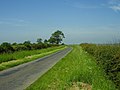 Country lane north of Wymondham - geograph.org.uk - 840178.jpg 640 × 480; 75 KB
-

-
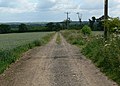 Farm track near Tugby - geograph.org.uk - 884697.jpg 640 × 459; 83 KB
-
 Farmland and buildings north of Tugby - geograph.org.uk - 884680.jpg 640 × 513; 102 KB
-
 Farmland north of Husbands Bosworth - geograph.org.uk - 864289.jpg 640 × 587; 53 KB
-
 Field and woodland west of Belton - geograph.org.uk - 849504.jpg 640 × 480; 94 KB
-
 Footpath at Cossington Lakes - geograph.org.uk - 853272.jpg 640 × 459; 99 KB
-
 Footpath near Ragdale Hall - geograph.org.uk - 883379.jpg 640 × 469; 114 KB
-
 Footpath onto the Cossington Meadows - geograph.org.uk - 853292.jpg 640 × 483; 89 KB
-
 Footpath to Hoby - geograph.org.uk - 883451.jpg 640 × 480; 89 KB
-
 Footpath to Seagrave - geograph.org.uk - 857590.jpg 640 × 489; 103 KB
-
 Footpath to Wanlip, Leicestershire - geograph.org.uk - 853328.jpg 640 × 429; 76 KB
-
 Friendly cows near Paudy Farm - geograph.org.uk - 859004.jpg 640 × 480; 82 KB
-
 Inn Without a Railway - geograph.org.uk - 186833.jpg 640 × 480; 87 KB
-
 Market Harborough railway station, Leicestershire, 2008 (geograph 3777413).jpg 1,024 × 768; 181 KB
-
 North along the A426 Leicester Road - geograph.org.uk - 867832.jpg 640 × 471; 88 KB
-
 North along the A6 Loughborough Road - geograph.org.uk - 853357.jpg 640 × 433; 69 KB
-
 North along the M1 Motorway - geograph.org.uk - 867836.jpg 640 × 486; 65 KB
-
 Public footpath near Paudy Farm - geograph.org.uk - 859012.jpg 640 × 548; 135 KB
-
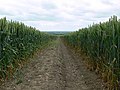
 Public footpath to Lutterworth - geograph.org.uk - 869063.jpg 640 × 500; 97 KB
-
 Public footpath to Saddington - geograph.org.uk - 864216.jpg 640 × 473; 120 KB
-
 South along the A426 Leicester Road - geograph.org.uk - 867833.jpg 640 × 375; 67 KB
-
 The Blue Lion, Thrussington - geograph.org.uk - 855483.jpg 640 × 425; 62 KB
-
 The Horse and Groom, Rearsby - geograph.org.uk - 853676.jpg 640 × 334; 54 KB
-
 The Malt Shovel, Worthington - geograph.org.uk - 849492.jpg 640 × 480; 95 KB
-
 The Wheel Inn, Rearsby - geograph.org.uk - 855439.jpg 640 × 441; 63 KB
-
 Tram lines - geograph.org.uk - 883468.jpg 640 × 476; 100 KB
-
 View southwest across Seagrave Wolds - geograph.org.uk - 876947.jpg 640 × 496; 80 KB
-
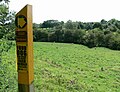
 View towards Ragdale Wood - geograph.org.uk - 883384.jpg 640 × 458; 100 KB
-
 War Memorial - geograph.org.uk - 855486.jpg 463 × 640; 91 KB
-
 White Roundabout - geograph.org.uk - 843164.jpg 640 × 427; 224 KB


.jpg)


